Putting some facts on the table

Field Naturalist Richard Piesse met with DELWP officers last week to table surveys conducted by local naturalist Ern Perkins over the last ten years. The intention of the meeting was to highlight the necessity for burn operations to be conducted in full knowledge of the natural values at stake.

Some of the findings of the surveys were:

–A large percentage of the eucalypts in most of the forests are looking stressed due to the cup gum [moth?] caterpillar infestations and our ‘mini drought’ conditions.

Acacia gunnii in the Fryers Ranges,'one of Victoria's best wildflower areas.'

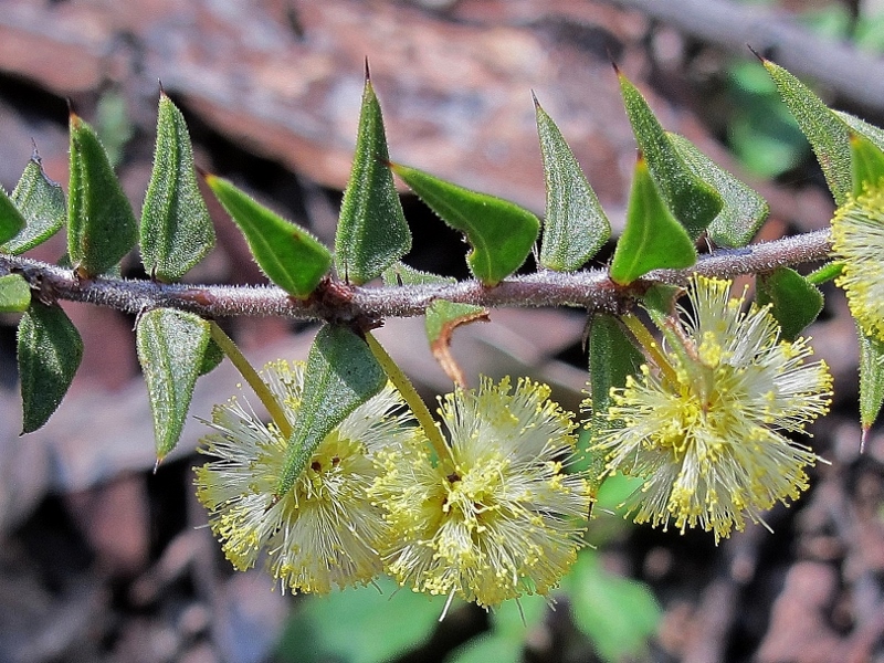
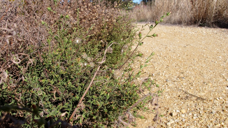
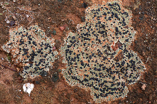
Acacia gunnii in the Fryers Ranges,’one of Victoria’s best wildflower areas.’

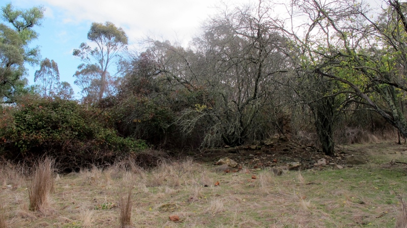
–Kalimna Park: Castlemaine must be safe from fire; but lots of KP is a wildflower paradise which should be preserved for the community and visitors.

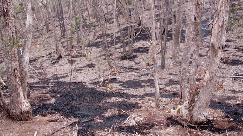
–Blowmine Track: the latest burn in 2011 destroyed good areas of bushland and the vast majority of the eucalypts

–Flame heath location on Tatt town track: a hot control burn in 2009 appears to have killed off all the flame heaths east of the Tatt Town track.

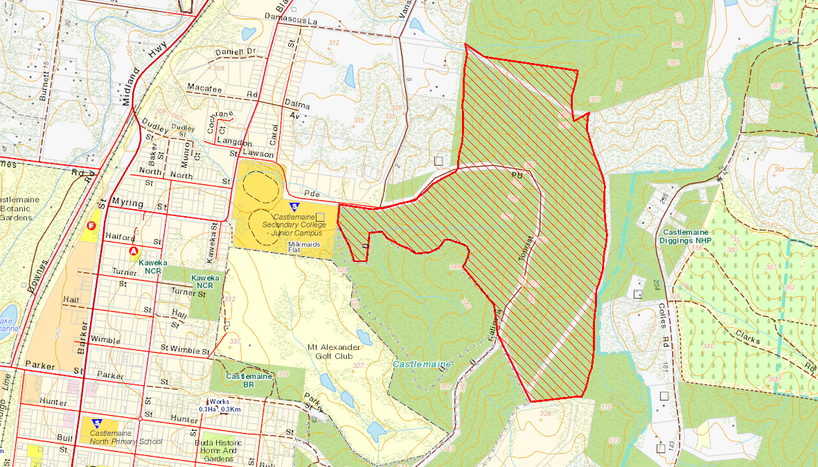
–Fryers Ridge: one of Victoria’s best wildflower areas; too many fires close to the ridge will destroy the amazing biodiversity. The last was in 2013.

–Southern end of Porcupine Ridge Road [in the vicinity of Wewak Track, Loop Track and the Great Dividing Trail] is similar to the Fryers Ridge, with a great diversity of plants, including threatened species.

FOBIF has consistently argued that all operations in our forests, including fuel reductions, should be conducted by workers fully briefed in detail on what they’re dealing with. There is a large amount of knowledge of these bushlands built up not only by field naturalists, but by Department researchers: but in the past it’s hard to believe any of it was seriously considered before fire operations began. Things may have changed: the survey info presented by Richard was positively received by the fire officers. We’ll see what happens in practice–and, of course, that mainly depends on the resources available to fire personnel.

Meanwhile, the Minister has had the Inspector General for Emergency Management’s report on fire management issues for over two weeks now, but is yet to release it.

Posted in Fire Management | Comments Off on Putting some facts on the table

Nuggetty Range walk

The weather on Sunday (17th May) was perfect for our FOBIF walk into the Nuggetty Range. Thirty-three people came along and it was good to see some newcomers to FOBIF on the walk.

Nuggety-walk_170515_2775

Walkers enjoying the sun and morning tea at a high point on the Range.

The group was ably led by geologist, Brian Cuffley, who had prepared maps and an introductory handout. The Nuggetty Range, he explained

is part of the metamorphic aureole surrounding the Harcourt Granite to the north. The granite has heated and hardened the slate and sandstone bedrock and has produced a hard flinty rock called hornfels. Hornfels is very resistant to erosion, thus it has formed a range about the granite which has weathered away more rapidly.

Nuggety-walk_170515_2781

This rock from the Nuggetty Gold Mine shows the contact between granite (right) and hornsfel (left).

web.Nuggety-walk_170515_2778

Looking into the Nuggetty Gold Mine.

From the Nuggetty Gold Mine, the walk continued in a westerly direction to the lunch spot at the Rock of Ages (Mt Moorul). This location also had a terrific scenic outlook. Walkers then proceeded along the Rock of Ages Track to the beginning point on the corner of Church Street and Davies Lane, Maldon.

Our next walk will be led by Bernard Slattery in the Goughs Range. See walks page for more info.

Posted in News | Comments Off on Nuggetty Range walk

Put it in the diary

The FOBIF AGM will be held on Monday July 27 at 7.30 pm at the Ray Bradfield Rooms, beside Victory Park Castlemaine.

The guest speaker will be Sarah Lloyd, author of the remarkable book, Where the slime mould creeps, a guide to common–and strangely beautiful–life forms you never even knew existed. Put it in the diary!

Posted in News | Comments Off on Put it in the diary

Our friends the blackberries?

Walkers along the Moonlight Creek edge of Kalimna Park in the last week have been puzzled by the fact that DELWP seems to have gone to a lot of trouble to protect a mountain of blackberries from its recent management burn. This involved carving a fire break around the area, about 50 metres long, and grooming surrounding areas of vegetation.

The mountain of blackberries is more than it seems, however: it conceals–or mostly conceals–a nineteenth century ruin, with adjacent orchard. Looked at with that in mind, it’s quite an evocative sight.

You could walk past it and see only blackberries, but it's actually a historic site, probably dating from the 1870s. The wall of the ruin is to the right.

You could walk past it and see only blackberries, but it’s actually a historic site, probably dating from the 1870s. The wall of the ruin is to the right.

FOBIF had assumed that after the fire exercise had been finished, Parks Victoria would go back and remove the blackberries from the ruin. This is not the case: it’s a depressing fact that the weed is being left there, because it is seen as a deterrent to vandals who might be inclined to come and steal stone from the building.

This isn’t great news, given that there’s a big infestation of blackberry in nearby Moonlight Creek, and this particular weed has expanded its range dramatically since the breaking of the drought. But there’s logic in the managers’ position. Vandalism, in the form of graffiti on historic sites, and removal of relics and building materials, is an international problem. And, believe it or not, weeds have some kind of a record in protecting historic sites: as an example, an Aboriginal stone arrangement in the Western District was protected for many years by an infestation of thistles!


Posted in News | Comments Off on Our friends the blackberries?

Look again: there’s something there

Those interested in getting a better look at relatively obscure elements of our bushlands should get along to the Nature Abstracted exhibition at the Falkner Gallery in Templeton Street Castlemaine.

The exhibition of photographs by Bronwyn Silver concentrates on lichens, with a few quite spectacular moss photographs as well. Bronwyn was a major contributor to the FOBIF Guide to mosses in south eastern Australia.

Moss and lichen photos from the 'Nature abstracted' exhibition. The moss species are clearly identifiable, and the lichen photos are spectacularly evocative 'maps'.

Moss and lichen photos from the ‘Nature abstracted’ exhibition. The moss species are clearly identifiable, and the lichen photos are spectacularly evocative ‘landscape maps’.

To get an idea of what’s on offer, we can’t go past the artist’s own statement:

‘There are over 3000 known species of lichen in Australia; some are leafy, some are plant-like and some are flat. In this exhibition I have focussed on one of the flat types, Rhizcarpon geographicum, commonly known as map lichen.

‘This species is tightly encrusted to rock surfaces, comes in many colours and often has intricate abstract arrangements due to each lichen being surrounded by a black border and adjacent to another. Many of the rock surfaces covered with Rhizcarpon geographicum look like aerial maps.

‘Unless you watching out for this lichen, these subtle and often small formations can be easily overlooked. Once I became aware of its wonderful abstract qualities and sought it out, I found it to be quite common. It became an absorbing pastime to find and photograph the variety of its rock face displays.

‘Lichens are sometimes confused with moss but they are unrelated to moss or any other plant.  They represent one of the most remarkable alliances in nature: one species of alga or cyanobacteria or both and one species of fungus grow together in a mutually beneficial relationship known as symbiosis. These mysterious composite organisms can grow in widely diverse habitats and fossil lichens have been recorded back to the Mesozoic era (135-225 million years ago). They have been shown to remain largely unaffected when exposed to outer space.

‘Lichens can help with soil stabilization and the colonisation of barren environments.  Some animals eat them, insects shelter in them and people have used them for dyes, perfume, medicine and food. They form part of our aesthetic appreciation of the bush with their vivid colours, unusual shapes and wonderful patterns on the surfaces of rocks, trees, leaves and soil.

‘As well as lichens, I have included some photos of moss and eucalyptus leaves.  Despite these not having the strong abstract content of the map lichen photos, they share some of the same features. All are detailed images demonstrating the stunning beauty of our bushlands when viewed at close range. Moss species in each photo can be identified on request.’

The exhibition runs till June 21st.


Posted in Nature Observations | Comments Off on Look again: there’s something there

Coming down to earth

Mount Alexander Shire has released a draft Environment Strategy 2015-2025 for public comment. The draft can be found here

FOBIF will be making a brief submission on the draft, and urges members to do likewise. At first sight, the document looks fatally infected with woolly jargon [‘The overarching challenge is to move from an exploitative relationship with our planet to a symbiotic one, both in spirit and action’] and grandiose aims [‘Environmentalism and sustainability become mainstream’], and weak on specifics—but we’ll be making a perhaps more considered response to the draft by the closing date of May 14.

Stinkwort on the Colles Rd  footpath: there are outbreaks on major and minor roads in the region, and they look as  if they've been spread by machinery.

Stinkwort on the Colles Rd footpath: there are outbreaks on major and minor roads in the region, and they look as if they’ve been spread by machinery.

Here’s an illustration of the way in which nice but vague aims can give the impression you’re doing one thing, when in fact you may be doing the opposite: residents may have noticed outbreaks of the noxious weed Stinkwort on many of our roadsides and tracks: Forest Creek Track in Chewton, Colles road footpath, Midland Highway, Vaughan Springs road, and Joseph Young Drive on Mt Alexander among them. These outbreaks look suspiciously as if they come from road maintenance machinery, and some of them look like Council responsibility. This has happened at least once before, when Council machines spread the weed around newly landscaped areas in the Wesley Hill industrial estate, then had to go back and eradicate it.

A check of the Shire’s Roadside Conservation Management Plan 2012-17 shows the following aims:

  • ‘Improve conservation values and connectedness of roadsides to bushlands and adjacent farms.
  • ‘Reduce fuel for fire and increase bushfire preparedness consistent with recommendations of Royal Commission into the Black Saturday Fires.
  • ‘Reduce feral animals and control the spread of existing weeds and avoid outbreak of new weed species on roadsides.’

These laudable aims are unfortunately not backed by a more modest and practical one: ‘clean Council machinery, so that Council does not inadvertently spread weeds instead of controlling them.’ Simple [though tiresome] procedures have long existed for this, and are urged by Federal authorities as a way of limiting the $4 billion we lose every year through weed infestations.

If enough submissions make the point clearly, the Shire’s Environment Strategy might be made much tighter and more practical. Submissions are easy to make at the Shire’s link above. Have a go!


Posted in News | Comments Off on Coming down to earth

Kalimna fire

The Department of Environment, Land, Water and Fire completed its management burn at Kalimna Park on April 23. The treatment area is shown on the map below.

Kalimna Burn 2015


Representatives of FOBIF and the Friends of Kalimna Park have examined the site on several occasions since, and FOKP members walked the area with fire managers last Thursday. Managers Simon Brown and Paul Bates declared themselves satisfied that the Department’s fuel reduction objectives had been achieved.

Though locally severe, the burn was patchy, apparently inhibited by overcast, cool, still conditions. In any case, most of the area seems to carry a very low fuel load. Residents who have examined the area have expressed the view that the most serious damage done in the course of the operation was the crude preparatory track work. FOBIF has written to David Major, the responsible manager, about this [see our post], but has received no reply. In addition, in their laudable efforts to exclude an Eltham Copper Butterfly population from the burn, the managers have created a rough bare earth zone which could quickly become a damaging bike track unless quickly rehabilitated. We’re hoping this will be done within weeks.

Kalimna, late April 2015: a combination of low fuel loads and cool conditions created a patchy management burn.

Kalimna, late April 2015: a combination of low fuel loads and cool conditions created a patchy management burn.

As to the medium to long term effects of this fire, we’ll be visiting the area regularly in the coming months and reporting on what we see.

Meanwhile, the Inspector General for Emergency Management has finished his review of performance targets for fuel reduction on public land, and has submitted it to the State Government. We’ll report on details when they become available.

Posted in Fire Management, News | 2 Comments

Rezoning at McKenzie Hill?

Hearings have opened over the Mount Alexander Shire’s proposal to rezone land at McKenzie Hill, to the west of the town, from Rural Living to General Residential Zone. The effect of the zone change would be to allow denser development to take place.

More details on the zone amendment [coded C76] can be found here.

FOBIF has opposed the amendment on two grounds: first, that significant parts of the area are at medium or high risk of bushfire; and second, that the rezoning is not urgent, as there is sufficient undeveloped residential land in the town of Castlemaine to cope with projected population growth for the next 20 years.

The amendment is linked to a proposal for adjoining land, the Diamond Gully Structure Plan, which will come before a hearing later in the year.

FOBIF’s submission to the panel reads as follows:

Introduction

Friends of the Box/Ironbark Forests group (FOBIF) believes this Amendment [C 76] has not responded correctly to the critical change in strategic planning policy for bushfire protection that resulted from the Royal Commission into the Black Saturday Bushfires.  The land involved in this Amendment was identified for possible rezoning to residential use well before the Black Saturday catastrophe and hence has not had the benefit of being assessed against the new strategic requirements for bushfire protection.

FOBIF has always argued that the best place for new housing estates is on already cleared land well away from the forested areas.  Some of the land involved in this Amendment, which is well away from the forest, may be such land.

The reasons for this approach are two-fold:

  • Whenever there is a new housing estate established next to forested areas, there is consequent deterioration of the biodiversity of the forest due to increased feral pets, escaped garden plants, trail bike riding, dumping of rubbish, etc.
  • The other effect is that when these new residents realize the dangerous situation they have been put in, from bushfires – they will exert pressure to have vegetation cleared in the forests in the hope that it will lessen their danger. This effect will become more pronounced as the bushfire seasons become worse due to climate change.

Continue reading

Posted in Fire Management, News | Comments Off on Rezoning at McKenzie Hill?

FOBIF walks

Walks for young people

FOBIF are running lots of events for kids this year. We have bushwalks for small children with their families, youth walks for people who are secondary school age and a June School Holiday program based in the Castlemaine Botanical Gardens. 

Our flyer gives information about all of these events and contact details. Many of the events are free or free for members, so tell your friends and families so that we can foster a love and protection of our local wild places. Click here to see a report on our first young people’s walk for 2015.

FOBIF April walk

At Dunn's reef: a convenient guide was available for consultation on mosses  brought out by recent light rain.

At Dunn’s reef: a convenient guide was available for consultation on mosses brought out by recent light rain.

In spite of the months long dry, resilient moss came back after light rain in Muckleford in Mid April.

In spite of the months long dry, resilient moss came back after light rain in Muckleford in Mid April.

A wild and windy Sunday morning did not deter the 25 walkers who checked out the landscape of the Muckleford State Forest on Sunday 19th April. Capably led by Neville Cooper this 7 km walk starting from the Red, White and Blue Poppet Head Mine went past the proposed site for a Castlemaine Hot Rod Centre (CHRC) where plans for a Dynamic Vehicle Testing Facility, Events and Recreation development are being discussed, and then on to a tour of Dunn’s Reef and a quick lunch break. The understorey through this area is gradually recovering and the bird life was taking advantage of this – an always changing landscape!


Next month’s walk will be in the Nuggety Ranges. Check the program for details.

Posted in News | Comments Off on FOBIF walks

Kids walk and craft at Clinkers Hill

Eight families from across Castlemaine came together to hear about restoration work and environmental values at the Clinkers Hill Bushland reserve on Sunday the 26th April.

260415_2678

Elvyne explaining how to identify a Stringy Bark.

Elvyne Hogan gave an introduction to the site, outlining work done by the Victoria Gully Group, showing little ones which species of eucalypt that occupied the area lead to funding for a project with Connecting Country through their Yellow Box Woodland program.

Cassia Read then introduced the children and adults to the Cherry Ballart and collected insect galls which shortly afterwards became bush creatures with the addition of feathers, leaves and sticks found on site. After a snack and cuppa the children were encouraged to find some ‘habitat’, a big word when you’re four, for their creatures.

Kids and adults enjoyed the bush and company of other like minded families.

A lichen that Cassia pointed out on the walk back.

A lichen that Cassia pointed out on the walk back.

On the return walk Cassia contiuned to share her knowlege about the plant and moss species found in the reserve.

Thanks to Elvyne and Cassia for their time in presenting to our small people and their families.

(Click on photos below to enlarge.)

Posted in News | 1 Comment