What’s the prospect for rural land?

The Mount Alexander Shire has released a Future Directions Paper on rural land in the shire as part of its rural land study. The paper emphasises the importance of keeping a viable agriculture as part of our rural landscape, but leaves open the possibility of some rezoning of farm land, both for ‘innovative’ agricultural or horticultural ventures and for possible residential development. The paper can be found here.
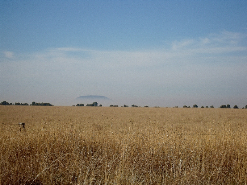
Muckleford: the Future Directions Paper emphasises the importance of keeping a viable agriculture in the shire.

A combination of drought, relatively poor land and small acreage [among many other factors] has put some agriculturalists in our area under pressure. FOBIF has made a submission to the paper, which reads in part as follows:

‘We do not have an opinion about the viability of agriculture in the shire, leaving this matter to those with expertise in the area. We do believe, however, that any proposals to rezone farm land should have environmental stewardship as a major aim, possibly through extension of the use of Rural Conservation Zones and an encouragement to implement Trust for Nature covenants… Any rezoning should take account of the status of the vegetation communities involved, and should perhaps be informed by the kind of landscape restoration [encouraged by] Connecting Country.

‘We note the listing of ‘bushfire hazard and associated safety provisions’ as a factor in ‘Issues for rural living.’ We would like to register our opposition to any proposal which involves zoning for housing close to areas of bushland which would inevitably have to be cleared for safety reasons as a result of  development.’

We also urged that any rezoning proposal include strict control over the construction of ornamental/amenity dams. Water authorities have estimated that such dams, which have no productive use, capture about 31% of inflows into the Eppalock catchment.

Posted in News | Comments Off on What’s the prospect for rural land?

The Coliban gets a drink

Following expressions of concern by local residents at Taradale [and by FOBIF–see our April 18 post] about the state of the Coliban river, Coliban Water started a small release of four megalitres a day into the river last week.

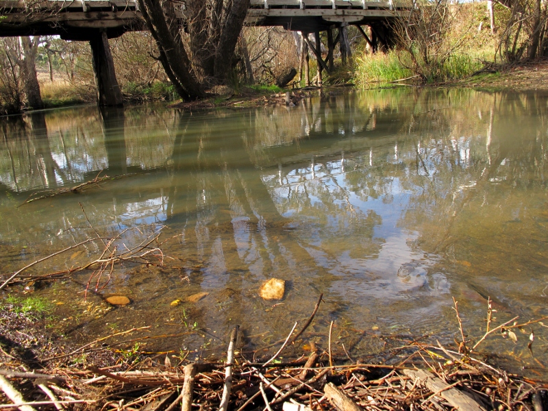
The Coliban at the Metcalfe road bridge, Taradale, May 7: Coliban Water started a small environmental release from Malmsbury reservoir into the river last week, and it makes a (small) difference.

Four megalitres isn’t much, but the river, sometimes called ‘the forgotten river’, definitely looks the better for it. Details on Coliban Water storages and flows from its reservoirs can be found on the authority’s website: http://www.coliban.com.au/water_security/reservoirs.asp

In spite of the frequent contention that environmental flows mean less water for people, common sense suggests that they’re as important for communities as they are for ‘the environment’. As the newly constituted Department of the Environment and Primary Industries puts it:

Continue reading

Posted in Nature Observations, News | Comments Off on The Coliban gets a drink

Poverty Gully: achievements, and puzzles

FOBIF members have had a preliminary look at the CAS 107 Zone 2 Arthur’s Track management burn in Poverty Gully this week. The exercise, conducted last Friday April 4, was the continuation of the burning operation begun late last year. The purpose, in the words of DSE’s Code of Practice, was to ‘protect nearby assets, particularly from ember spotting during a bushfire.’ It also aimed ‘to achieve ecological outcomes by seeking to manage for ecologically desirable outcomes, provided bushfire protection objectives can still be met.’

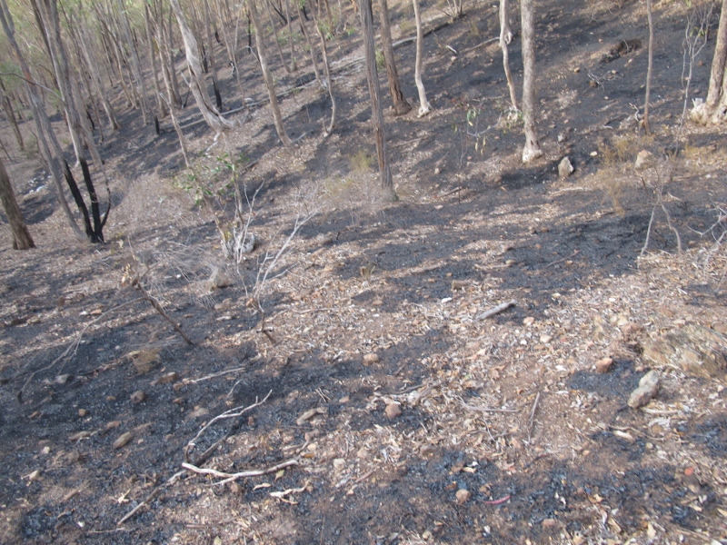
At first sight a moderate mosaic burn seems to have been achieved, as the first photo shows. Further, the Eltham Copper Butterfly and endangered spider orchid areas were avoided.

Arthur's Tk burn: a moderate mosaic, with protection for areas where endangered species are known.

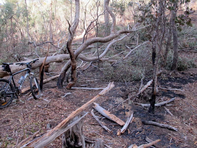
On the other hand, we were faced with a puzzle which we’ve often faced before: although relatively few trees were brought down in the fire, some of the ones which did come down were among the biggest in the area:

Peppermint gum felled by DSE fire. This tree, like one of equal size near it which was also brought down, was next to an administration track. It's baffling that it could not have been identified and protected.

We can’t see any fire protection gain in the destruction of such trees, and the ecological loss, in an area with few big trees, is obvious. We will be pursuing with DSE the possibility of getting a more reliable method of identifying and protecting such trees.

Posted in Fire Management, News | 1 Comment

Another side of Kalimna

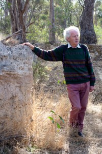
Julian Hollis

On a perfect Autumn day, geologist Julian Hollis recently led fourteen walkers on the second FOBIF walk of the year, through Kalimna Park. We were lucky to be accompanied by Julian, who is often seen walking in the area and has studied it for some years.

Kalimna is well known for its variety of native vegetation, and particularly its spring wildflowers. It is less well known for its 400 to 450 million years of geological history, but Julian’s explanations brought that history to life for the walkers.

On the way to Kalimna we stopped at the cutting on the north-east corner of the intersection of Campbell and Hargreaves Street. There, Julian explained that the cutting was created in the 1850s so that horses would not be faced with such steep inclines. Two interesting geological features of the cutting were the quartz reef and anticline shown in the photos below. 

Quartz reef and Anticline on the corner of Campbell and Hargreaves Streets

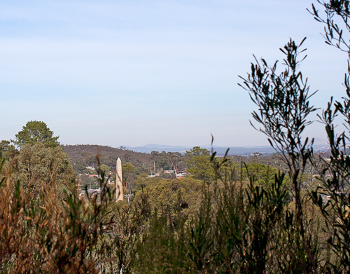
Heading towards the Tourist Road we stopped to take in the view to the south, where Mount Franklin and other peaks could easily be seen.

View over Castlemaine and beyond from Kalimna

In the couple of hours that followed we walked on tracks to the north-east of the Park and then back to the Mount Alexander Golf Course. Julian discussed the large anticline on the Tourist Road, as well as some intriguing tube-like holes in a rock face, and he pointed out evidence of early miners’ cottages. We now know that some of those miners were unlucky, because we saw a shaft in excess of 35 metres, in which no gold at all was found. 

Anticline on the Tourist Road (left). Looking into the deep mine shaft (right).

Many will have driven over the Tourist Road but fewer would know that its original gravel surface came from quarries in Muckleford. 

We also saw evidence of a little known geological ‘shear’, and Julian showed how rocks can be dated according to the impressions left by graptolites known to have lived at particular times.

Thanks to Julian for leading another informative and authoritative walk in our local area.

Dominique Lavie has sent us some extra photos which highlight the stunning colour and texture of the many rock formations we viewed. Her photos can be found here.

Posted in News | Comments Off on Another side of Kalimna

Burglars, super heroes and moss

 Castlemaine has had less than 40% of its long term average rainfall over the months since the start of October 2012.

This is a source of concern for a number of reasons. One is that it has delayed the start of activities for the FOBIF moss group, which is preparing the publication of a field guide for later this year.

One advantage of such a field guide is that it would enable readers to see through  criminals trying to disguise themselves as moss. You may think this is a bizarre idea, but a couple of years ago an ambitious burglar disguised as a lump of moss tried to break into a museum in Oregon. You never know where the next threat is coming from.

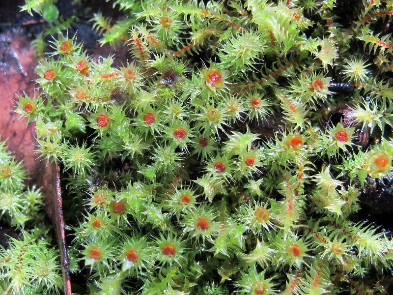
Breutelia affinis and Triquetrella papillata, Mount Alexander: we don't recommend these as disguises for bank robbers. We're not sure about appropriate dress for moss superheroes.

Our source for this story is the New York Post. It’s a Murdoch publication described recently as having ‘long since given up on being a real newspaper’, but we’re prepared to believe this story. The thief was caught when bitten by a police dog which saw through the disguise. The Post’s sub editors were thus unable to resist the headline ‘A Peat Offender: Thief makes a moss of it.’ Not terribly scientific, but what can you expect of the Post?

Moss isn’t only an aid to criminals. David Meagher has revealed in the Australian Bryological Newsletter that there is a super hero called Moss Man. Since we suspect our readers are not well informed on super heroes, we offer David’s in depth research here:

Continue reading

Posted in Moss and Liverwort Field Guide group, News | 1 Comment

Poverty Gully reduction burn completed?

 DSE completed the second half of its Zone 2 reduction burn in Poverty Gully on Friday April 4. Our reports on the first half of this operation can be found here and here. We will be having a look at the results in the next week and reporting what we find.

Murray Goldfields Fire Manager Simon Brown has revealed that the Kalimna Park burns will be delayed till next year. These will involve the area around Kalimna Point and almost the whole of the rest of the Park, on both sides of the tourist road.

Posted in Fire Management, News | Comments Off on Poverty Gully reduction burn completed?

Poor Coliban

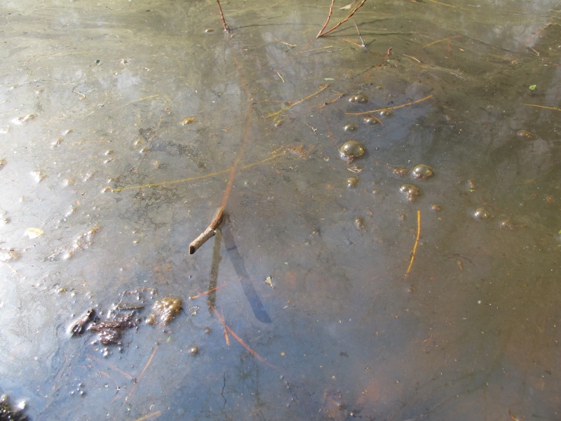
Travellers across the Coliban River on the Taradale-Metcalfe road recently will have noticed that the river is looking terrible. Although there’s a very small flow,  the water is an unhealthy milky colour and there’s a peculiar scum on it.

The problem is that there’s been little rain since October and practically none this year. The Catchment Management Authority is aware of the problem, and is planning a small environmental release from the Malmsbury reservoir in the near future.

The Coliban at Taradale. An environmental release is planned to give the river a break: but maybe the Coliban would be in better shape if water wasted in the Poverty Gully channel in January had been put into the river instead..

There’s an interesting dimension to this problem. The water in the Malmsbury/Upper Coliban dams is managed by the Coliban Water Authority, mostly for community and licence holder use.. The CMA is entitled to a very small amount of this water for environmental flows into the river system.

The problem is that some of the water released to licence holders seems to be blatantly wasted. As an example: in January water was released into the notoriously leaky Poverty Gully water race. Although it’s hard to get a figure on it, Coliban water has conceded that a relatively small proportion of the water released at Malmsbury actually makes it through to Castlemaine. Sources at the authority tell us that they’d like to take the race out of commission–but for some reason or other they haven’t taken the necessary steps to do this.

The water released into Poverty Gully is relatively small, in the grand scheme of things: but when the Coliban river is sick, it would seem to be a better idea to give it a hand, rather than toss precious water into the air.

The CMA welcomes community feedback on river quality: write to info@nccma.vic.gov.au

Posted in News | Comments Off on Poor Coliban

How to shoot birds

On Thursday 25th April Chris Tzaros will give a presentation on tips and techniques for photographing birds, at Newstead Community Centre at 7.30pm. “We are really looking forward to having Chris address our group again” said Frances Cincotta, President of Newstead Landcare Group.

Chris has maintained a strong interest in natural history since his childhood. Brought up in central Victoria, he has a particular passion for and knowledge of woodland and wetland ecosystems, particularly birds.

In 2005 Chris authored a comprehensive book on birds, mammals, reptiles and amphibians of our local area titled, “Wildlife of the Box-Ironbark Country”.  The nature soundscape CD that comes with the book was recorded by Andrew Skeoch, a member of Newstead Landcare.

“I’m currently employed with BirdLife Australia” said Chris. “I co-coordinate a major woodland bird conservation project throughout Victoria, New South Wales and Tasmania”.

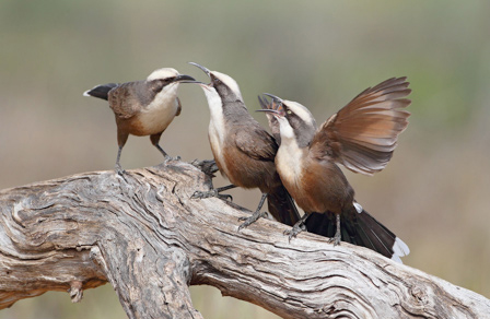
Grey-crowned Babblers photographed by Chris Tzaros

Everyone is welcome to Newstead Community Centre next Thursday evening to learn how Chris gets the amazing shots that he produces. The presentation will go for about an hour and will be followed by supper. A gold coin donation from attendees helps the group cover costs.

On the following Saturday Chris Tzaros and Geoff Park will run a workshop on bird photography, but that booked out very soon after it was advertised on Geoff’s “Natural Newstead” blog.  Another talented member of Newstead Landcare, Geoff has been photographing nature and writing about it on-line since December 2008 and you can read and subscribe to this informative nature diary by clicking here.

Posted in News | Comments Off on How to shoot birds

Sunday 14 April – Nature Search Day, Maldon Historic Reserve 9am – 4pm

How do management burns change our bushlands? This isn’t an easy question to answer, given the lack of information on ‘before and after’ monitoring.

The informal Muckleford Forest Friends Group is confronting this problem by organising a day in an area designated for burning, to record its values. FOBIF members are urged to rock up—just make sure you RSVP beforehand to the address below. Here are the details:

“Come along and help map some key natural values in a section of the forest proposed for a ‘prescribed burn’ in autumn 2014. By getting to know the forest and documenting its values, we can really engage with DSE as they plan the burns, helping make sure the most valuable areas are not damaged.

“We’ll look at an area of around 180 hectares in the Maldon Historic Area just north of the Gowar School: it’s on the Castlemaine-Maldon Road.

“You don’t need to be an expert – although experts are very welcome – and everyone will get a chance to try at least two of different recording methods.

“You can come for the whole day – or just the morning or the afternoon. The morning recording session will be 9am to 12 noon, lunch 12 to 1 and afternoon recording 1-4pm. We will meet at the Gowar School ruin at 9am, or at lunch time if you are just coming for the afternoon. Dress for the weather and bring your own food and water. And PLEASE let us know you are coming, and if you have field recording skills or equipment you can bring – email mucklefordffg@bigpond.com

“Our plan is to record:

  • Big Trees – we’ll photograph, measure and GPS big trees – including coppiced trees with big hollows in their base – such hollows are often the only hollows available for a range of animals, but are very vulnerable to ‘burn out’ during prescribed burns
  • Birds – we’ll record birds we see and hear under the guidance of Geoff Park
  • Understorey – we’ll do a series of transects and sample the amount and diversity of understory plants to get a sense of vegetation quality
  • Fuel load – we’ll use the DSE method to sample and record the amount and form of fuel

“We’ll be testing approaches that we hope can then be applied to other parts of the Muckleford Forest – and to other forest areas as well. If you have ideas for other documentation that could be done on the day, please let us know by email.”

Posted in Fire Management, News | Comments Off on Sunday 14 April – Nature Search Day, Maldon Historic Reserve 9am – 4pm

Butterflies feeding on sap

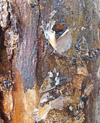
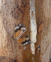
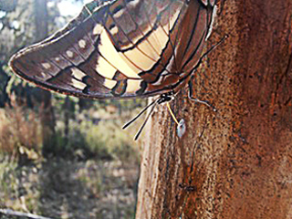
Tony Morton has sent us these observations of butterflies in Kalimna Park. The photos were taken on the west side of Kalimna, in the Castlemaine Copper patch, just above the bench, in mid-April 2012. He plans to look to see if there are any signs of a repeat performance this year. This patch of the Park is due for a management burn this autumn.

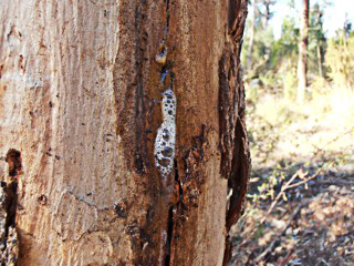
‘Sap exuding from a tree often attracts insects.  This sap was oozing quite plentifully from the tree (a young Lemon scented Gum?) at about waist height.  It was very sticky and sweetish to the taste, but without any discernible eucalypt flavour.


‘Note the many wings of female Common Browns (Heteronympha merope), trapped in the sap, heads and bodies presumably taken by European wasps, which were in attendance (far left photo). One of the butterflies was caught as I watched.


‘Also feeding on the sap were a couple of Four-tailed Emperors (Polyura sempronius).  You can see the Emperor’s orange proboscis (very like the Purple Emperor’s of Europe) in this photo. As they feed, head down, they shift their hindwings up and down, like a Lycaenid does.  This butterfly, endemic to Australia, is more often encountered in sub-tropical areas up the Eastern coast, but it seems to have spread south over the last decade or two.  I have occasionally seen them flying powerfully about on the Point over the last few years, but they are never common.  Flying, they look much whiter than they actually are, but they are far bigger than any other butterfly usually encountered in this area. The larvae feed on various species of Acacia.’

Posted in Nature Observations, News | 1 Comment