Next FOBIF walk on 19 July

The planned FOBIF walk led by Jeremy Holland will take place next Sunday 19th July. We will meet as normal at Community House in Templeton Street, Castlemaine at 9.30am.

Total walk distance will be 8.5 km and you will need to bring lunch for a mid afternoon finish. We will be walking in the Columbine Creek and Stony Creek area. There is more information on our walks page.

Due to current restrictions and regulations we can only have a maximum of 10 people in a group on the walk. We are therefore requesting that people register with FOBIF (info@fobif.org.au) by next Friday 17 July if they are planning to go on the walk. If there are more than 10 people we will divide up and have two separate walks groups of 10 or less. We will confirm your registration before the walk. Alternatively ring Bronwyn Silver by Friday on 0448751111.

We will also be practicing social distancing on the walk and not car pooling to the start of the walk. 

For more information contact  Bronwyn Silver 0448 751 111.

Posted in News, Walks | Comments Off on Next FOBIF walk on 19 July

What is it? And where is it going?

So: what’s that grey discolouration in the water of Forest Creek at the Wheeler Street bridge, after rain last week?

Answer: It’s pollution runoff come down the gutter from somewhere in the town. We won’t speculate as to exactly what works–in fact, it’s reasonably common for rubbish and other pollutants to pour into the creek at this bridge, and pedestrians passing over it at almost any time of the year would be able to peer over the edge and get an insight into the less attractive aspects of our culture, as we’ve pointed out before.

The grey flow coming down the Wheeler Street gutter contrasts with the relatively clear water coming down Forest Creek. The great Australian tradition: pour it down the creek, and it will go away…


This discolouration is a bit different from your normal junk, though. It looks like construction waste, and it’s a reminder that there’s a great Australian tradition we could do without: treating our creeks as drains carrying the debris of our industrial system out of sight. That grey colour puts the observer in mind of…that’s right: sludge.

Sludge: a toxic mix of ‘thick, semi-liquid slurry of sand, clay, gravel and water that flowed out of mining operations.’

Readers of one of last year’s horror publications, Sludge—disaster on Victoria’s goldfields (Latrobe Uni Press and Black Inc) will know that throughout the second half of the 19th century mining sludge in terrifying volumes was dumped into our waterways. In fact, the embankments at that point in Forest Creek were built in 1860 to divert sludge from mining works  away from the town of Castlemaine. Those walls have a kind of charm nowadays, but we shouldn’t forget that they were built to turn the creek into a  drain.

FOBIF recommends Sludge as a good read for Coronavirus times. It’s not exactly joyous reading, but it’s a handy reminder of times when there was virtually no restraint on industry’s tendency to trash the environment, when protests by farmers and citizens against the destruction of our waterways were powerless against mining interests. Those were the days when ‘cows wandering down to drink at Campbells creek in Castlemaine routinely got bogged and half drowned (in sludge)’; when Laanecoorie lost half its capacity in its first 40 years, silted up with sludge; when sand slugs clogged up the Loddon at Newstead, reducing its capacity to form deep pools (they’re still there). Levee banks five feet high were powerless to protect farmland against the flow. The situation was in some ways bizarre: a bloke at Fryerstown got a permit to withdraw 68 million litres of water a day from the Loddon—twice its actual flow!

These are practices we’re still paying for, as the book points out. It’s handy to keep that in mind when people complain about ‘green tape.’

Meanwhile, Forest Creek is sometimes a striking reminder that bad habits die hard.

Posted in News | Comments Off on What is it? And where is it going?

A track to nowhere

Speaking of tradition: we occasionally hear complaints that conservation reserves ‘lock up’ public land, and deprive people of their traditional rights, including the right to drive anywhere they like.

The fact that millions of Australians visit our reserves each year rather dents the ‘locked up’ claim. But it’s  true that sometimes conservation does require restrictions of access, or at least of some kinds of access. And here’s a possible example: maybe this track on the west side of Mount Tarrengower should be closed, to prevent further damage:

Tarrengower, west side: this track goes nowhere, and appears to exist solely to provide sport for people who love tearing up the land.

The track in question doesn’t serve a useful purpose, unless you count as ‘useful’ the chance for tough people in heavy vehicles to rip up a bit of dirt. The process is simple, and has the inevitable result of forming deep grooves, some nearly a metre deep. These become undriveable, and so the drivers in question just form another road, and repeat the dose:

Ruts on tracks relentlessly develop into erosion channels.

The result is, of course, erosion, especially on the steeper sections of this track.

As the track deteriorates and becomes undrivable even for the toughest of tough guys, new tracks are created, as seen on the left of this picture.

FOBIF has asked Parks Victoria if it has a policy about keeping this track open. It’s not always easy to close tracks, because of that old chestnut about ‘locking up’ the land: but in this case, it’s hard to believe anyone could credibly claim a public benefit in leaving it open. The environmental damage is clear. Not all traditions are good–and the ‘tradition’ of tearing up the country for fun is no better than pouring sludge over it.

Posted in News | Comments Off on A track to nowhere

NEW FOBIF greeting cards

Eight new FOBIF greeting cards (series 2) are now available. They feature photographs of our local bushlands by Frances Cincotta, Joy Clusker, John Ellis, Patrick Kavanagh, Sarah Koschak, Doug Ralph, Bronwyn Silver and Albert Wright. Our first series has now sold out.

You can see the whole image for each new card by clicking on the thumbnails below. Each folded card is 10 x 14.5 cm with details of the photograph on the back.

They are available for sale as a set of 8 with envelopes. Cost for the 8 cards including postage is $20. Click here for purchase details.

You can also buy the cards at Buda, 42 Hunter St, Castlemaine, Friday to Sunday, 1-4 pm. They have a few earlier sets of our cards for sale as well as series 2. 

Posted in News | 2 Comments

MTB park planned for Walmer State Forest

Readers of the Castlmaine Mail sports section on June 5 will be aware that there are plans afoot to create a mountain bike network of ‘about 50 kilometres’ in the Walmer State Forest. This forest is already networked by informal and, strictly speaking, illegal trails probably amounting to  rather  more than 50 ks.

MTB track near Dalton’s Tk, Walmer State Forest. The plan is to regularise what are now wildcat tracks.

We’re informed by DELWP  that the project is part of the state government’s ‘great outdoors’ program, set to deliver about $14 million statewide to projects designed to encourage people into outdoor pursuits. It seems the current proposal will formalise some existing tracks in the forest, and add a picnic area to the pine plantation, which is currently being cleared of unsafe trees. It’s believed that some existing tracks will be closed. Over the years, tracks have proliferated in this area.

Bike track [if you can see it] near Dalton’s track, after a ‘management burn’, 2011: if a new recreation facility is created in this forest, will it change management fire practice?

Development of the site will be in the hands of Ja Ja Wurrung work crews, and there is talk of cultural interpretation boards.

As we’ve made clear before, FOBIF is not opposed to programs designed to improve people’s engagement with nature. We are, however, interested in what environmental considerations have been factored into this plan, especially given that the La Larr Ba Gauwa mountain bike park at Harcourt was constructed after extensive ecological surveys. We’re looking forward to talking to the project officer, in due course.

Goldfields Grevillea [Grevillea dryophylla, Walmer State Forest. This plant is listed as ‘rare’. FOBIF is interested in what ecological surveys will be conducted around the MTB project.

Another interesting dimension of this project is that the Walmer forest has suffered from some  pretty savage Department ‘fuel reduction burns’ in the past. It will be interesting to see how differently the area is treated when it’s a developed community asset, complete with trail markers and picnic tables.

Posted in News | 2 Comments

What do we know? And how do we know it?

Anyone tried to look for useful info on the Parks Victoria website?

Anyone had a go at finding the Castlemaine Diggings NHP management plan, for example?

Forget it. Parks website does carry a number of management plans, but not for Castlemaine Diggings. It seems that Parks Victoria’s web page is undergoing a makeover, and also that the Diggings Park’s management plan is being ‘reviewed.’ Until that process is finished, you won’t find it on the web.

The plan is a pretty indigestible document, though a careful reading of it provides some statements which should be embarrassing to Park administrators.

Check this policy, for example:

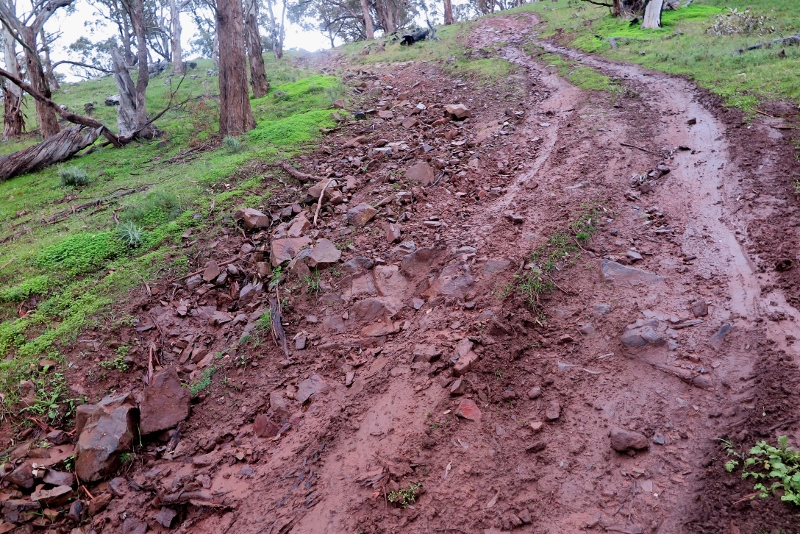
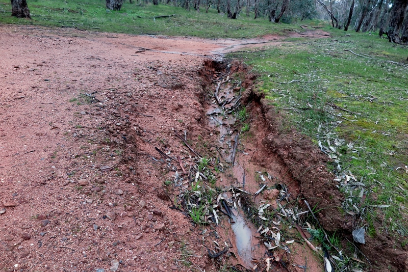
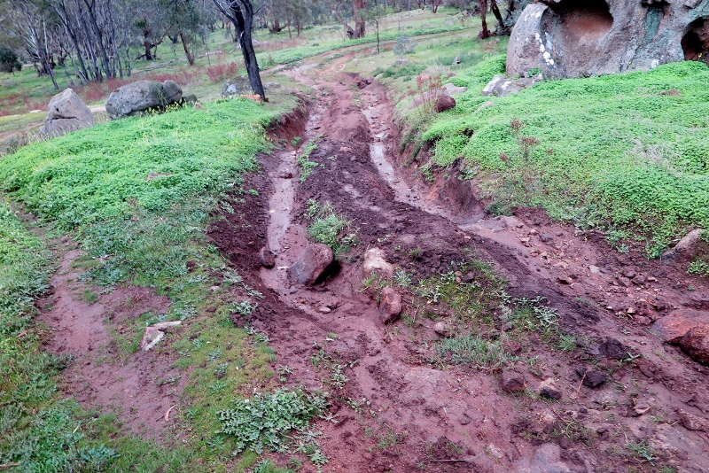
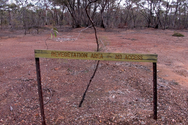
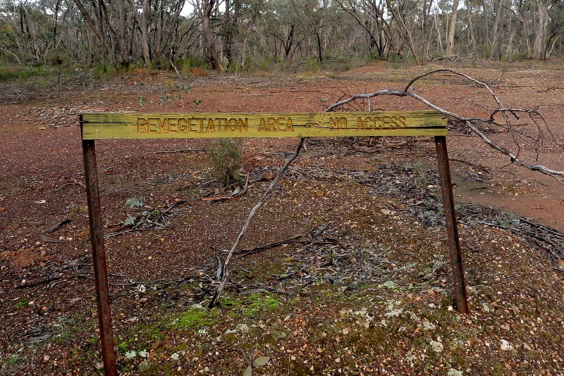
‘Minimise the impact of vehicle and track management on the park’s cultural and natural values.’ Readers of this site will know that this part of the management plan is treated with contempt. Roadside vegetation is routinely massacred by careless roadworks…

So it would be good if the Plan was more accessible, and better known…We look forward to an updated version being made available to the public.

More important than that plan, however, is the absence of practical Park information from the web. Parknotes, for example, have disappeared. These are the A4 sized sheets, often full of interesting information.

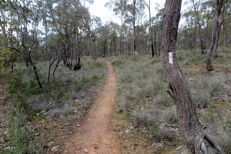
That info is now unavailable from Parkweb, however. If, for example, you wanted to find out something on the Rise and Shine reserve, this is what Parks gives you:


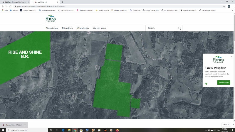
That’s it! If you want something more useful, go to Geoff Park’s Natural Newstead site, and you’ll find notes to accompany you on the walk through that reserve.

Parkweb is similarly lacking in info on other sites in the region.

Does this matter? Can’t people just work out for themselves what to see and where to go? Well, yes and no. Parks Victoria is supposed to have an educational role, and a lot of people need and want information on the places they visit.

That unavailable management plan, for example, tells us that one of the aims of the park is to enhance visitor understanding of ‘the park’s cultural and natural values’ by the implementation of an information, interpretation and education program.’

Parknotes is a cheap and very friendly way of doing this. The sooner they’re made more available to the public the better.

Posted in News | Comments Off on What do we know? And how do we know it?

Too much gold?

That persistent gold…is it gorse? Is it oxalis? Is it Cootamundra Wattle? Is it a pain? Yes to all four!

Let’s forget about Oxalis and Cootamundra, and focus on gorse  (Ulex europaeus). Introduced to Australia as a hedge plant in the 1880s, it’s now one of our worst weeds, and has few friends in this country.

Gorse: it’s estimated to cost over a million dollars annually in the central highlands through lost productivity and control costs. A mature infestation can produce up to six million seeds a hectare…and seeds can last in the soil for up to 30 years.

The Victorian Gorse Taskforce will be delivering a series of community-wide extension programs in the Sutton Grange, Ballarat and Pipers Creek areas through July 2020.

The VGT Extension Officer, Brydie Murrihy, will conduct a property assessment either alone or assisted by the landowner and will provide professional best practice management advice tailored to the property.

The landowner will receive extension material and information on any support or assistance that may be available to them, a property map detailing location of gorse plants, a detailed weed management plan and follow up phone calls and/or visits with landholders if required.

This program is a free service and the property inspections will be scheduled to suit the participants involved.

For enquires and to set-up an inspection contact: Brydie Murrihy  0428 335 705 or email bmurrihy@cva.org.au.

Posted in News | Comments Off on Too much gold?

Have your say on cats and dogs

Recent research, funded by the Australian government’s National Environmental Science Program, has reviewed data from more than 60 studies on domestic cats:

Domestic cats are killing an estimated 230m native Australian birds, reptiles and mammals every year, according to new research that quantifies the pet’s national toll on native animals for the first time.

Researchers said owners of Australia’s 3.7m domestic cats needed to make sure their pets were indoors or contained to reduce their impact on native species. (The Guardian)

This along with many other studies has highlighted concerns about the decimation of wildlife caused by both feral and domestic cats.

Pet cats kill 61 million birds a year in Australia, a new study estimates. (The Guardian. Photograph: SilviaJansen)

We are therefore pleased to see that the Mount Alexander Shire Council is currently undertaking a review of the control of dogs and cats in a public place. They have developed a survey to help review this process. Click here to find the survey and have your say.

Posted in News | Comments Off on Have your say on cats and dogs

FOBIF walk in Fryers Ridge

The first FOBIF excursion since March attracted a group of 10 walkers. The forecast didn’t look good but it turned out to be good walking weather with no wind or rain. Christine Henderson who led the walk and lives in the Fryers Ridge area was able to take us off-track on kangaroo paths where the understory was wonderfully damp and full of surprises. Here the group poses amongst a mass of Hakeas.

Walkers in the ‘Hakea garden’

Other plants in flower or about to flower included the Bendigo Wax-flower, Pink-Bells, Tall Greenhoods, Common Heath and Woolly Wattles. It’s been an excellent year for fungi. This rare fungi, Cortinarius rotundisporus, looked just like a fried egg.

Cortinarius rotundisporus

Another spectacular sight was a mass of lichen that looked like strewn cauliflowers.

Cladina confusa

Some other plants and moss we came across are shown below. 

Thanks to Christine Henderson for leading this walk and sharing her in depth knowledge of the area, Frances Cincotta for help with identifying plants and Joy Clusker for help with identifying fungi and lichen.

Our next FOBIF walk is planned to take place in the Columbine Creek area led by Jeremy. See walks page for more details. We are not sure if government regulations will place restrictions on the number of people allowed in a group outside so please consult this website for updated details. We may have to get people to register with FOBIF once again if they intend coming on the walk.

Posted in News, Walks | Comments Off on FOBIF walk in Fryers Ridge

Sign of the times: be patient…

When we published the photo below five years ago, the only features in this bleak wasteland were a single golden wattle, a pile of rubbish, one patch of Gold Dust Wattle, and two small bushes of Daviesia ulicifolia, Gorse Bitter Pea. We gave the photo the caption, ‘Is this the saddest sign in the region’?

Sign near Perkins Reef, June 2015: at the time we asked, ‘is this the saddest sign in the region?’


The sign retains its decrepit quality, characteristic of much of the signage on public land in this region. The news for the landscape could be worse, however: we counted about 20 eucalypt seedlings (much browsed), not one but two species of pea, a few coffee bushes and much moss and lichen. Gold Dust Wattle is creeping in from the edges. The Golden Wattle is gone, and the rubbish is still there, plus a pile of what looks like eucalypt cuttings.

The same sign five years later: hanging on, hanging on. But believe it or not, that bleak ground now supports many eucalypt seedlings, together with two species of pea plants, some coffee bush, much moss and lichen…Give it a few hundred years…

OK: it’s not a paradise of biodiversity, but it’s a start. Give it a few more years…or a few hundred.

Posted in News | Comments Off on Sign of the times: be patient…