Following its objections to roadworks scalping valuable vegetation from the Fryers Ridge, FOBIF has written to the Environment Minister asking for clarification of policy on vegetation management of roadsides.
The letter reads, in part:
“Forest managers have told us that, though this method of vegetation management is not ‘ideal’, budgetary restraints prevent them from using more labour intensive methods—like selective removal of obstructive vegetation, or moderate grooming. Further, there seems to be a common assumption in the Department that ‘priority to safety’ means absolute disregard for environmental values, when it should mean: careful management of vegetation to maintain sight lines and encourage sensible driver behaviour.
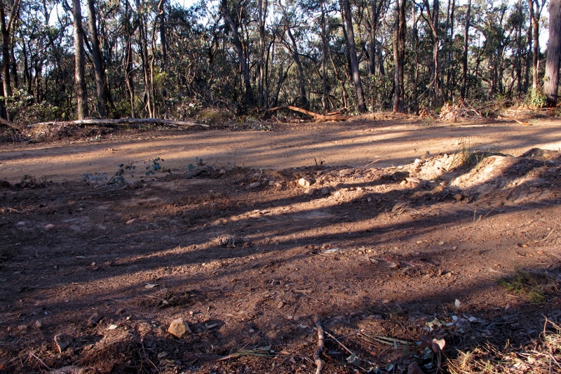
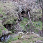
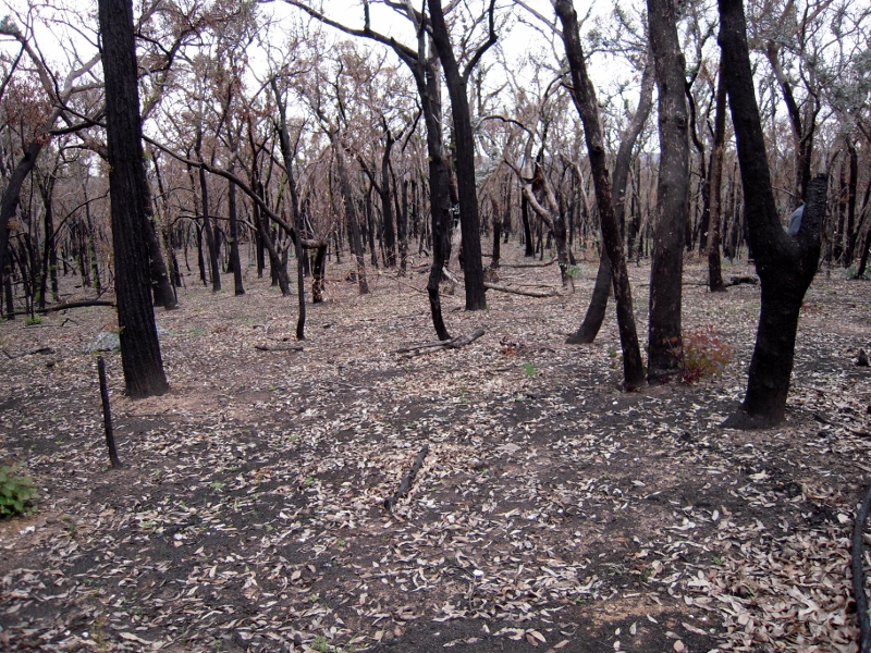
Fryers Ridge, July 2015: the road is the strip in the background. Managers plead that budget restrictions mean that ‘scalping’–scouring the earth–is the only option they have in managing roadside vegetation.
“Our group is fully aware of the necessity to maintain proper fire access roads, and to manage adjacent vegetation to minimise the likelihood of accidents. We believe, however, that this should be done with minimum of disturbance to environmental values. We assume that Victoria adheres to the common principle ‘avoid, minimise, mitigate and lastly offset’ in its road management policy?
“Given that managers often justify crude practices by appealing to budget limitations, we have four questions:
- What is the Department’s [and the Government’s] policy on roadside scalping?
- What is the Department’s 2015-6 budget for a. Forest management and b. conservation reserve management, compared to the same figures of 2005-6?
- Do the native vegetation clearance regulations which have been the subject of recent community consultation apply to the Department’s own managers?
- Is there any monitoring of the effects of roadside clearing on the environment?”
As this post is being written, controversy sputters over the destruction of 900 ancient river red gums as part of improvements to the Western Highway: seemingly another exercise by government in which ‘safety’–or in this case, speed–sweeps aside any other considerations.

![Grey mistletoe [amyema quandang, Barkers Creek, August 2015]: Mistletoes are favoured sources of food for many butterflies, and this particular species has been investigated for the medicinal properties of its leaves.](https://www.fobif.org.au/admin/wp-content/uploads/2015/08/grey-mistletoe-A-quandang-White-Gum-Rd-20-8-15-7-800x5341.jpg)


 Click on image for info/order page
 Click on image for info/order page
 Click on image for info/order page

")


")


