Water 1: jump in…again

The government is conducting another in its series of Engage Victoria consultations, this one being on the North Central Regional Catchment Strategy 2021-27. Readers may have picked up a touch of cynicism in FOBIF’s approach to these surveys, which we find seriously lacking in attention to detail. In particular, they operate in a kind of vacuum which takes no account of previous work in the area. What, for example, was achieved by the 2013-9 strategy? Or the one before that? Or the numerous other heavy documents on water in the last 20 years? [see our posts here and here]

Reports and strategies keep piling up. What have they achieved?

But hope springs eternal. We suggest you have a go.

The survey can be found here. There will be a regional round table community consultation at Harcourt Leisure Centre hall on Tuesday 17 March from 6.00 to 8,30 pm with a meal available from 5.30 pm. Book here.

Posted in News | Comments Off on Water 1: jump in…again

Water 2: guess what–it’s getting drier

We know the land is getting drier—well, most people know. Some politicians and commentators think this is just a passing phase. The rest of us have to deal with it.

On this matter it’s worth quoting some draft findings from the Victorian Government’s Long term water resource assessment.[2019] This process irritatingly divides water use into four categories, including  ‘water for human use [ household, industry, farming]’ and ‘water for environmental use [to keep waterways healthy for us and for native flora and fauna]’. News flash: water ‘for environmental use’ is water ‘for human use’. Separating human and environmental priorities creates unproductive conflicts, and is a practice that should be abandoned.

But there’s informative stuff in the draft findings. They’re for southern Victoria, but we find them eerily familiar. Here are some examples:

‘The assessment found that long-term surface water availability across southern Victoria has declined by up to 21 per cent. Current longterm surface water availability is less than when it was last estimated for the sustainable water strategies… The main cause of declines in surface water availability is drier conditions. Upstream interception of water for storage in domestic and stock dams and plantations may also be contributing to the decline in surface water availability in some basins.’…

‘Water availability for consumptive uses (by people, farms and industry) has declined in most of southern Victoria, with percentage decline varying from 1 per cent to 13 per cent. Water availability for the environment has declined in all basins except the Otway Coast. The percentage decline varied from 4 per cent to 28 per cent, mainly due to declines in above-cap water. Above-cap water is water that remains in a river after limits on diversions have been reached, as well as spills from storage and unregulated flows that cannot be kept in storage.’…

‘In most basins, aspects of waterway health most important for people, animals and plants have not been monitored for as long or as frequently as the assessment needed to identify long-term trends.’ [FOBIF emphasis]

Sound familiar? These and similar realities are what the next North Central strategy will have to deal with.

Posted in News | Comments Off on Water 2: guess what–it’s getting drier

Photo show celebrating our bushlands

As mentioned in a previous post, five local photographers are holding an exhibition at the Newstead Arts Hub in March. They are Janet Barker, Frances Cincotta, Patrick Kavanagh, Geoff Park and Bronwyn Silver. 

The exhibition, Photographers of the Goldfields 2020, is part of the Newstead Open Studios and the Castlemaine Open Studios 2020. It will be open on all weekends in March, 10am to 4pm, beginning on Saturday 7th. Also open Labour Day, 9 March. 

The official launch with refreshments is on Sunday 8 March at 11 am. Everyone is welcome.

Newstead Arts Hub: 8A Tivey Street, Newstead.  Enquiries: Bronwyn Silver 0448751111.


Heron and Egret. Photo: Geoff Park

Antechinus. Photo: Patrick Kavanagh

Fog. Photo: Janet Barker

Leaves found on FOBIF walk. Photo: Frances Cincotta

Moss and lichen on granite rock, Mount Alexander. Photo: Bronwyn Silver

Posted in News, Photo Exhibitions | Comments Off on Photo show celebrating our bushlands

Kalimna Park: the old might be new, and the new old…

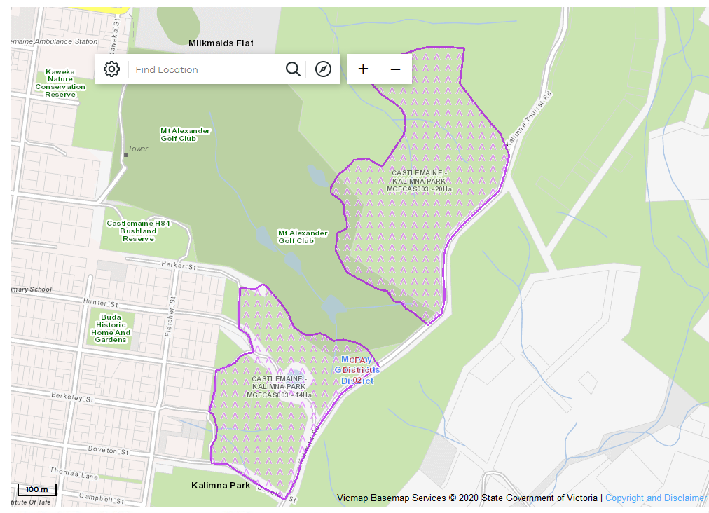
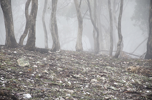
A planned fuel reduction burn for Kalimna Park is due to take place this April. The burn will be in two sections on the western side of the tourist road, and total 34 hectares.


The burn will take place as a new approach to management in the park is being developed by the Dja Dja Wurrung under its Walking Together- Balak Kalik Manya Project. The project ‘is focusing on how we can increase community connection with nature, improve visitation rates and encourage healthy use of these sites, all while maintaining and improving biodiversity. The project will promote Djaara employment and assist in Djaara reconnecting with traditional practices of land management.’ The first project newsletter can be seen here.

The proposed DELWP burn will take place in parallel with the new Indigenous approach to park management, and it’s fair to say that the two approaches will be in tension, especially when it comes to fire.

The Balak Kalik project is being developed in the context of renewed Indigenous activity in land management, including fire. ‘Cultural burning’ and DELWP fuel reduction burning are two distinct approaches to land management, and the differences between them can be seen clearly in this comment in the Dja Dja Wurrung Country Plan:

‘Planned [DELWP] burning is largely centred on fuel reduction—the cultural outcomes, impacts on Dja Dja Wurrung food and fibre plants and animals, cultural connections and obligations have been little considered. While controlled burning is beginning to integrate DDW cultural practices, fire regimes continue to damage Country. Cultural heritage in the Parks can also be damaged by the use of fire retardants, mineral earth fire breaks, control lines and in some cases the intensity of controlled burns.’

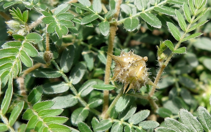
How the two approaches to land management co exist is still a work in progress, and it looks like Kalimna may be one of the more interesting sites of interaction. Managers are aware that Kalimna presents a difficult challenge. A horror fire season has put pressure on them to show they can reduce the fire threat: but Kalimna is not only a valued local asset, it’s home to the endangered Copper Butterfly. Fire managers do not want to be seen destroying the creature’s habitat.

DELWP fire managers have been consulting with Indigenous rangers about this management challenge. It remains to be seen how the two approaches to fire interact. It’s to be hoped that the very old practice of cultural burning might go some way to creating a new DELWP approach to fire.

Posted in Fire Management, News | 1 Comment

Decline or blip?

Most of our readers will be familiar with Geoff Park’s blog, Natural Newstead. If you haven’t read his recent posts on local bird numbers, it’s worth having a look:

During the week I paid visits to Rotunda Park and Mia Mia Track and on both occasions observations followed recent trends – very few birds and a lack of variety. No sign of robins (apart from a single Eastern Yellow Robin in the Mia Mia) or whistlers and very few honeyeaters. Let’s see what happens over the next month … I’d be very interested in other local notes to add to the mix. (see 29th February post, Natural Newstead)

Damian Kelly, another local bird expert, has commented:

I read your recent blog posts about species numbers with interest. Being out and about quite a bit I have to agree with your comments. Apart from a few Yellow Robins and a couple of Jacky Winters locally I have not seen any other small insectivores so far this year. Quite disturbing. (See Geoff’s post for full text.)

Geoff plans to follow this theme in posts over the next month.

Posted in Nature Observations | Comments Off on Decline or blip?

Here’s a new friend you may not want to meet

The harmless, even charming looking plant below is Tribulus terrestris—variously called Caltrop, bindii, cat’s head, goat’s head, yellow vine. It’s a native of North Africa, now naturalised around the world, including Australia. It’s thought to have been introduced here as a contaminant in seed from the Mediterranean area, California or South Africa, and spread widely when its seed was caught in car tyres in the 1920s and 1930s.

Calthrop/Bindii…a new arrival in our district: how did it get here?

A grisly list of the problems associated with this plant can be found here. They relate to the seed, a diabolical looking object vaguely like a land mine from an alien planet. It’s painful to stand on, punctures bike tyres and can stick to pets’ feet. Obviously not something to have to put up with on a sports field.

Caltrop seed: a glance will suggest why it’s painful.

Caltrop/Bindii is most commonly found in the North of Victoria, but seems to have recently arrived in Castlemaine, where it’s been found on the Western Oval and some roadsides. How did it get here? The common factor in all sites found so far is that they’ve been disturbed by road and other works, or seem to have soil brought in from elsewhere: another reason for paying more attention to the cleaning of machines, and for being more careful about transferring soil from one place to another.

Posted in News | 1 Comment

Fire 1: Here we go again?

The terms of reference for the national royal commission into bushfires contain some potentially fruitful lines of enquiry, including the ideas of national policy on biodiversity, land use planning, and indigenous land use practices.

One of the challenges the commission will face is the directive to take into consideration ‘other reports and enquiries’. There have been more than 50 of these, and it’s hard to see how the commissioners can come up with something new, unless it’s a way of actually getting recommendations effectively implemented.

Take land use planning, for example. Here’s part of the Black Saturday Royal Commission recommendation 39 on the matter: ‘The State amend the Victoria Planning Provisions relating to bushfire to ensure that the provisions give priority to the protection of human life, adopt a clear objective of substantially restricting development in the areas of highest bushfire risk—giving due consideration to biodiversity conservation—and provide clear guidance for decision makers.’ [FOBIF emphasis].

Here’s Kevin Tolhurst on the fate of that recommendation:

‘The Government and its agencies has … been timid in applying land-use planning regulations in bushfire-prone areas. While the CFA, with its experienced and specialist bushfire planning staff, has been removed from its role as a planning authority with the power to accept or reject planning applications for buildings and developments in bushfire-prone areas.’

Let’s see how this Royal Commission goes around that circle.

Posted in News | Comments Off on Fire 1: Here we go again?

Fire 2: Around and around the burning bush

Another part of the terms of reference is to investigate the matter of ‘hazard reduction.’ Although this has been a favourite theme of commentators wanting to distract the public from the fact that climate change might be making bushfires worse, it also could be a good subject to consider.

Except that it too is an idea that’s been kicked around endlessly with no apparent consensus. Who now remembers the 2008 Victorian Parliamentary enquiry into land management and bushfires? One of its recommendations was a huge burn off target. The State Government said of that recommendation:

‘The Victorian Government supports planned burning to improve protection, conservation and production outcomes. However, the annual area treated by planned burning needs to be determined based on science and risk management frameworks and be subject to  opportunities as dictated by seasonal conditions.

‘Given this, the Government recognises that the amount of planned burning will vary to take into account these factors.

‘The Government supports a move away from focusing on hectare—based targets which may lead to inappropriate planned burning outcomes. They do not account for differences in the effort required for small area asset protection burns (often around settlements) compared to larger scale mosaic burns in more remote areas.

Then, only a few years later, the Black Saturday Royal Commission recommended a rolling 5 per cent target…and it was found unworkable and ineffective by the Commission monitor, for exactly the reasons set out in 2008—but only after a large area of land had been burned for no sensible reason.

Let’s hope we don’t have to go around that circle again.

Posted in News | Comments Off on Fire 2: Around and around the burning bush

Fire 3: the human factor

Here’s a factor which should not be forgotten: human causes of fire. We’re not talking only about arson: carelessness or sheer ignorance are factors. The fire which seriously threatened the Canberra suburbs recently was caused by an army helicopter…And it was a helicopter involved in fire protection!

It’s unfair to blame the army for this, but there’s there’s something farcical about it, although we don’t think Canberra residents would have been laughing. The lesson of it, maybe, is that for increasing lengths of time throughout the year, past ways of doing things don’t work…that the way we do things has to change. Let’s see how the Royal Commission approaches that one.

Posted in News | Comments Off on Fire 3: the human factor

Fire 4: here’s a side issue that’s not a side issue

We know the land is getting drier—well, most people know. Some politicians and commentators think this is just a passing phase. The rest of us have to deal with it, now.

On this matter it’s worth quoting some draft findings from the Victorian Government’s Long term water resource assessment.[2019] This process irritatingly divides water use into four categories, including  ‘water for human use [ household, industry, farming]’ and ‘water for environmental use [to keep waterways healthy for us and for native flora and fauna]’. News flash: water ‘for us’ is water ‘for human use’. Separating human and environmental priorities creates unproductive conflicts, and is a practice that should be abandoned.

But there’s informative stuff in the draft findings. Here are some examples:

‘The assessment found that long-term surface water availability across southern Victoria has declined by up to 21 per cent. Current long term surface water availability is less than when it was last estimated for the sustainable water strategies (SWSs). The main cause of declines in surface water availability is drier conditions. Upstream interception of water for storage in domestic and stock dams and plantations may also be contributing to the decline in surface water availability in some basins.’…

‘Water availability for consumptive uses (by people, farms and industry) has declined in most of southern Victoria, with percentage decline varying from 1 per cent to 13 per cent. Water availability for the environment has declined in all basins except the Otway Coast. The percentage decline varied from 4 per cent to 28 per cent, mainly due to declines in above-cap water. Above-cap water is water that remains in a river after limits on diversions have been reached, as well as spills from storage and unregulated flows that cannot be kept in storage.’…

Posted in Fire Management, News | Comments Off on Fire 4: here’s a side issue that’s not a side issue