Parks Victoria has released a draft Land Management Strategy for consultation. You can find it here, together with info on how to put in a response to the strategy. The consultation is open till November 1.
The draft document has many pictures of happy people and healthy wildlife. It has some good material in it too, about indigenous co-management, population pressure, and responses to climate change.
Parts of it, however, are less attractive, even downright sinister. Look at these objectives:
–Ensure that existing and proposed private operations add value and deliver benefits for parks
–Work to ensure that private operations and Parks Victoria’s own business operations in the parks are efficient and sustainable
–Adapt and reuse heritage places where appropriate to support tourism, commercial and community activities
–Develop, where appropriate in partnership with private operators, sustainable tourism businesses
(Our emphases)
It’s clear that Parks Victoria is now in thrall to the idea that it has to encourage private and profit making businesses in the Park estate. This is not in fact the purpose of national parks, as defined in the 1975 National Parks Act, though of course well managed parks do bring tremendous financial and social benefits to the community. The above proposals are full of jargon about sustainability (the word appears multiple times through the document). Further, marketing jargon like ‘target markets’, ‘visitor segments’ and ‘nominated indicators’ infests the document. There are probably people who are excited by such language. It’s not the language of conservation, however.
Is there a problem with tourism enterprise penetrating the parks? There is, if ‘licensed tour operators’ actually replace park rangers as the face of our parks system. The problem with this document is that it doesn’t even canvass the problem as a problem: for Parks Victoria, and the state government, the debate, if there has been one, is over. Maybe the state of thinking on this theme is summed up by this sentence, on page 34 of the document:
‘Partner with tourism, industry organisations and Traditional Owners to initiate and promote.’
That’s right. The sentence makes no sense. But we get the meaning: we want to initiate and promote… whatever.
Have a look at the document, and offer an opinion. But maybe we should draw attention to the quite menacing caveat offered by Parks at the very start:
‘This publication may be of assistance to you but Parks Victoria and its employees do not guarantee that the publication is without flaw of any kind or is wholly appropriate for your particular purposes and therefore disclaims all liability for any error, loss or other consequence which may arise from you relying on any information in this publication.’

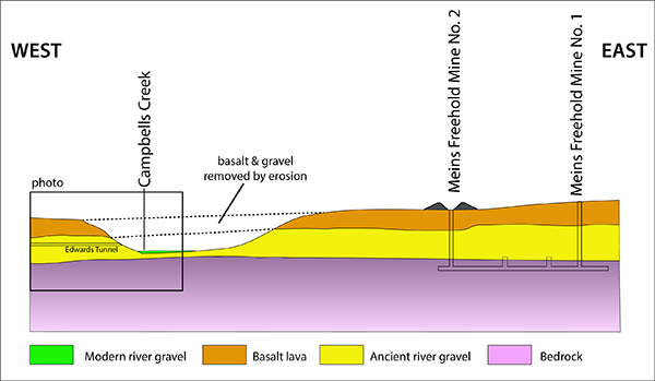

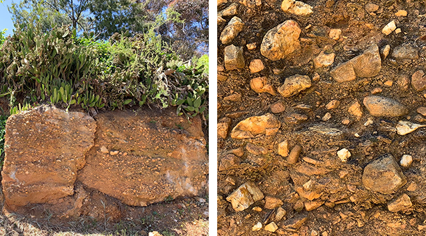
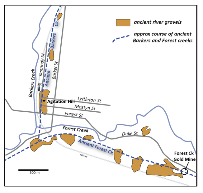 This is the first post in our geology series written by Clive Willman.
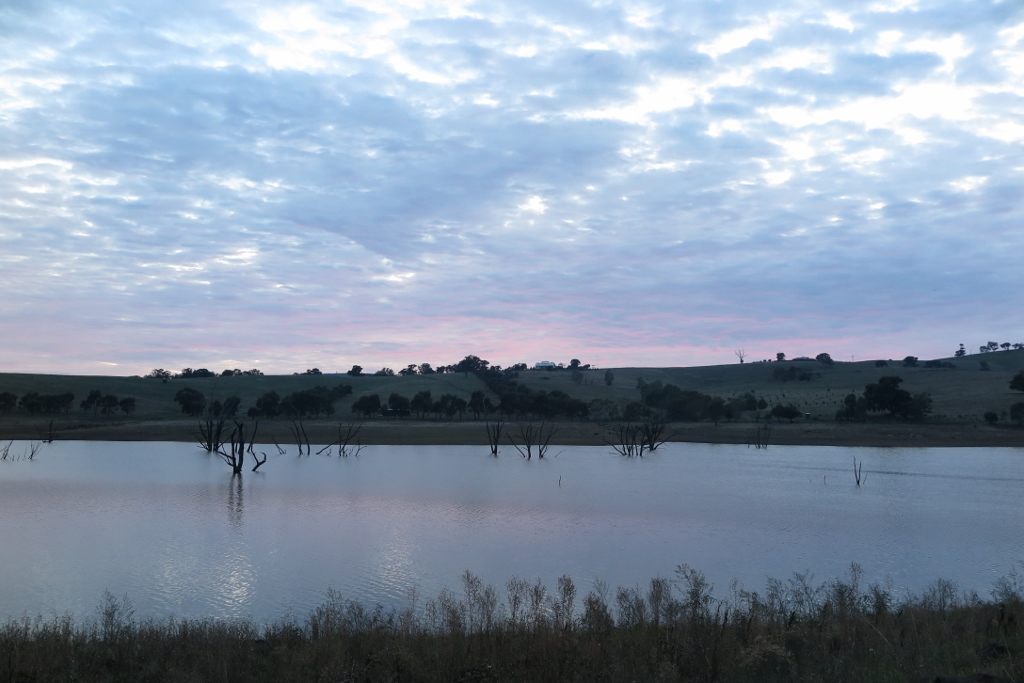


 Click on image for info/order page
 Click on image for info/order page
 Click on image for info/order page

")


")


