
A small group of FOBIF members took a stroll last week through a patch of the Fryers Forest slated for burning within the next two years. This is burn is coded CAS-0243 Glenluce – Columbine Creek and is in the area bounded by Hunters Track and Hunters Lane. FOBIF walkers passed the edge of this zone last year on our Columbine Creek excursion.
Like all of our bushland, this small (71 hectares) patch of bush has its own fascination. Significantly mined in the distant past, and burned by the Department in 2008, it’s variably covered with tussock grass woodland, with some areas of dense, mainly wattle, understorey. The trees are larger than most in the Fryers forest, and there are few or no coppiced trees.
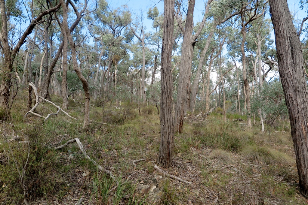
In the Hunters track proposed fire zone, April 2021: a mix of tussocks and shrubs, in an area burned 13 years ago.
The unburned areas bounding this zone, especially on the western side of Hunter’s track, are a remarkable example of tussock woodland, with trees very much larger than we are accustomed to seeing in this region. FOBIF sees this unburned bush as a kind of control zone, an indicator of the effect of fire both as a fuel reduction method, and as a way of influencing the ecology of the bush.

In the adjacent forest, unburned for many decades. The photo was taken in December, when the grass was greener, but in other respects the scene is unchanged.
FOBIF has enquired of DELWP about the burn history of this block. We have also asked questions about the recent department burn around Wattle Track, in the Fryers Nature Conservation Reserve. This varied from a moderate, patchy effort to an extremely severe and destructive fire. We’re trying to find out how our managers assessed the result of the exercise.
Our questions arise from our curiosity about the actual effects of hazard reduction burns, both ecologically and from the point of view of fuel loads. In our view, this is a very complex issue: but the political debate about it is infected with the convenient notion that reduction burns vacuum up fuel and make us all safer. Only by paying close attention to the effects of each burning exercise will a more realistic view emerge. That would require better resourcing for managers, of course.
A map of the zone in question, and other proposed management burns, can be found on the Department’s excellent interactive map here.


 Click on image for info/order page
 Click on image for info/order page
 Click on image for info/order page

")


")


The final points here are extremely important. But how do we get the agents of our governance to give specific answers to specific questions ? The usual answers, being wordy, generic and deflective, are, it seems to me, intentionally obfuscatory and lack integrity.