Reminder to register for FOBIF walk

The next FOBIF walk on Sunday 17 October will be to the Fryers Range area. See the walks section of the website for more details. If you are interested email FOBIF (info@fobif.org.au) to register. At this stage the walk will probably go ahead with limited numbers but check the website before the walk as things could change. People will have to wear masks and car pooling won’t be possible.

Posted in Walks | Comments Off on Reminder to register for FOBIF walk

Strategic Fuel Breaks 1: settlements

The draft map below shows the strategic fuel breaks proposed for the Castlemaine township area. Final decisions about the breaks are yet to be made, but the works are expected to be completed this financial year.

The main fuel breaks projected are

North of Castlemaine: Dalton’s Track and Youngmans track.

In the township: borders of Kalimna and Kaweka

South of the town:

—areas along Moonlight and Forest Creeks

—Poverty Gully, Little Bendigo, the Loddon Prison, Mathiesson Drive.

—Chewton: around Adelaide Street and the Fryers road.

The fuel breaks are essentially mulched areas up to ten metres wide along roadsides: but we are assured that they will not be all the same. The Forest Creek works will involve removal of weeds, for example, as will much of the work around Kalimna. The Castlemaine Field Naturalists have expressed concern about the effects of mulching Youngmans Track, a notable wildflower area: discussions are proceeding on this part of the project.

Posted in Fire Management, News | Comments Off on Strategic Fuel Breaks 1: settlements

Strategic fuel breaks 2: bushlands

The draft map below shows the strategic fuel breaks proposed for the Castlemaine region. The lines are provisional but we are assuming they’ll be close to final.

The black lines are the breaks around the Castlemaine-Chewton area, plus the important Chewton-Fryerstown road. They are to be implemented this financial year.

The blue lines are for works planned for 2022-3. They include an east west break through the Muckleford Forest, along Bells Lane Track; and Fryers Ridge Road and Salt Water Track in the Fryers Forest.

As we’ve previously reported, FOBIF is generally supportive of appropriate fire protection works around settlements, or directly concerned with settlement safety. Our main worry with this project relates to the forest breaks: in our view, mowing high value roadsides permanently down to 10 centimetres and mulching the result would be an amenity catastrophe and a serious biodiversity setback. The fuel breaks project includes provision for research by the Arthur Rylah Institute on the ecological effects of mulching, but in our view such research would have a lot in common with an autopsy.

Fryers Ridge Road, September 2021: Under current proposals this would be mown down to 10 centimetres, mulched, and kept permanently in that state.

FOBIF has asked the fuel breaks project leaders to consider whether the desired safety outcome could be achieved by extra tree thinning and judicious understorey management along roadsides. A justification for this approach can be found in Melbourne University research. The authors of the research conclude:

‘Thinning to reduce fire risk is intended to slow the rate fire spreads, lower flame heights and improve recovery after wildfire hits. This was shown in a 2016 extensive review of US research, which found thinning and prescribed burning helped reduce fire severity, tree mortality and crown scorch. A 2018 study on Spanish pine forests had similar results.

‘Our own research on Australian forests also supported these findings. We found mechanical thinning plus burning in silver top ash reduces fire fuel hazard, with major reductions in dead trees, stumps and understory.

‘We compared thinned and unthinned alpine ash forests using computer modelling, simulating severe to extreme weather conditions. And we found modelled fire intensity decreased by 30% and the rate of fire spread and spot fires moving ahead of the main fire decreased by 20% with thinning.’

Thinning, properly implemented, can also have ecological benefits.

FOBIF is not wedded to this or any other specific approach to fire safety: what we are urging is that fire managers investigate approaches which might have safety and ecological benefits. We are as concerned about safety as anyone: but we are opposed to any approach which assumes that human safety is incompatible with ecological health.

Posted in Fire Management, News | Comments Off on Strategic fuel breaks 2: bushlands

October walk

Our next FOBIF walk will be led by Christine Henderson in the Fryers Ridge area on October 17. Check the walks page for more details. If you are interested in coming you will need to register by emailing FOBIF (info@fobif.org.au). Check the website before the walk in case regulations change regarding outside gatherings.

Posted in Walks | Comments Off on October walk

Strategic fuel breaks: is it necessary to flatten nature to make our forests safe?

As we reported on August 16, DELWP is planning to create fuel breaks in this region, both near settlements and through bushland: ‘Strategic Fuel Breaks are a strip of land where vegetation has been permanently modified to reduce the rate of spread and intensity of fire for the direct protection of assets and/or assist fire control.’ (FOBIF emphasis).

Fryers Ridge road: how would this verge look when turned into a fuel break?

The breaks will generally be along tracks or roads. They could be up to 40 metres wide, including the width of the roads, though in our region they may be narrower. There is some confusion about how they’ll look: some documents say that they are mown down and mulched to 10 centimetres, others that they can resemble ‘open grassy wood or heath lands.’ The difference is important: no heathland would survive being mown and mulched to 10 centimetres. We’re hoping to clear up exactly what is meant by the breaks proposed for our region.

Some of the proposed breaks are centred around Castlemaine and Chewton, others are planned for the Fryers Forest and the Diggings Park, including Fryers Ridge road and Porcupine Ridge road.

Last Monday the FOBIF committee adopted the following position on the breaks:

  1. Fuel breaks near settlements are in principle a good idea, consistent with the principle of giving priority importance to human life.
  2. Thinning of bush roadside trees, and removal of hazardous ones, is a sensible safety measure, if properly done
  3. The mulching of bush tracksides is a serious biodiversity and amenity risk. Each trackside should be treated on its merits, but we believe that mulching the Fryers Ridge and Porcupine Ridge road verges would be

–an amenity catastrophe: the status of the roads as wildflower hotspots will be perhaps definitively damaged. We believe that the view shown in the above photo will no longer be seen along these roads.

–a very serious reduction of biodiversity value for the whole of those forests, regardless of the protection offered to pockets of endangered species.

FOBIF is acutely aware of the risks posed by fire in a warming climate. We believe, however, that fire protection measures should be undertaken with every effort made to avoid damage to natural systems. There’s not much point in destroying the village to save it.

Is it possible to manage vegetation along major bush roads so as to ensure firefighter safety, without reducing vegetation to a lawn? We hope so.

So far, consultations between local environment groups and the fuel breaks team have been constructive. We hope they continue that way.

Posted in Fire Management, News | 2 Comments

September walk cancelled

We have decided to cancel Geoff Nevill’s September FOBIF bushwalk due to the current restrictions on group gatherings. Hopefully we will be able to offer the walk next year.

The October walk in the Fryers Ridge will be led by Christine Henderson. Check out the details here. Once again check this website beforehand.

Posted in News, Walks | Comments Off on September walk cancelled

In case you missed it…

ABC Television’s Gardening Australia program ran a segment on our local bushlands on August 20.

Gardening Australia’s Millie Ross (right) discusses carnivorous plants with Cassia Read. The program covered soil crusts, Ironbarks and quite a lot in between.

The program, filmed on the Monk, packed a lot into its 8 minute duration. Local ecologist Cassia Read invited viewers to take a close up look at their surrounds, starting from the ground up; and presenter Millie Ross reminded us that gold was just a ‘moment’ in the history of this place, and that we would do well to take the long view on what is of value in it.

You can find the program on iview, here. The segment starts just after 29 minutes.

And while we’re on the subject of looking about us,  it’s National Wattle Day this Wednesday, September 1: not a big day on the calendar, maybe, but worth a moment’s reflection. We recommend Megan Backhouse’s short Age article on wattles, here.

Posted in News | Comments Off on In case you missed it…

Ian Higgins: A world lost…A world to regain?

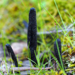
The nature and function of peas

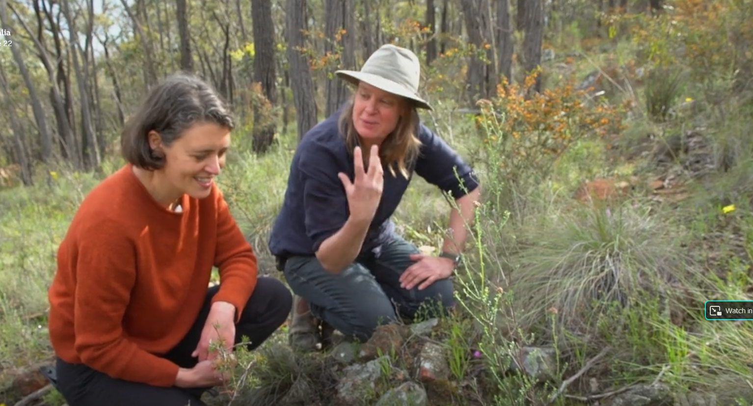
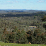
The lush grasslands Major Mitchell called Australia Felix in 1836 were the starting point of Ian Higgins’s inspirational talk to the FOBIF AGM on August 9.

The park-like scenes which so excited Mitchell were the end-product of processes the Major knew nothing about: Indigenous management, and a botanical complex entirely suited to the soils and climate of Victoria.

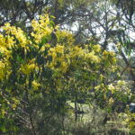
Mitchell spoke in ‘rhapsodic terms about how brilliant the native pastures were.’ Legumes—native pea plants — were the nitrogen fixing engines of these pastures…

‘Inert Nitrogen gas is abundant in the atmosphere, but needs to be chemically “fixed” in the soil for it to be made available to plants, for which it is an essential growth nutrient.  While the chemical “fixing” is always done by micro-organisms, some plants host these organisms allowing them to work faster.  The best known are the legume plants, all of which now belong to the Fabaceae family—including our native peas.

Globally, legumes and other natural processes create the vast majority of fixed nitrogen, but since the industrial revolution, fossil fuels have been used to “fix” nitrogen into ammonia (which is then modified into fertilisers).  Widespread and increasing application of artificial nitrogen fertiliser is now a global problem degrading waterways and polluting groundwater (not to mention the greenhouse gas consequences of their production).

The fate of native legumes in pastoral lands

Mitchell did not understand the importance of peas to the health of our grasslands, and neither did the pastoralists who followed him.

It took less than five years for the rich native pastures of Victoria to be degraded by European practices.  Pastoralist John Robertson described the fate of these idyllic landscapes in 1853, after just 3-4 years of his management:

‘Many of our herbaceous plants (which included 37 species of grasses) began to disappear from the pasture land… and die in our deep clay soil with a few hot days in spring, and nothing returns to supply their place until later in the winter following. The consequence is that the long deep-rooted grasses that hold our strong clay hill together have died out;  the ground is now exposed to the sun, and it has cracked in all directions, and the clay hills are slipping in all directions; also the sides of precipitous creeks—long slips, taking trees and all with them…

‘…One day all the creeks and little watercourses were covered with a large tussocky grass, with other grasses and plants, to the middle of every watercourse…now that the only soil is being trodden hard with hard with stock, springs of salt water are bursting out in every hollow or watercourse, and as it trickles down the watercourse in summer, the strong tussocky grasses die before it…the clay is left perfectly bare in summer…Now mostly every little gully has a deep rut…ruts seven, eight and ten feet deep, and as wide, are found for miles…

‘…And after all the experiments I worked with English grasses, I have never found any of them that will replace our native sward. The day the soil is turned up, that day the pasture is gone for ever as far as I know.’ 

In SE Australia, the agricultural solution to widespread depletion of soil nitrogen was the introduction of exotic legumes, particularly, subterranean clover.  This is a technique known as ley farming, where crop or pasture species are interspersed in time or space with legumes to maintain soil nitrogen that would otherwise diminish with every harvest.

Unlike our native legumes, the exotics couldn’t be sustained on our infertile soil without the addition of phosphate fertiliser—in Australia, usually as “superphosphate”.

The “sub and super” combination certainly was a revolution in terms of propping up exotic (foreign species) based agriculture for a century, but it was the death knell for many native species that until the advent of aerial fertiliser broadcasting, could persist in steep or rocky bush paddocks.

Where imposed, this high fertility regime brought about widespread dieback of trees, worsened the dryland salinity problem and, wiped out most of our native herbaceous plants, which cannot compete with the luxuriant growth of pasture composed of invasive species.  Locally, our indigenous leguminous herbs that were once typical components of grasslands and woodlands are now extinct or almost so.

Having ransacked the Pacific islands for its phosphate supply, Australia and the rest of the world may soon face “peak phosphate”.  Regardless, inexorably rising prices will eventually make phosphate dependent exotic ley farming unsustainable in naturally infertile areas.

When that happens, wouldn’t it be nice to have some native legumes that can thrive in low phosphate landscapes!

Could the lost world of native pasture lands be brought back?

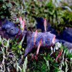
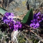
Ian presented pictorial profiles of the native peas of our region that are now locally rare, endangered or extinct.  All but one of these are herbaceous and would have been among those that greeted the Mitchell expedition, and caused him to call Western Victoria ‘Australia Felix’.

Ian posed a challenge for local enviro groups and concerned citizens: “Can we not, in our environmentally aware community restore these species to viable, wild populations?”.

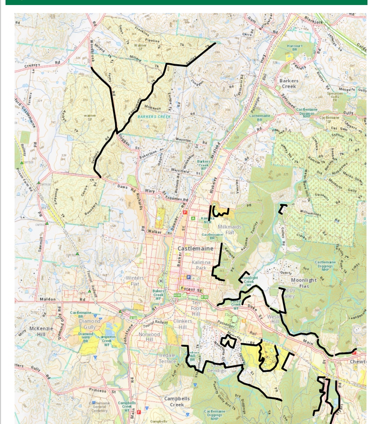
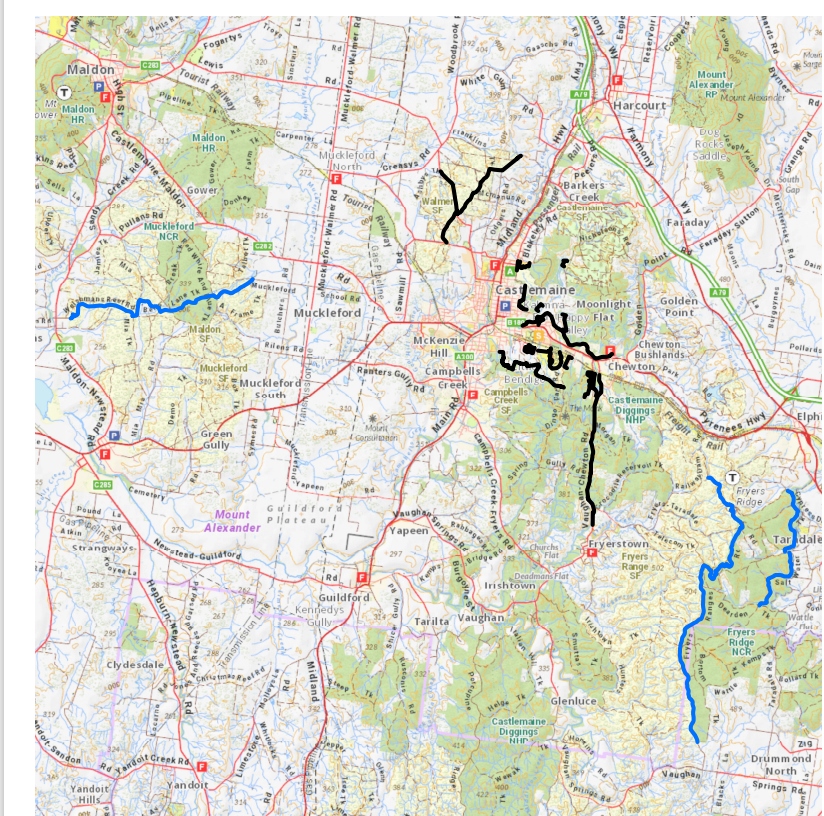
The table below lists these plants.  The botanical names are hyperlinked to photos on another of Ian’s projects, the VicVeg Online website.

Common name Botanical name Indigenous ley farming opportunity?
Slender tick-trefoil Desmodium varians
Clover glycine Glycine latrobeana
Variable glycine Glycine tabacina
Austral Trefoil Lotus australis
Southern Swainson-pea Swainsona behriana
Broughton Pea Swainsona procumbens ✖ (toxic to introduced livestock)
Emu-foot or Tough Scurf-pea Cullen tenax
Golden Spray Viminaria juncea ✖ (woody shrub)


Ian said: “there’s good reasons for hoping that we can get back some of these plants in our district”.  One was that Mount Alexander Shire has more landcare and environmentally focussed groups than anywhere else in Victoria.  He encourages us to request these plants from local indigenous nurseries and grow them in whatever way we can manage: even in gardens or in pots they can produce more seed which is in extremely short supply.

Another was that amazing things can happen once fertility of soil is reduced.  As an example, Ian noted the reappearance of orchids in his suburban native grass lawn established on top of repeatedly disturbed soil mixed with building rubble.  This happened by itself once the fertility was reduced by removing the lawn clippings over a period of twenty years or so.

Lastly, the regenerative agriculture movement described by Charles Massey in his book, Call of the reed warbler offers a more sustainable approach to agricultural production.  Pastoralists working in this field seek to return perennial native grasses and other herbs through grazing management.  They understand that high fertiliser applications are counterproductive.  Ian proposed engaging with the regenerative agriculture movement as one way we might restore our native pasture legumes to the district.

On a sobering note, he pointed out that plants constitute 57% of endangered species, but get only 4% of funding devoted to their conservation management.

‘Plant blindness is a terrible affliction’

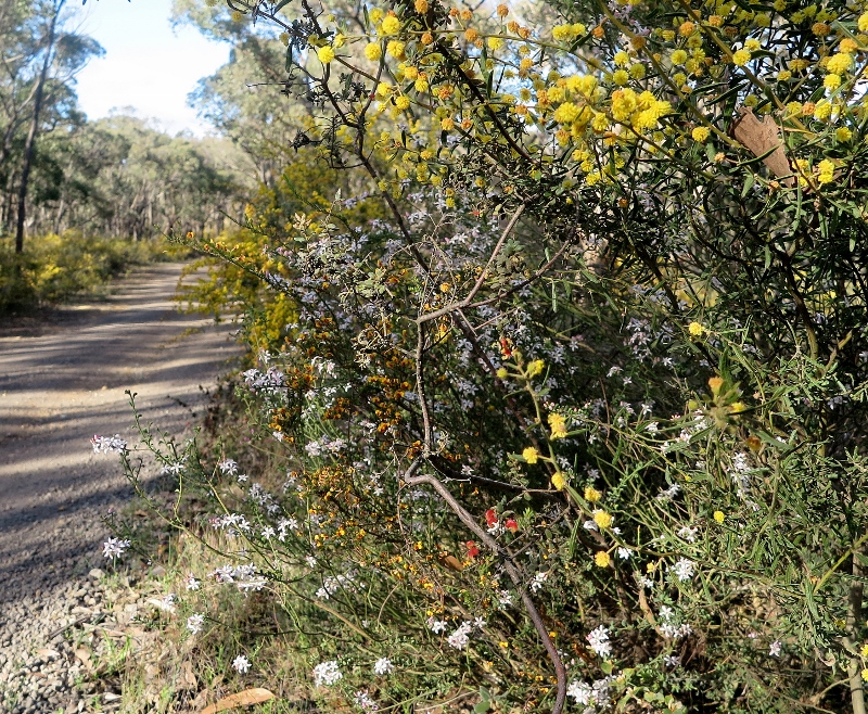
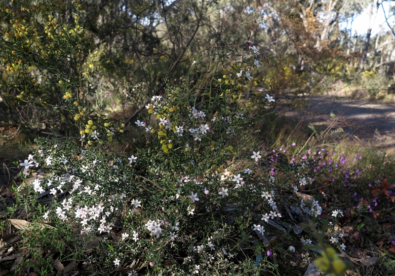
Although our herbaceous peas have declined dramatically, we still have many pea species in our district.  The story of their survival is also linked to phosphate levels.  The more fertile parts of our region that supported grasslands and woodlands were preferentially converted to agriculture, exterminating our herbaceous peas in the process.

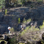
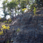
In contrast, much of the low fertility sedimentary ranges were left relatively unscathed by farming (though often ravaged by gold mining).  Here, a wonderful variety of forest pea shrubs still survives and thrives, thanks to their evolution of sclerophylly and other traits that enabled them to cope with extremely low levels of soil phosphate.

Their diversity is bewildering to beginners at plant identification who often resort to the old “egg and bacon flower” as a generic name to cover the twenty or so local species.

Ian acknowledged this difficulty and gave a run down on ID guides to plants over the decades, before launching FOBIF’s Native peas of the Mount Alexander region, which he very kindly placed in company of such wonderful guides as that by Leon Costermans.  Plant identification, he argued, is ‘a way to deal with reality’, and added: ‘Plant blindness is a terrible affliction’.

Part of the cure for this affliction is now –potentially—in our hands!

Posted in Nature Observations, News | 4 Comments

Slime mould knows the way out of Ikea!

Here’s a curious note on slime mould research, from the London Review of books :

Trichia affinis in a Castlemaine garden: slime moulds are very mysterious life forms: not plants, not fungi, a little bit like animals. If they can find their way out of Ikea, maybe they have something to teach us?

‘The mycologist Lynne Boddy once made a scale model of Britain out of soil, placing blocks of fungus-colonised wood at the points of the major cities; the blocks were sized proportionately to the places they represented. Mycelial networks quickly grew between the blocks: the web they created reproduced the pattern of the UK’s motorways (‘You could see the M5, M4, M1, M6’). Other researchers have set slime mould loose on tiny scale-models of Tokyo with food placed at the major hubs (in a single day they reproduced the form of the subway system) and on maps of Ikea (they found the exit, more efficiently than the scientists who set the task). Slime moulds are so good at this kind of puzzle that researchers are now using them to plan urban transport networks and fire-escape routes for large buildings.’

We’re not exactly sure what to conclude from this, except that it suggests that fungi and slime moulds would be terrific subjects for research.

And adapting Ian Higgins’s assertion (see our post), we could say, ‘Nature blindness is a terrible thing!’ So, if you’re looking for some lockdown reading, here are a few suggestions:

Alison Pouliot The allure of fungi: a book of amazement, beautifully illustrated.

Alison Pouliot and Tom May: Wild mushrooming– fungi for foragers. How to tell the delicious from the deadly!

Joy Clusker and Ray Wallace: Fungi of the Bendigo region. The one to carry around our bushlands…

Sarah Lloyd: Where the slime mould creeps. This book is a real eye opener. Sarah’s talk at the FOBIF AGM a few years ago was a hit, and her Instagram photos are astonishing.

Posted in News | Comments Off on Slime mould knows the way out of Ikea!

A walk on the high side

A small group took on FOBIF’s August walk in brisk sunny weather yesterday. The route started below the Expedition Pass spillway and negotiated the western end of the Reservoir and up to the highest point of Specimen Gully Road, then back along the top of the ridge above the Res.

The spillway, Expedition Pass reservoir, August 15: the water is not an everyday sight.


The spillway was flowing freely—not something you see every day of the year. Hovea and Hardenbergia were in prolific flower, some unusually grand Stringybarks were passed along the way, and the views from the ridge top were, as expected, exhilarating–taking in a sweep from Mount Alexander around to Macedon, Franklin and Kooroocheang.

The distance covered: between 9 and 10.8 kilometres—the best minds in the group were unable to reach agreement!

Our thanks to Barb Guerin and Lionel Jenkins for devising a terrifically interesting route, and negotiating passage from no less than five landowners.

Next month’s walk is planned for the Muckleford Forest. Given the possibility of changed virus regulations, please check the website before the due date.

Photos by Liz Martin (first 10 photos) and Bernard Slattery (last 2 photos):

Posted in News, Walks | 3 Comments