
The draft map below shows the strategic fuel breaks proposed for the Castlemaine township area. Final decisions about the breaks are yet to be made, but the works are expected to be completed this financial year.
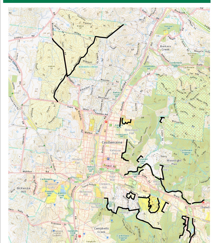
The main fuel breaks projected are
North of Castlemaine: Dalton’s Track and Youngmans track.
In the township: borders of Kalimna and Kaweka
South of the town:
—areas along Moonlight and Forest Creeks
—Poverty Gully, Little Bendigo, the Loddon Prison, Mathiesson Drive.
—Chewton: around Adelaide Street and the Fryers road.
The fuel breaks are essentially mulched areas up to ten metres wide along roadsides: but we are assured that they will not be all the same. The Forest Creek works will involve removal of weeds, for example, as will much of the work around Kalimna. The Castlemaine Field Naturalists have expressed concern about the effects of mulching Youngmans Track, a notable wildflower area: discussions are proceeding on this part of the project.


 Click on image for info/order page
 Click on image for info/order page
 Click on image for info/order page

")


")


