Last FOBIF walk for the year

Alex Panelli led the last 2014 walk on 19 October in the Fryers Ranges around the Sugarbag Track area. Noel Young wrote the following piece on the walk and included an extensive flowering plant list:

On a day of glorious weather, the walk for most of us quickly turned into a Wildflower Walk as Alex had selected an area which was flowering profusely and appeared to be at the peak of the season. Unlike last month’s walk there was no sign of cup moth damage, and the trees looked very healthy. Another healthy sign was the almost constant calling of birds all along the track. Although I have not mastered all the bird calls, I could list as definites: Horsefield’s Bronze Cuckoo, Golden Bronze Cuckoo, Fan-tail Cuckoo, Grey Thrush, White throated Tree-creeper, Rufous Whistler, Fuscous Honey-eater, Olive backed Oriole, Grey Fantail, Blue Wren, Kookaburra, and Spotted Pardalote.

I counted about 30 species of flowering plants: Yam Daisy, Slender Rice flower, Pink Bells, Milkmaids, Creamy Candles, Primrose Goodenia, Fairy Wax-flower, Common Beard-heath, Grey Everlasting, Sticky Everlasting, Downy Grevillea, Billy Buttons, Fireweed (Senecio sp), Showy Parrot-pea, Matted Bush-pea, Prostrate Flat-pea, Bulbine lily. Chocolate lily, Black Anther Flax-lily, Erect Guinea-flower, Daphne Heath, Native Violet and Twining Fringe-lily.

Spider-orch-10049

Spider Orchid (Caladenia phaeoclavia). Photo by Noel Young

Orchids: Spotted Sun-orchid, Bearded Greenhood, Purplish Beard-orchid, Pink Fingers, Hooded Caladenia and Waxlip Orchid.

Theo Mellick-Cooper took the first three photos below and the rest were taken by Bronwyn Silver. Click to enlarge.

Posted in News | Comments Off on Last FOBIF walk for the year

The Road Not Taken

web-map

Robert Frost wrote a famous poem called ‘The Road Not Taken’ that begins with the line ‘Two roads diverged in a yellow wood’. Had he been writing about Kalimna Park he might have added ‘then diverged again, and again, and again’. It’s a fact that Kalimna Park has got more trails than it knows what to do with and a walk there almost always involves a series of decisions about which ‘road’ to take that day.

Enter Jase Haysom. Central Victoria’s original GPS-wielding cartographic adventurer and community mapper extraordinaire. Jase has spent the last few months mapping Kalimna Park to create a topographical map that shows almost all of the roads and trails in the Park – he drew the line at kangaroo paths and goat tracks.

Thanks to Jase’s effort you can now download a map of Kalimna Park page from his Cartography Community Mapping website.

The map will also be made available as a hardcopy from the Castlemaine Information Centre and will be used by the Friends of Kalimna Park to help them plan activities and promote the park. The Friends hope that the map can eventually be installed at the Kalimna Point carpark.

As for the ‘road not taken’, Jase will never have to sigh at the thought it – he’s mapped them all!

Posted in News | Comments Off on The Road Not Taken

‘Foolishly, disastrously wrong’

‘There was never a body of men so foolishly, disastrously wrong,’ wrote Eric Rolls in his 1984 book, They all ran wild.

He was talking about the Acclimatisation Societies of Australia, people who believed that this continent was lacking in nice plants and animals, and decided to bring a few good ones in. Among their introductions were carp, rabbits, sparrows and starlings.

Local researcher Doug Ralph has unearthed the 1874 annual report of the Castlemaine branch of the society. It’s easy to be superior about their efforts from this distance, but their attitudes were shared by some pretty well informed people at the time: Victoria’s preeminent botanist, Ferdinand von Mueller, for example, is responsible for bringing blackberries into the state!

Assorted weeds near Chewton: the nineteenth century enthusiasm to 'improve' Australia has left us with an expensive legacy of feral plants and animals.

Assorted weeds near Chewton: the nineteenth century enthusiasm to ‘improve’ Australia has left us with an expensive legacy of feral plants and animals.

Part of the 1874 report is printed below. It’s worth noting that the society’s effort to bring carp to the district eventually failed. This pest didn’t appear in numbers in Victoria till the mid 20th century:

‘In our last report we stated that the efforts of the society had been more particularly directed to stocking the various reservoirs and watercourses with fish This work has been continued during the past year, and we have received from the Ballarat Fish Acclimatisation Society several consignments of English perch, which have been placed in the Muckleford Creek and elsewhere We cannot omit referring to the immense amount of food and enjoyment this fish has afforded to the inhabitants of Ballarat, when from Lake Wendouree (which was four years ago a dry plain) upwards of nine tons of fish were caught during the past season We have every reason to believe that our experiments may prove equally successful. The trout which we reported as having been placed in the Harcourt reservoir we have not yet heard of any being seen or caught. But, in case they have survived, we should have some evidence during the next few months. The Murray cod and other fish
placed in the Expedition Pass Reservoir we have information that they have been seen, and no doubt during the next season there will be plenty of fish for the anglers in this sheet of water. The carp also have multiplied wonderfully in the several private dams where they were placed, and no doubt they exist in large quantities in the various larger reservoirs where they have been placed.

Continue reading

Posted in News | Comments Off on ‘Foolishly, disastrously wrong’

Risky business

Strategic bushfire management plan: West Central bushfire risk landscape. DEPI 2014

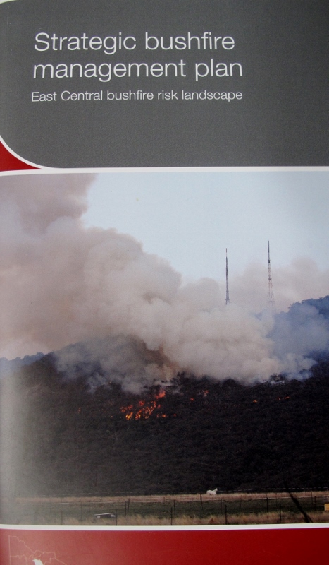
This document has been anticipated with some interest—as have its companions, the plans for the East Central and Barwon Otways districts. It was launched at last Friday’s Creswick conference by Lee Miezis, DEPI’s Executive Director, fire and emergency management– with some suggestion that it promised a new improved approach to fire management.

The promise is still there: there’s no doubt that careful risk assessments and computer modelling of bushfire behaviour could enormously improve our capacity to deal with bushfires. This document disappoints in the delivery, however.

Fuel management map: the grey areas are 'priority fuel management areas. In our area they're north and west of Castlemaine, Maldon and the Midland Highway. 40% of planned burning on public land will be in these areas...which are mostly private land.

Fuel management map: the mid grey areas are ‘priority fuel management areas’. In our area they’re north and west of Castlemaine, Maldon and the Midland Highway. 40% of planned burning on public land will be in these areas…which are mostly private land.

Its first problem is that it largely confines its consideration of risk to the matter of fuel and fuel management. On page 31 of a 33 page document we’re told that fuel management is ‘only one of a range of approaches to reduce bushfire risk on public land.’ The others include prevention, preparation, response and recovery.

You’d think the first of these [‘prevention, to minimise the occurrence of bushfires, particularly those started by people’] would be a high priority, given that most fires are started by people [in the Mount Alexander shire there are an average of 53 fires a year, and only 6 of these are naturally occurring. 42% of fires dealt with by DEPI since 1972 have been accidents, 35% were deliberate, and 17% ‘unknown or other causes’]. It will be dealt with ‘over the next few years’. In the mean time we have a range of advertising and punitive measures with a limited success record. Priority is given to fuel, and the community is given to understand that its management is the main way to reduce risk.

Continue reading

Posted in Fire Management | Comments Off on Risky business

Six seasons – not four! A journey through the six seasons of the Wombat Forest

Tanya Loos will be giving a one-hour presentation on her recently published Daylesford Nature Diary at the next Newstead Landcare Group meeting on this Thursday (16 October). The evening will start at 8pm and take place at the Newstead Community Centre. The talk will be followed by a very brief AGM and a light supper. Gold coin donations would be appreciated. Tanya will also have copies of her book for sale.

If you like the idea of marking the seasons by such things as the arrival of spring migrants, or fabulous fruiting fungi – do come along.

There is also more information on Tanya and her diary on the Connecting Country website.

poster DND


Posted in News | Comments Off on Six seasons – not four! A journey through the six seasons of the Wombat Forest