Koala

The satisfied looking individual above was photographed by John Ellis at Golden Point last week. He was ‘a friendly chap, who didn’t mind posing at camera height.’

Koalas are not uncommon in our area, with some landholders reporting sightings every couple of weeks. Numbers around the country vary widely: last year Federal Conservation Minister Tony Burke classified koalas as ‘vulnerable’ in NSW, Queensland and the ACT. Numbers there have dropped by over a third in the last 20 years. In Victoria the situation is complex, with populations so heavy in some areas south of the ranges that they’re eating trees bare—a problem both for the animals and for the environment. The Victorian Koala Management Strategy is a bit out of date, but still worth a look. Among other things, it offers the information that the koala is worth over a billion dollars a year to the Australian tourism industry!

It seems that in the maintenance of healthy populations corridors linking appropriate habitat are important. Among threats to koalas are domestic dogs. For practical info on this, check the Koala Foundation.

Koalas feed on leaves from a variety of species of eucalypt leaves, and will occasionally have a go at wattles, tea tree and melaleuca. We’d be curious to hear from anyone who has observed their dietary habits in this area. According to DSE, the preferred forage species in Victoria are River Red Gum, Southern Blue Gum, Swamp Gum and Manna Gum, but koalas also feed in other trees present locally, including Yellow Box, Grey Box, Red Stringybark and Red Box. The specimen pictured above was on an Angophora!
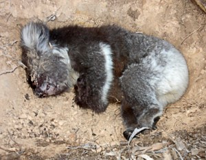
On a less positive note: this week Paul Hampton found the young koala pictured at left in distress on his property in Muckleford. It died before animal rescue could be effected. It seemed to have fallen from a tree, possibly heat affected.

Post script: Good Koala pics taken in the Muckleford Forest can be found in Geoff Park’s January 14 post on the Natural Newstead blog.


Posted in Nature Observations, News | Comments Off on Koala

Rosella fledgings display their colours

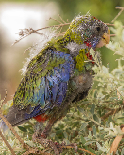
Several Eastern Rosella fledgling recently fell out of a nest box in John and Marie’s yard at Golden Point. They landed in saltbush below where the adults fed them for a week before they finally flew off.

One of the Rosella fledglings. Photo by John Ellis, December 2012

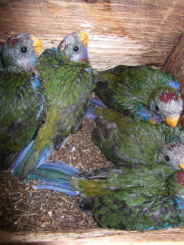
A week or two previously Doug Ralph also discovered young Rosellas. This time they had stayed in their nest box.

Photo by Doug Ralph, December 2012

To see even younger Eastern Rosellas have a look a Geoff Park’s site here and here. In this brilliant sequence of photos, Geoff has recorded the transformation of chicks from nestling to fledging stage over a 25 day period.

Posted in Nature Observations | Comments Off on Rosella fledgings display their colours

Comeback

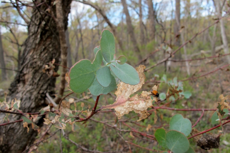
The cup moth caterpillars have come in their millions and munched away, but it seems that they’ve gone to pursue their careers as moths, and the bush is responding accordingly. Green shoots are appearing everywhere, and things aren’t looking anywhere near as desolate as they were a month or so ago.

Fryers Forest, early December: new growth in the eucalypts is an indicator of the disappearance of the cup moth caterpillars.


Posted in News | 1 Comment

Catch this

North Central Waterwatch has released a handy Fish Field Guide for waterways in the area bounded roughly by Donald in the west, Creswick in the South, Heathcote in the east and Swan Hill in the north. Native fish are little known and it’s a bit of a downer to find out in the guide that 10 of the 22 species in this region are listed as endangered. Threats to native fish include, among others, removal of woody debris and riparian disturbance: another argument for careful restoration of our waterways.

Expedition Pass: a population of Macquarie Perch has been released here as a conservation measure.

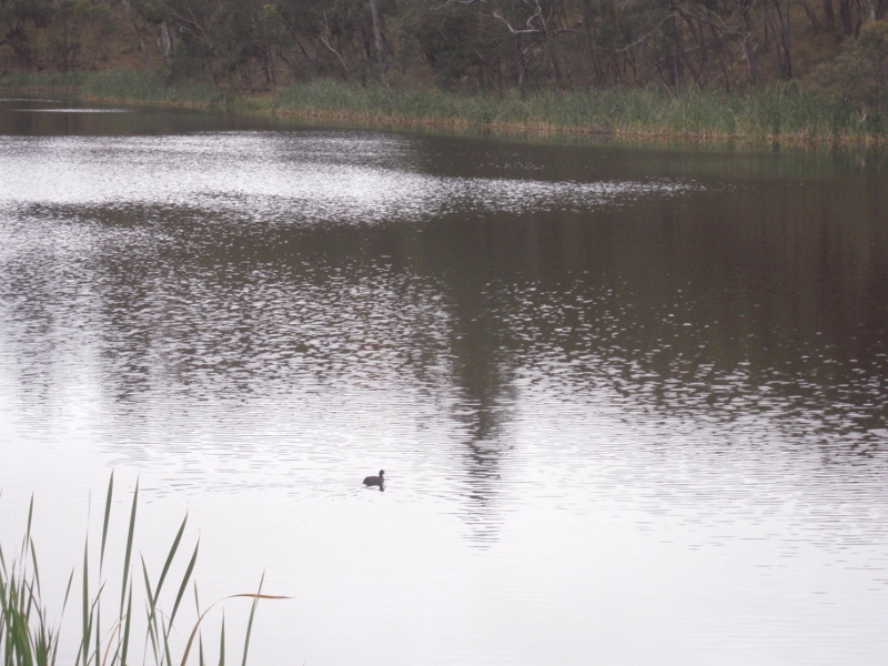
Fishing is one area where conservation and recreation have an uneasy relationship. For this reason it’s of interest to note that 10,000 Macquarie Perch were released into Expedition Pass a couple of years ago with the support of local anglers. Macquarie Perch is an endangered species found in catchments to our east. It is described in the guide as ‘likely to have historically occurred in the Loddon River basin’, and the stocking is an attempt to re establish it in the area.

As of December this year the population at Expedition Pass is reported to be doing well. We believe it’s not legal to fish it here. [‘Macquarie perch can only be taken from three waters in accordance with strict catch limits and a three month closed season: http://www.dpi.vic.g…macquarie-perch ‘]

The guide can be got from the Catchment Management Authority in Huntly.

Posted in News | Comments Off on Catch this

How should we look after our waterways?

FOBIF has made a submission to DSE’s draft Waterway Management Strategy.

Apart from suggesting that some of the policies in the document are a bit vague, our submission centred on two matters: the influence of management fire on catchments, and the proliferation of ornamental dams.

We’ve been seriously concerned about the influence of thoughtless DSE burns on steep catchments. The draft document on page 195 says:

‘Excessive runoff from recently burnt waterways can cause flooding and carry high loads of sediments and nutrients into waterways,  particularly if a bushfire event is followed by heavy rains. Increased nutrients can lead to algal blooms in downstream water bodies. Sediments can reduce instream habitat….’

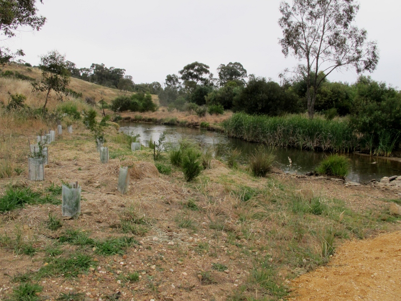
Castlemaine Landcare plantings along Forest Creek: the Waterway Strategy dismisses the idea that such revegetation projects act as fire 'fuses'. It also points out that such projects control erosion and reduce water speed.

This is the kind of thing which happened in this year’s Tarilta Gorge burn, and we’re concerned that it doesn’t happen in the proposed Amanda’s Track burn along Middleton Creek. We’ve proposed that DSE be obliged to consult with water authorities before any burning takes place in catchments. [This is already supposed to be routine policy, but there’s reason to suspect that it’s not taken too seriously].

On ornamental dams [wrongly called ‘farm’ dams], we’ve called for tighter licensing conditions. The Nationals MP for Northern Victoria, Damian Drum, has estimated that “…In our part of the state as much as 124 billion litres of water a year don’t make it to our creeks and streams because of the explosion in small, mostly unlicensed dams.” Mr Drum correctly states that this water would be better used on farms and in cities—and we would add that it would be better used flowing down to the Murray and downstream towns.

The document has some interesting observations on page 195 about riparian vegetation and fire. It dismisses the theory that revegetated waterways act as ‘wicks’ or ‘fuses’ carrying fire to settlements: ‘under low to moderate fire conditions, well managed riparian vegetation, with limited grass and weed growth, is less likely than pasture or crops to contribute to the spread of fire across a property or the  wider landscape.’ Even under extreme conditions riparian areas, it is argued, have less influence than ‘landscape level grass and forest fuels.’ Fire risk from revegetated areas declines as grass and weeds are replaced by appropriate shrubs.

Revegetation projects are widely believed in some sections of the community to be dangerous fuses—in fact, many CFA officers subscribe to the theory—so it would seem that there’s room for a bit of community discussion on the subject.

Posted in News | Comments Off on How should we look after our waterways?

‘Due consideration’: does this mean, ‘Not interested’?

FOBIF has received a reply from the Minister for Bushfire Response, Peter Ryan. We asked him if he had considered Royal Commission Monitor Neil Comrie’s recommendation that the five per cent burning target be revised. It’s now clear from the three letters we’ve had from Government members that there is no intention of doing anything about Mr Comrie’s recommendation.

When Mr Comrie’s report was released, Mr Ryan told The Age  [August 1], ”I see the logic of what he argues and we will give it due consideration,” he said.

Mr Ryan doesn’t bother getting even this specific in his response to FOBIF. His letter runs as follows:

‘Thank you for your correspondence received by this office…in which you raise concerns regarding planned burning.

Tarilta Creek valley before this year's 'control burn': Large operations like this in remoter areas reduce DSE's capacity to do the detailed work which would enable it to protect the community without damaging the environment. The Government appears to be ignoring the Royal Commission Monitor on this matter. Photo: Dominique Lavie

‘It is important to note that planned burning is part of an integrated plan to reduce the bushfire risk to people, property and communities. Combined with community and householder preparedness, planned burning is a very effective way to reduce the risk of future bushfire by reducing the extremely high fuel loads that have built up in our environment, slowing bushfires down and  making them less intense, and therefore easier to control before they grow and threaten properties and communities.

‘As the issue you raise relates to the Department of Sustainability and Environment, I have forwarded your correspondence to the Honourable Ryan Smith MP, Minister for Environment and Climate Change, for his consideration and response.

‘Thank you for raising this matter with me.’

In other words: ‘I’m not answering your question.’ As our readers know, we have already had Mr Smith’s reply in the form of a letter from DSE’s fire boss, Lee Miezis. He didn’t answer our question either: from which we have to conclude that the Government isn’t going to do anything about Mr Comrie’s recommendation. There’s no evidence that it’s been given any consideration at all.

Continue reading

Posted in Fire Management | Comments Off on ‘Due consideration’: does this mean, ‘Not interested’?

Burning season under way

With DSE starting burns around Castlemaine, it’s worth clarifying what the Department’s targets are. The following has been supplied to us by DSE for land within the Murray Goldfields district:

Zone: 1. Asset protection 2. Bushfire management 3. Landscape management 4. Planned burning exclusion
Area total 8,322 ha 59,119 227,846 56,716
Area annual 1,664 5,912 6,092 0
Burn rotation Every 5 years Every 10 years 37 years plus 0

In his reply to FOBIF’s question of the safety value of the five percent target, DSE Executive Director, Fire [Lee Miezis], sought to create the impression that Asset Protection burns, those most directly concerned with human safety, had been vigorously pursued, while Landscape Management burns in remoter areas were relatively softly pursued.

It’s clear from the above table that nearly half DSE’s fuel reduction burns in the Murray Goldfields district are in remoter areas. FOBIF’s view [like that of the Royal Commission Monitor], is that the effort put into these exercises would be better spent doing a more effective job in areas closer to settlements.

This more effective work might, for example, involve fuel reduction through methods other than burning [grooming and slashing, for example]–but these can be time consuming and labour intensive.

Part of the problem is that Royal Commission recommendation 56 was for ‘prescribed burning’, not ‘fuel reduction’. There are other ways of reducing fuel than setting fire to the bush, but we have found that there is confusion in the DSE itself about whether fuel reduction by, for example, grooming 50 hectares of gorse, counts towards the five per cent target. The result is a drive to burn regardless, and the government is apparently unwilling to review this policy.

Posted in Fire Management | 1 Comment

We have the answer, but where’s the answer? [and what’s Hawkeye?]

FOBIF has had another go at finding out what if anything the Government intends to do about the Royal Commission Monitor’s suggestion that the five per cent target be revised. The letter we received from DSE Director of Fire, Lee Miezis, failed to answer our question on this.

We’ve also asked Mr Miezis to give us examples to back up his claim that the Monitoring program Hawkeye is ‘guiding approaches to planned burning.’ Though we believe that local DSE fire managers are trying to tighten up their practices, we haven’t seen any evidence on the ground of a guiding research principle.

According to DSE”s 2011 publication ‘Fire ecology program achievements 2009-11’, Hawkeye is a ‘long-term biodiversity monitoring project’ established in 2010 ‘to inform the way [DSE] conducts planned burning and guide how we balance the dual objectives of fire safety and biodiversity protection.’  The project began field operations in 2011. Hawkeye might be a very good project: we think it could be. But to claim that it is already ‘guiding’ DSE approaches to planned burning –one year into a long term project!–is testing our goodwill.

It should be remembered that DSE and its predecessors have been producing Codes of Practice, Strategic Directions and Guidelines and Procedures on fire management for many years. The oldest one we have is the 1995 code, which stipulates that fire management practices must ‘be appropriate for maintaining the vigour and diversity’ of our native flora and fauna; that they must protect water quality by minimising impact on streams; that they must prevent ‘inappropriate destruction’ of soil; that the possible introduction of pest plants and animals be avoided; and that burns should be monitored when specialist officers recommend.

The claim that burning is being guided by a program that’s one year old seems to be an admission that the requirements of numerous Codes of Practice over the years have been widely ignored.

Posted in Fire Management | Comments Off on We have the answer, but where’s the answer? [and what’s Hawkeye?]

State of the forests, 1870

Doug Ralph has supplied us with the text below, as evidence of 19th century attitudes to forest use. The report is from the Argus newspaper, and can be found on the National Library’s Trove website:

“The following report of the inspector of state forests for the year 1870, was presented to Parliament last night by the Chief Secretary :

TO THE HON. SIR JAMES M’CULLOCH,” KNIGHT, CHIEF SECRETARY.

Sir,-I have the honour of transmitting to you my report on the state forests for the year 1870.

During this year my attention has been chiefly directed to the preservation of the indigenous timber in the several state forests situate at Mount Macedon, Bullarook, Haddon and Windermere, Fryers and Elphinstone, and Mount Alexander, the several timber reserves immediately around Castlemaine, and the extensive redgum forests at Barmah, and Yellima on the Murray River.

Mount Alexander 2012: by 1870 the Mount had been ‘completely denuded’ of useful timber, as had the forests between Taradale and Castlemaine.

For some years past the forests in the vicinity of the various goldfields have suffered severely from the wanton devastation and reckless manner in which timber for mining purposes has been obtained ; but now that certain areas are reserved for state forests and timber reserves, and a more rigid supervision is carried out by Crown lands bailiffs generally, I have every reason to believe that the young indigenous timber trees fast growing up around the principal goldfields, will, in a very few years, supply all the requirements for mining purposes.

Continue reading

Posted in Nature Observations | Comments Off on State of the forests, 1870

What exactly are the pine plantations?

Amendment  C 65 before the Mount Alexander Council proposes to rezone the Moonlight Flat Pine Plantations to Farming Zone. FOBIF has opposed this rezoning as follows:

‘We believe the proposed rezoning of Crown land leased to Hancock Pine Plantations should not go ahead and the land should remain in a Public Conservation and Resource Zoning (PCRZ).

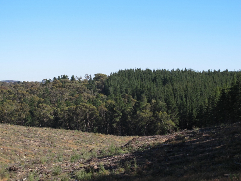
Moonlight Flat plantation: FOBIF believes that the fire threat from this area should be taken more seriously.

‘The stated purpose of Amendment C65 is to correct zoning/overlay errors. There is no error in the existing zoning of this land. It is Crown Land and hence a public land zoning is required and the PRCZ zoning is the most appropriate. A Farming zone is only applied to private land.

‘The land being proposed to be rezoned to Farming contains a large tract of significant box-ironbark forest in the north of the leased area. A PCRZ zoning provides the best protection of this native forest.’

‘There is no mention in the Amendment documentation of any ecological assessment of this box-ironbark forest or any details of any overlays to be applied to protect this vegetation. This would need to done before any proposed rezoning could be considered.

‘The Amendment documentation is also deficient as it contains no information on any overlay (or other planning measure) to protect neighbouring properties from the serious bushfire threat posed by this pine plantation. There has been continuing concern expressed in the Chewton and Golden Point communities, following Black Saturday, about the bushfire threat posed by this pine plantation to their north. We

Continue reading

Posted in Fire Management | 1 Comment