Floods: running to the past

Recent heavy rains in Victoria have brought about a return of calls to strip vegetation from waterways as a way of reducing flood levels.

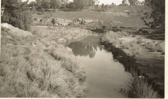
The claim that vegetation along waterways raises water levels was raised last year when some locals blamed landcare plantings for flooding in Castlemaine. At the time FOBIF pointed out that creeks and streams had been stripped of vegetation for many years up to the 1990s. This practice had not solved the flood problems but had produced a few of its own, including, predictably, erosion of stream banks. It’s worth remembering that the shocking floods in the past came along streams entirely stripped of vegetation—the catastrophic 1889 event being the most infamous.

In our post we quoted Australian Land and Water research which showed that ‘Adding or removing large wood (snags) in streams has little effect on the height and duration of large floods.’ This is the consensus opinion of those who have looked seriously at the flood problem, but it has not stopped the State government from announcing that it would consider going back to the practice of ‘desnagging’ streams. It’s hard to believe that the government will proceed with a practice which so obviously failed, but we’ll have to wait and see.

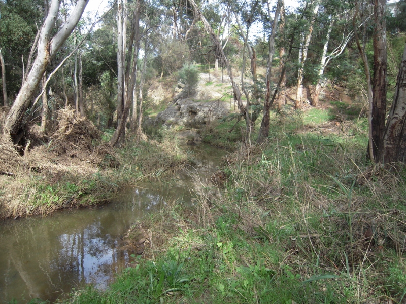
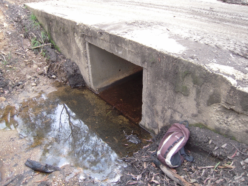
In the meantime the Midland Express carried a front page article with photo on March 6 showing Nationals MP Damien Drum with a local businessman examining vegetation which allegedly raised flood levels in the previous week. FOBIF members have been down to look at the site in question. There is debris in the creek at the point in question, but in our opinion there is no case for wholesale vegetation removal [see picture]. At that point Campbells Creek does a sharpish left turn which would cause some banking of water, but the creek itself was not seriously blocked.

Campbell's Creek near Gaulton St, March 14 2012. FOBIF believes that there is a case for vegetation management in town creeks, but that wholesale removal of native vegetation is a policy proven to have failed in the past.


There is a case for removing vegetation which clearly chokes streams—willows being a prime villain in this respect, and the CMA has been busy in Campbell’s Creek doing just that. It is also obvious that some measures should be taken to protect buildings which past planning mistakes have allowed to be built under flood levels—and that Council should vigorously resist future attempts to build on flood  prone land. For this to happen we would need precise flood mapping–and, amazingly given the number of floods we’ve had over the last hundred and twenty years, that doesn’t seem to be available.

Posted in News | Comments Off on Floods: running to the past

Bendigo fire meeting

FOBIF was represented at a meeting in Bendigo on March 7 with DSE land and fire community engagement officer Simone Blair. The meeting was organised by the Bendigo and District Environment council.

The meeting was an opportunity for community groups to table their difficulties in communicating with DSE on matters specifically to do with fire management. FOBIF believes that these difficulties arise mainly because DSE is obliged to implement a very blunt range of policies, the main one being that of burning off five per cent of public land, regardless of local conditions. Nevertheless, we believe that even under these constraints, DSE could do better: and we are of the view that some of their efforts smack of carelessness or neglect—the burning of Tarilta Gorge being one [see below].

BDEC members present were insistent that DSE should try more actively to counter unreasonable fear of the bush, and that the dangers of grass fire should be made clearer to the public. The belief persists that the Bracewell Street Black Saturday fire was a bushfire, when it burned mainly through waste grassland. They also underlined the importance of fire protection works on private land.

There will be a follow up meeting in April.

Posted in Fire Management, News | Comments Off on Bendigo fire meeting

Walkers observe the effects of a Fuel Reduction Burn

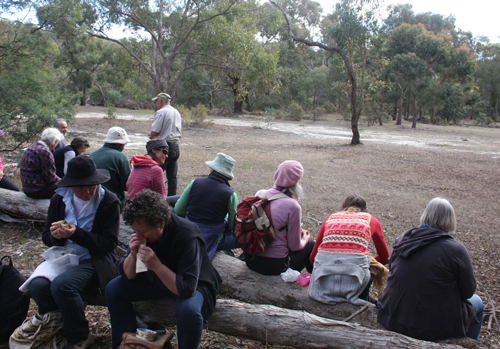
Forty-five walkers set out from the SEC Dam Track in Green Gully on 21 March for the first FOBIF walk of the year.  It was not the normal scenic bushwalk as the route was mainly through areas of the Muckleford Forest which had been burnt in the fuel reduction burns in the Spring of 2011.

Frances Cincotta from Newstead Natives Nursery and Chris Johnston, author of the Muckleford Forest blog led the group.

Frances and Chris explaining the areas affected by different burn zones. Photo by Noel Young

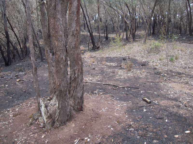
The areas burnt in spring were mainly in Zone 2 and 3 – Zone 2 is Strategic Wildfire Management Zone and Zone 3 is Ecological Management Zone.  One of the aims of the walk was to see if we could identify the differences in the % of landscape burnt based on the zoning. Zone 2 can be up to 80% burnt, and Zone 3 is 30-50% burnt. (Zone 4 Prescribed Burning Exclusion). The group walked along Demo Track, a renowned wildflower area, so people could see the stark difference between the burnt and unburnt sides of the track.

Left and right sides of Demo Track at same point (unburnt and burnt). Photos by Noel Young

Apart from Gold Dust Wattle, Dianella and epicormic growth on eucalypts there was little evidence of regrowth and the number of trees, including at least one Native Cherry Exocarpos cupressiformis, that had been destroyed was disturbing. This post is based partly on a Muckleford Forest blog article. Click here to see more.

Posted in Fire Management, News | Comments Off on Walkers observe the effects of a Fuel Reduction Burn

Tarilta Gorge: burned off, washed away

It’s sometimes hard to know what to call DSE burning operations: control burns? Fuel reduction? Ecological burns? Too often none of the above apply: there’s little control, apart from keeping the burn inside the control lines [and as we know, that isn’t always achieved]; the fuel is only temporarily reduced, as the severity of the burns sometimes provokes massive regrowth of flammable scrub; and the ecological function of the operations is mysterious, to put it mildly.

DSE burn CAS 0051, Limestone Track [better known to us as Tarilta creek valley], is described on the DSE website as aiming to ‘create a mosaic burn coverage appropriate to meet requirements of localised EVC’s [ecological vegetation classes] and to reduce the spread of fire.’ It’s in Zone 3 [Ecological Management Zone–EMZ]. FOBIF was given to understand at a DSE briefing in September last year that in such a zone the managers will aim at about one third coverage of the area with fire.

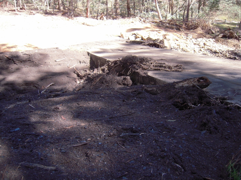
Tarilta Creek, March 19, 2012: silt and ash washed off the steep burned hillsides is in places over a metre deep.


The EMZ’s ‘primary objective’ is ‘promoting biodiversity and ecological renewal. Planned burning will be used to manage native species and ecological communities which require fire to regenerate. This also assists with fire protection outcomes by reducing overall fuel in the landscape.’ [DSE Fact sheet]

Tarilta was burned by DSE on the weekend of March 10th, and a very large plume of smoke suggests that it flared up again on Tuesday 13th. Heavy rain was forecast that week, and duly arrived on Wednesday 14th.

FOBIF representatives have visited the 556 hectare site [between Mount Franklin and Guildford] twice since the burn. We were concerned about this one in advance, and sceptical of its usefulness as a safety exercise, especially given the research released in January on the relative pointlessness of large burning operations remote from settlement [see our Post].

We had expressed our concerns to DSE in our response to their zoning proposals last year, as follows:

‘We noted Kevin Tolhurst’s comments on ABC local radio on August 25 to the effect that these burn plans might work ecologically if they are ‘low intensity’. This comment provides context for our second main concern, namely, CAS0051, Limestone tk, in the Tarilta creek area. This is a very interesting area, and our experience with last year’s Wewak track burn makes us very apprehensive about both the fuel load and ecological outcomes. The rampant destruction of mature trees and resultant explosive regeneration, together with much bare earth, is a great cause for worry when considering the Tarilta creek, a much steeper and therefore erosion prone topography. We believe that detailed planning of this burn, and tight supervision, will be necessary to avoid last year’s problems [or worse, given the steeper slopes]’.

Steep tributary gully burned out by DSE. Heavy rain was forecast before the burn, but no erosion control measures seem to have been taken.


Our conclusions after two visits [and we intend to go down there regularly to see what kind of ecological change happens] are:

Continue reading

Posted in Fire Management, News | 3 Comments

Moss identification cards

For those interested in the moss identification workshops, Cassia has prepared some moss illustrations. Click here to view them. The first moss workshop recapping what was covered in 2011 is now being organised. Details will be posted on this site.

Posted in Moss and Liverwort Field Guide group | Comments Off on Moss identification cards