It’s sometimes hard to know what to call DSE burning operations: control burns? Fuel reduction? Ecological burns? Too often none of the above apply: there’s little control, apart from keeping the burn inside the control lines [and as we know, that isn’t always achieved]; the fuel is only temporarily reduced, as the severity of the burns sometimes provokes massive regrowth of flammable scrub; and the ecological function of the operations is mysterious, to put it mildly.
DSE burn CAS 0051, Limestone Track [better known to us as Tarilta creek valley], is described on the DSE website as aiming to ‘create a mosaic burn coverage appropriate to meet requirements of localised EVC’s [ecological vegetation classes] and to reduce the spread of fire.’ It’s in Zone 3 [Ecological Management Zone–EMZ]. FOBIF was given to understand at a DSE briefing in September last year that in such a zone the managers will aim at about one third coverage of the area with fire.

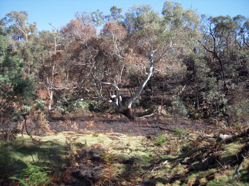
Tarilta Creek, March 19, 2012: silt and ash washed off the steep burned hillsides is in places over a metre deep.
The EMZ’s ‘primary objective’ is ‘promoting biodiversity and ecological renewal. Planned burning will be used to manage native species and ecological communities which require fire to regenerate. This also assists with fire protection outcomes by reducing overall fuel in the landscape.’ [DSE Fact sheet]
Tarilta was burned by DSE on the weekend of March 10th, and a very large plume of smoke suggests that it flared up again on Tuesday 13th. Heavy rain was forecast that week, and duly arrived on Wednesday 14th.
FOBIF representatives have visited the 556 hectare site [between Mount Franklin and Guildford] twice since the burn. We were concerned about this one in advance, and sceptical of its usefulness as a safety exercise, especially given the research released in January on the relative pointlessness of large burning operations remote from settlement [see our Post].
We had expressed our concerns to DSE in our response to their zoning proposals last year, as follows:
‘We noted Kevin Tolhurst’s comments on ABC local radio on August 25 to the effect that these burn plans might work ecologically if they are ‘low intensity’. This comment provides context for our second main concern, namely, CAS0051, Limestone tk, in the Tarilta creek area. This is a very interesting area, and our experience with last year’s Wewak track burn makes us very apprehensive about both the fuel load and ecological outcomes. The rampant destruction of mature trees and resultant explosive regeneration, together with much bare earth, is a great cause for worry when considering the Tarilta creek, a much steeper and therefore erosion prone topography. We believe that detailed planning of this burn, and tight supervision, will be necessary to avoid last year’s problems [or worse, given the steeper slopes]’.

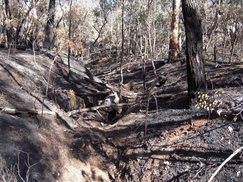
Steep tributary gully burned out by DSE. Heavy rain was forecast before the burn, but no erosion control measures seem to have been taken.
Our conclusions after two visits [and we intend to go down there regularly to see what kind of ecological change happens] are:
- Our request for care about burning steep slopes was completely ignored. The whole area is quite steep [that’s why it’s popularly called a ‘gorge’], but the sections sloping down to the actual creek are the steepest. These have been burned bare, and the resultant soil washaway into the creek is spectacular: the soil and ash is up to a metre deep on the creek bed–in places deeper [see pictures]. This seems to us a pretty plain case of ecological vandalism. It was known in advance that heavy rain was due, and the effect of burning such steep slopes was quite predictable. It’s hard to see what ‘ecological renewal’ can be promoted by taking out topsoil in a vulnerable area, but we will enquire of DSE what their understanding of their achievement is.
- On our estimate, more than 60% of the area was burned—possibly over 75%. We will try to verify this on future visits, and through enquiries to DSE. It does not, however, look anything like a ‘mosaic burn’ to us.
- Many large trees were destroyed, including a candlebark whose trunk was at least a metre in diameter at breast height. The ‘ecological renewal’ dimension of this is not clear
- As to fuel reduction outcomes, we’ll monitor this: the outcome across the Porcupine ridge road, burned a couple of years ago with rampant growth of flammable saplings in the last two years, is not encouraging.

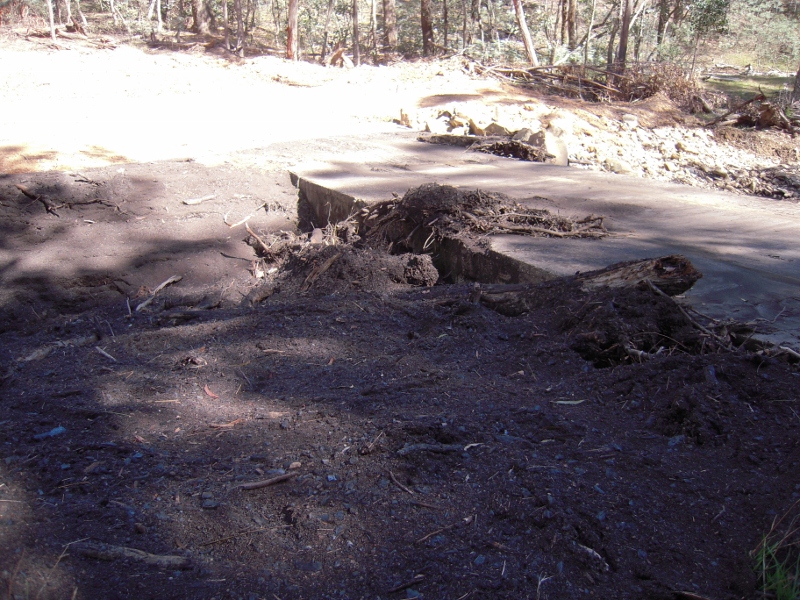
Silt and ash piled up at the Limestone Track crossing: loss of topsoil from the steep slopes must be considered a serious ecological setback.
And here’s a post script from the CSIRO: ‘it is the condition of the land that determines the impact of floods. Good vegetation cover is the key to preventing erosion, but drought, fires and overgrazing cause the loss of protective vegetation. These degraded habitats take years to recover their natural resistance to erosion and during this time are at high risk of losing their soil. Special care and management is required to prevent this.’


 Click on image for info/order page
 Click on image for info/order page
 Click on image for info/order page


Ecological vandalism is exactly what we would call it, thank you for expressing our views so clearly. Living in this area (Tarilta Creek runs through our property) we also expressed our concerns to DSE about the gorge to no avail. The reason given for burning this area was for the protection of Glenlyon as bark from this area during a bush fire could travel 28 kilometres ahead of a fire front, or so were told – we pointed out that this was not a blue gum forest!!!!
We have contacted NWCCA and Prof Andrew Bennett with our concerns and photos of the resulting damage.
We intend following this up with the local member Geoff Howard and encourage him to do a walk of the gorge and take up the matter with the minister as we feel we are only getting the bureaucratic response from the departments.
You may be interested to know that the southern front was not monitored from 6.00pm on Saturday until 10.00 am on the Sunday, and that the fire did jump the Limestone road boundary near Sawpit Gully road.
I agree with Rob and Anne Simons who live in and care for the Holcombe forest.
I was visiting the forest during the burn and have since seen the Tarilta Creek massacre. I understood the fire was not monitored; was concerned about the native animals; and had dicomfort from smoke inhalation.
I agree with you Anne & Rob. All this smells of politics. DSE has to be seen to be looking after private property by burning-off public land. Even when the land doesn’t require burning or when any environmental gains are outweighed by the resulting environmental losses. I love this part of the world and I’m really upset by what has happened. I still think that this section of the Upper Loddon State Park should have been included in the Castlemaine Diggings National Heritage Park.
Here is a short video on our Open Spaces blog showing a little bit of the gorge immediately before the ‘controlled burn’. http://osp.com.au/?p=3232