The Monitor reports: How’s the research and reporting going?

On the subject of monitoring and reporting, almost everything in the Monitor’s Report referred to developing strategies, frameworks, ‘additional measures’ to be implemented: to things that are going to be done, not things that have been done. Meanwhile, the burning program charges on: it’s like someone driving flat out along the highway at twice the speed limit, while a group of experts in the back seat try to figure out whether this is dangerous, or whether the engine might burn out.

We’ve put some giveaway passages in bold:

‘[The draft new annual reporting framework] is a comprehensive framework that also includes commentary on community engagement activities. Data will be presented in a simple, user-friendly format, which displays outcomes against performance indicators via a traffic light ratings system. The framework reviewed by the BRCIM was indicative and did not include actual data. Data will be incorporated in time for publication in the DEPI 2012-13 Annual Report on the Planned burning program.

‘The BRCIM notes the progress in the development of additional measures to ensure planned burning outcomes are captured and reported. It is, however, premature to comment on the efficacy of these initiatives until they are incorporated into the DEPI Annual Report on the Planned Burning Program as outlined in recommendation 57(a) above. The BRCIM will revisit action 57(b) in the 2014 Annual Report.
Continue reading →

Posted in Fire Management, News | Comments Off on The Monitor reports: How’s the research and reporting going?

The Monitor reports: thinking about maybe changing tack…

 On the subject of the hectare target, Mr Comrie appears to accept the Government’s view that all is going well in the development of an informed approach to fuel management: but most of what he cites as evidence for this is talk, not action:

‘The BRCIM notes that in May 2013, the Minister for Environment and Climate Change stated in the Public Accounts and Estimates Committee:

“We are also doing a lot of work around developing a risk based strategic approach to fuel management on public land. We want to have a program that is based on the risk to human life and critical assets. We want to have an approach that helps us make evidenced-based decisions around bushfire management and also allows us to assess the work we have done and make sure that we have the policy objective of reducing the risk of bushfires while having an eye on property and critical infrastructure and certainly on ecosystems.” p 63

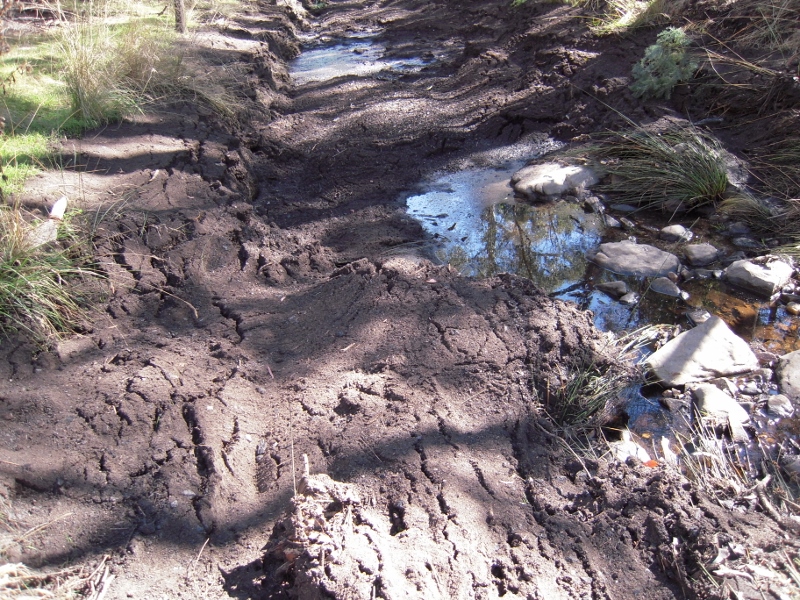
Sludge in the Tarilta Creek after an 'ecological burn', March 2012. 'We want to have an eye on critical infrastructure, and certainly ecosystems.' The question is: why should 'having an eye on ecosystems' have to wait for the development of a flash new system?


‘The BCRIM has been advised that the State has recently adopted a broad accounting framework for planned burning and fuel management on public land as part of the strategic risk based approach described above by the Minister. The BRCIM strongly supports this more holistic approach to managing and reporting bushfire fuel reduction on public land. In the accounting framework, planned burning will be acknowledged as one (albeit the most substantial) of a range of fuel management treatments. Others will include slashing, mulching, mowing, spraying, grazing and under certain specific circumstances, bushfire which as mentioned above has traditionally been excluded from planned burning targets.

Continue reading →

Posted in Fire Management, News | Comments Off on The Monitor reports: thinking about maybe changing tack…

Planting!

This year Golden Point Landcare has been coordinating a project involving weed control, site preparation and revegetation works being undertaken by 7 Landcare and Friends Of groups along Forest Creek and its catchments, through funding from the Australian Government’s Caring for Our Country. The works are based on the Forest Creek Action Plan, and through a Community Action Grant, aim to enhance the natural regeneration of endangered Creekline Grassy Woodlands and create habitat connectivity.

Some planting events have happened…

Victoria Gully has had two exclusion plots constructed  and these have already been planted out with part of their plant order. Chewton Landcare is doing ongoing planting. Contact Rod Willaton if you’d like to join them on Whitehorse Gully at Chewton. (Ph 5472 3025)

POHAG‘splanting took place last Sunday on the northern side of the old tip site and similarly Castlemaine Landcare planted last Sunday, coinciding with National Tree planting Day.

Friends of Kalimna Park used funds to do weed control works earlier in the year.

But one great morning of planting is on this Sunday!!! Join us…

Golden Point Landcare  and FOBIF are planting THIS Sunday August 4th, on Forest Creek, south of the Welsh Street bridge (opposite ‘The Terraces’, Golden Point Road approximately 3kms from the Pyrennees Hwy turnoff, Chewton). 9.30am starting time until noon, bring morning tea. We will have the trailer so no equipment required.

We have 800 shrubs, sedges and grasses to put along the Forest creek streamside so we would love you to join us. This is a very child friendly event (if you don’t mind getting wet!!)

For more info: Jennifer Pryce Golden Point Landcare 0423 900 590

Posted in News | Comments Off on Planting!

When houses are built near bushland…

 FOBIF was told at the July 15 briefing in Bendigo that if a development of fifty houses or more is placed within 300 metres of public bushland, that bush will be rezoned to Zone 1, Asset Protection.

This information is relevant for a proposed 39 lot development in Happy Valley, near the eastern side of Kalimna Park. This section of the Park is currently zoned 2. An additional 39 houses could well lift the number of houses in this area to 50.

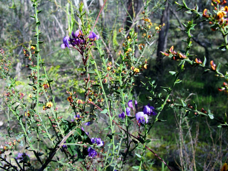
Spring wildflowers, east side of Kalimna Park: a more severe burning regime would have serious implications for this section of the park.

The township side of Kalimna Park is already classed Zone 1, Asset Protection. DEPI is faced with a serious and complicated challenge here: to manage the fuel load in an area close to houses, without destroying a precious and much used public resource.

A rezoning of the rest of the Park to Asset Protection would have severe environmental consequences: managers have more or less conceded that the frequency and severity of burning in these zones can be ecologically damaging.

This is not a simple matter. The Bushfire Royal Commission expressed the problem like this:

‘In the context of bushfires, ensuring the protection of human life means that sometimes compromises need to be made with people’s freedom to choose where they want to live, or the existence of pristine environments close to townships.’

Continue reading →

Posted in News | Comments Off on When houses are built near bushland…

A walk in the mist

Twenty five walkers led by Jelsje Veenstra took on a cold and misty Mount Tarrengower on Sunday the 21st. They missed out on some great views because of the limited visibility, but got a good look at the Mountain’s heritage qualities.

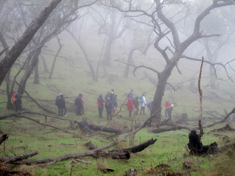
FOBIF walkers on a wintry Tarrengower: what the mountain loses in views, it gains in atmosphere. DEPI has changed its burning regime on the south side of the Mount to 'maintain species resilience'.

This section of the mountain is scheduled to be burned by DEPI next autumn. In last year’s Fire Operations Plan the whole of the summit area and surrounds was zoned 1, Asset Protection, to protect the township of Maldon. In our response to the Fire Operations plan last year we argued as follows:

‘This is a very large parcel for a Zone 1 burn—as far as we can see, more than double the area of any other Zone 1 in our district. It’s very hard to see why it has been zoned in this way. While it is clear that bushland abutting the town needs careful fuel management, it’s by no means clear why the south side of the Mount needs high intensive fuel reduction, especially since the area around the Tower was burned in 2009.’

In the draft Plan tabled at the July 15 information session in Bendigo the Mountain has in fact been rezoned to ‘ensure that the more ecologically sensitive eastern slopes of Mt Tarrengower are preserved from frequent fuel reduction burning to maintain species resilience.’ FOBIF has not seen the maps of the rezoned sections yet.


Posted in News | Comments Off on A walk in the mist