Soil protector: unobtrusive, and undervalued?

FOBIF’s moss group met at the Castlemaine Botanical Gardens last Saturday to move the project further towards its target: to publish a field guide to mosses of the region in Autumn next year.

This is not an eccentric interest in a picturesque but unimportant corner of our environment. Mosses play a key role in repair of damaged land and protection of soil against erosion. DSE analyses for the Goldfields bioregion show the following interesting figures: in Heathy Dry Forest, 10% of understorey is bryophytes [ie, mosses and liverworts] and lichens, and 10% is ‘soil crust’. In Box Ironbark Forest, 10% of understorey is bryophytes and lichens, and 20% is ‘soil crust’.

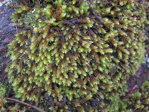
That humble term ‘soil crust‘ covers a combination of life forms, including mosses and lichens: which means that your unobtrusive moss is covering a hell of a lot of ground in our region.

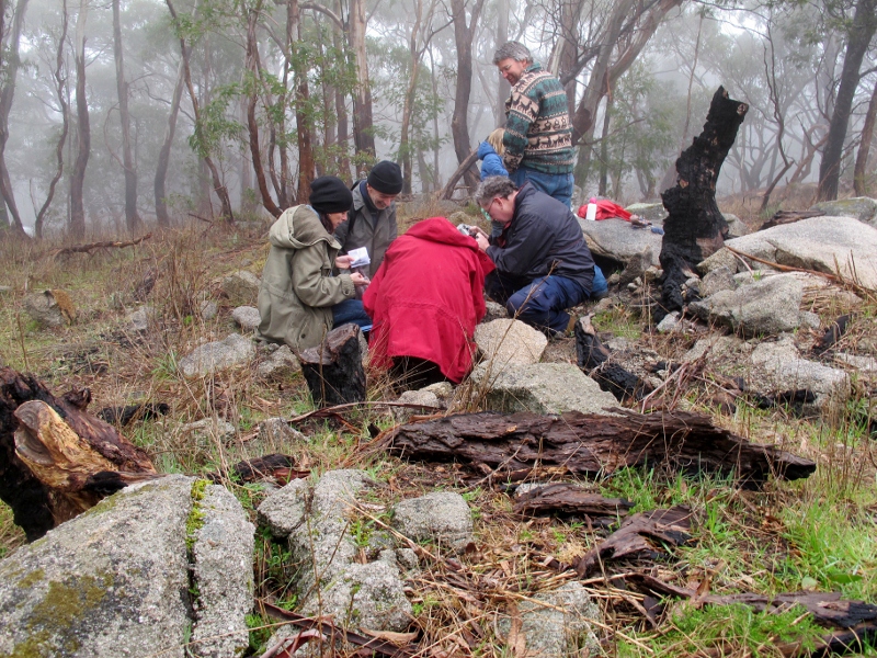
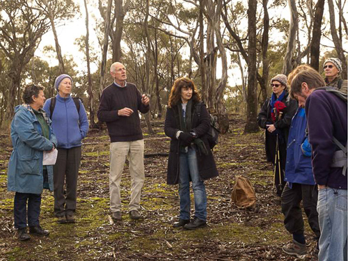
FOBIF moss group at work: moss is not just a green splodge...


The protective action of moss is easy to see. The following picture shows clearly how soil has been washed away from the area not covered by moss:

Road embankment, Castlemaine: soil has been washed away from the edge of the moss bed.


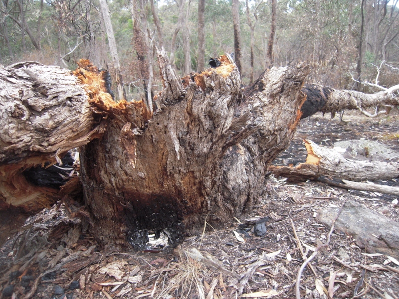
Moss and soil crusts are vulnerable to disturbance by trampling, or fire. Although mosses are not flammable, and therefore cannot be classed as fuel, they are often destroyed by ‘fuel reduction burns’. The following picture tells a story:

Continue reading

Posted in Moss and Liverwort Field Guide group, News | Comments Off on Soil protector: unobtrusive, and undervalued?

World Environment Day to be celebrated this Sunday in Castlemaine

To celebrate World Environment Day in our Shire, an community fair will take place in the Castlemaine Market Building from 9am-1pm on Sunday 3rd June. Whether people are interested protecting our diverse plants and animals, or sustainability initiatives and green technology opportunities, the fair will be a great source of information on what is happening locally.

The ‘mini expo’ format will give visitors an opportunity to talk to representatives from local environmental organisations, community groups and government agencies including: Connecting Country, Friends of the Box-Ironbark Forests, Landcare, Mount Alexander Sustainability Group, Trust for Nature, Parks Victoria, Mount Alexander Shire Council and Castlemaine Community House – Growing Abundance.

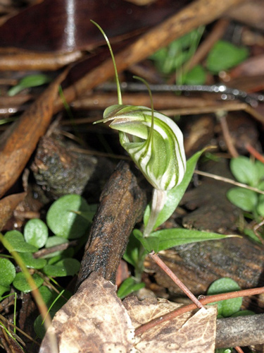
Among the attractions of the day is the opportunity to see a specimen of the rare and endangered Southern Shepherds Purse – a plant growing in the Mount Alexander Regional Park and nowhere else in the world!

The Castlemaine Farmers Market and Castlemaine Market Building Art Showcase 2012 will be on at the same time.

Kirsten from Trust for Nautre with Swifty the Parrot at last year's World Environment Day

Posted in News | Comments Off on World Environment Day to be celebrated this Sunday in Castlemaine

Places available for Alison Pouliot’s fungi workshop

There are still places available at Alison Pouliot’s Fungi Ecology Workshop this coming weekend in Inglewood.

The workshop details are posted at:

http://wedderburncmnnews.blogspot.com.au/2012/04/alison-pouliot-fungi-workshops.html

Posted in News | Comments Off on Places available for Alison Pouliot’s fungi workshop

FOBIF walk to Spring Gully

Eighteen people turned out for the May FOBIF walk led by Barbara Guerin and Lionel Jenkins. The walk was largely focussed on the area’s mining history and Dominique Lavie took a series of terrific photos which are reproduced below.

The morning began with a walk to the top of the Monk with views like the one below.

View to the east from the Monk.


Along Cobblers Gully there were many overgrown remains of an early mining settlement.

Remains of the Cobblers Gully settlement.


The walk along Spring Gully is covered one of Victoria’s most intact collections of quartz reef mines with well preserved machinery foundations and mullock heaps.  The mines worked from the mid-1850s to the late 1930s.

Spring Gully Mine and Battery ruins


Mullock heap, Spring Gully.


Lunch was enjoyed overlooking an enormous quartz tailing dam.

Walkers having lunch at a crushed quartz dam, Spring Gully.


The walk back was mainly off-track. Towards the end we came across this extraordinary chimney pictured below. It was discovered after the walk that according to notes made by Jack Cocks on the Eureka Reef and surrounds the chimney is in the area of the Eureka South mine, which was not particularly rich and closed in the early 1900s.  The reason for the chimney is unclear as the building next to it is not big enough to have housed a steam boiler. It may have been a roasting kiln for mineral recovered from the Eureka Mine battery.


Thanks to Barbara and Lionel for leading their first FOBIF walk and to Dom for her photos. The next walk will be to Tarilta Gorge. Doug Ralph will be the leader.

Posted in News | Comments Off on FOBIF walk to Spring Gully

Campbell’s Creek–past and present

Readers who have followed the intermittent controversies over whether vegetation along creek valleys raises flood levels might be interested in the picture below, showing Campbell’s Creek, looking downstream from the Gaulton St bridge in 1946:

Campbell's Creek, looking downstream from the Gaulton St Bridge, 1946. Lack of vegetation didn't improve flood levels


This is a photo of part of the above scene in 2011:

The same section of creek, 2011: the cliff where the creek takes a sharp turn to the left is visible in the background. This section of the creek featured in complaints that vegetation caused flooding in the last year.


The photo shows the result of years of revegetation work. Vegetation in the creek was blamed by a local businessman for raising flood levels last year. What is frustrating about such claims is that they could easily be judged if only the relevant authorities could refer to accurate flood  maps which would show water levels reached in previous floods–when there was little or no tree cover along the creek. Amazingly, it seems that such mapping is not available–not here, and not elsewhere in the state: which means that many planning decisions are made without vital knowledge of the places they’e dealing with. In the absence of such knowledge, we thought we’d run an occasional series of very short items recalling past floods [ones that happened when there was very little vegetation cover around our waterways], starting with 1909.

Continue reading

Posted in News | Comments Off on Campbell’s Creek–past and present

Tarilta: a revealing clean up

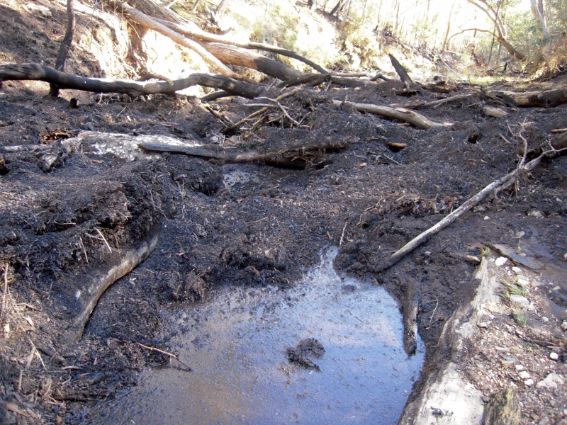
Readers will remember our original report on the destructive ‘reduction burn’ in the Tarilta gorge, with a picture of a choked creek at the Limestone Track crossing. This section of the creek has now been cleared of debris, presumably by DSE, and the works give some idea of soil loss resulting from the burn operation.

The picture below shows the cleaned up crossing:

Tarilta Creek at the Limestone Track crossing, May 22 2012, previously choked with washed out soil and ash.


And here’s the same crossing two months ago:

Limestone Track crossing, March 24 2012: soil washed down from the slopes chokes the creek.


Near the crossing, the soil and ash which has been removed from this small section of creek has been piled into a heap we estimate to be about a metre high, five metres wide and twenty five metres long. This is all stuff which has been washed off the steep slopes of the gorge, and it’s a pile which could be duplicated many times along the creek valley. The damage this soil loss represents to this section of bushland is hard to estimate, but maybe ‘catastrophe’ isn’t a bad word to use.

The works to clear the creek crossing are of course sensible, given that the debris blocking the bridge was a potential flood menace. The clearing of the creek also removes embarrassingly obvious evidence of the damage caused by by the fire. The evidence is still there if you look for it, however.

Posted in Fire Management, News | 1 Comment

‘So what if Newstead is flooded?’

A fascinating collection of old photos of our waterways collected by the Catchment Management Authority gives a bit of a sense of how far things have changed in the last sixty odd years. The picture below of the Loddon river bank upstream of Newstead, for example, shows a bank seriously prone to erosion, with erosion producing activity continuing.

1946 was the year work started on the building on Cairn Curran, in the romantic age of dam building. The project was not without its detractors, however: Newstead councillors expressed the fear that banked up water would flood the town, for example. For their pains they were the object of a tremendous blast in the Castlemaine Mail in March that year from one John Somer: ‘feebleness of brainpower’ was their problem, according to Mr Somer. Newstead was built in the wrong place, he said, seeming to look forward with some enthusiasm to the prospect of the town being flooded.

Loddon River bank near Newstead, c 1946: The top four feet, above the dark line, is 'muck, slum and sand' washed down from past dredging operations upstream. The tunneling is prospectors' work.

‘What if it is?’ he asked, before suggesting that everyone would be better off if Newstead was wiped off the map, so that a new, better town could be built on a more sensible site: ‘A new Newstead will arise in all its glory with properly designed alignments and something considerably more elegant in architecture than the higly pigly hotch potch of habitations that now exist.’

Mr Somers’ complacent contemplation of the drowning of Newstead was probably helped by the fact that he lived in Maldon. It’s also a bit hard to understand his negative portrait of a town most people [well, pretty well all people, actually] find very attractive. He did make some interesting points in his letter, however: he suggested that Aborigines, who knew the ‘vagaries of the Loddon’, made their settlements out of reach of floods, and were much more sensible than early white settlers who repeatedly went back to their houses after floods, only to be flooded again a few years later; and his description of the Loddon river flats as being covered with mining debris of ‘muck, slum and sand’ isn’t a bad description of what you can see in the photo above.


Posted in News | Comments Off on ‘So what if Newstead is flooded?’

Trying for cooperation on fire

Members of FOBIF and the North Central Victorian Combined Environment Groups met with DSE officials in Bendigo on Wednesday May 9 to discuss how we might have some more positive influence on the upcoming Fire Operations Plans. It’s fair to say that discussions were positive. The environment groups were concerned principally with implementation of fire plans: that is, it was understood that Government policy was not in question, and that what we were all concerned with was how practice might be improved.

Although FOBIF believes that the five per cent burning target supported by both major political parties is harmful and does little or nothing to improve public safety, our immediate concern is that in implementing this policy DSE is not observing its own code of practice.

Two examples [of many] in recent times are an asset protection burn on Mount Alexander which was allowed through lack of supervision to destroy ten times the target area; and the Tarilta burn which was theoretically intended to achieve ecological outcomes, but was in fact a mindless holocaust.


Raked earth around a tree in DSE burn zone, Muckleford forest: this practice is essential to protect older trees, but seems to be done erratically, and there is suspicion that it is done mainly closer to tracks, where damage will be more obvious. Environment groups have asked DSE for maps and documents which would show transparently the detailed planning which is supposed to go into every operation.

Environment groups at the Bendigo meeting tabled a list of documents they would like to see before the next Fire Operations Plans are finalised. The intention of the list is to get some kind of transparency into DSE’s fire practices. We would like to know what the reasoning is behind each burn, and what measures will be taken to ensure that the stated objectives are achieved. We were not promised anything, but were assured that efforts would be made to produce what documents were possible.

DSE staffing around the state, including Bendigo, is understood to have been cut by about 30%. The State Government as given assurances that none of the cut positions is ‘front line’, but this is a shady justification, suggesting that if you’re not ‘front line’, you’re not really needed. The documents listed below are produced by people who are essential to the proper conduct of ‘front line’ operations.

There will be a follow up meeting in June. The ‘wish list’ includes the following:

Continue reading

Posted in Fire Management, News | 1 Comment

What next for the northern catchments?

The Draft 2012-18 Regional Catchment Strategy is now out for public consultation, and anyone interested in land health in this area should be concerned to look over what the North Central Catchment Management Authority will, in theory, be using as its guide to action over the next few years. The draft will be the subject of a series of 10 public meetings in the coming weeks. In our region, the community meeting will be held at Campbells Creek Community Centre at 7 pm next Thursday 17 May.

The draft is quite startlingly brutal in its assessment of its predecessor, 2003-7 Strategy: ‘low level of ownership’ by the community, ‘rapidly outdated’, ‘lack of baseline data’, vague targets and vagueness in assigning responsibility for achieving targets are a few of the criticisms it lists of that now defunct document.

This one aims higher, but its success will depend heavily on the willingness of individuals and groups to have a go. This Strategy tries to be specific, and its approach is to begin by identifying assets in the region which can be clear targets for constructive action.

What are those assets? You can help answer that question by turning up at Campbell’s Creek on the 17th and having your say.

This is a wonderful opportunity to have input into the Regional Catchment Strategy – it’s reviewed every 6 years or so and many things can change in that time. It’s important that the community consultations highlight programs to protect, enhance and connect native fauna and flora: these are important not just in themselves, but as partners in creating the kind of land health which can underpin production.

If the word ‘strategy’ turns you off, there are probably lots of good reasons, over use being one. The draft Castlemaine Diggings NHP management plan some years ago listed as an aim the development of ‘a list of strategies…to develop strategies…!’ The word is often used to cover up a lack of activity: it’s important that the Regional Catchment Strategy doesn’t end up like that.

Details of public meetings, and access to the Draft Strategy, can be found by going to http://nccma.bangthetable.com/.

Posted in News | Comments Off on What next for the northern catchments?

Land restoration: is ‘local provenance’ enough?

About 70 people turned up to Sutton Grange on Tuesday night to hear Melbourne University’s Ari Hoffman deliver a stimulating talk about how landcare groups  might approach revegetation projects to cope with a rapidly changing climate. His talk was the third in the 2012 Connecting Country education program evening series.

Professor Hoffman’s absorbing talk was built on a number of propositions: the climate is changing rapidly—more rapidly than it ever has; the ability of plant communities to cope with change is directly related to genetic diversity; and that, therefore, we can enhance the ability of our vegetation communities to survive rapid change by increasing their genetic diversity.

Loddon River near Guildford, September 2010: Professor Hoffman used the example of River Red Gum to suggest that restoration works should use a proportion of plants sourced some distance from the work site, in order to enhance genetic diversity.


Professor Hoffman acknowledged that his argument potentially ran counter to the accepted thinking of Landcare groups and other land restoration practitioners: these currently operate on the belief that revegetation projects should be done with plants sourced from seeds collected locally: that plants having ‘local provenance’ will be best suited to local conditions. Ari Hoffman agreed that this is generally the case, but argued that in times of change, and in situations where plant and animal communities had been fragmented by land clearing and development, isolated populations can lack the degree of genetic diversity which could increase their resilience in the face of change. He suggested that future revegetation projects should use a provenance system roughly divided as follows: about sixty per cent ‘local’; thirty per cent sourced from a ‘medium’ distance away; and ten per cent from a significant distance away. A variety of approaches could be used, depending, for example, on whether a species used wind or birds to disperse seeds.

Professor Hoffman acknowledged that there were risks in this procedure, but noted that some natural hybridisation was common, and that experimental evidence had shown that isolated populations were strengthened by the introduction of new genetic material.

Discussion of this idea was lively, probing and constructive, and the audience stayed for a long time after the talk—encouraged by the presentation of outstanding supper desserts by Growing Abundance.

Posted in News | Comments Off on Land restoration: is ‘local provenance’ enough?