Questions, questions…

A small group of FOBIF members took a stroll last week through a patch of the Fryers Forest slated for burning within the next two years. This is burn is coded CAS-0243 Glenluce – Columbine Creek and is in the area bounded by Hunters Track and Hunters Lane. FOBIF walkers passed the edge of this zone last year on our Columbine Creek excursion.

Like all of our bushland, this small (71 hectares) patch of bush has its own fascination. Significantly mined in the distant past, and burned by the Department in 2008, it’s variably covered with tussock grass woodland, with some areas of dense, mainly wattle, understorey. The trees are larger than most in the Fryers forest, and there are few or no coppiced trees.

In the Hunters track proposed fire zone, April 2021: a mix of tussocks and shrubs, in an area burned 13 years ago.

The unburned areas bounding this zone, especially on the western side of Hunter’s track, are a remarkable example of tussock woodland, with trees very much larger than we are accustomed to seeing in this region. FOBIF sees this unburned bush as a kind of control zone, an indicator of the effect of fire both as a fuel reduction method, and as a way of influencing the ecology of the bush.

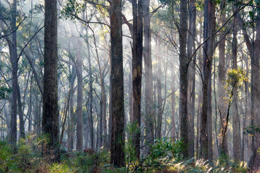
In the adjacent forest, unburned for many decades. The photo was taken in December, when the grass was greener,  but in other respects the scene is unchanged.

FOBIF has enquired of DELWP about the burn history of this block. We have also asked questions about the recent department burn around Wattle Track, in the Fryers Nature Conservation Reserve. This varied from a moderate, patchy effort to an extremely severe and destructive fire. We’re trying to find out how our managers assessed the result of the exercise.

Our questions arise from our curiosity about the actual effects of hazard reduction burns, both ecologically and from the point of view of fuel loads. In our view, this is a very complex issue: but the political debate about it is infected with the convenient notion that reduction burns vacuum up fuel and make us all safer. Only by paying close attention to the effects of each burning exercise will a more realistic view emerge. That would require better resourcing for managers, of course.

A map of the zone in question, and other proposed management burns, can be found on the Department’s excellent interactive map here.

Posted in News | 1 Comment

What’s special about this?

A strong group took on FOBIF’s walk to Middleton Creek yesterday, our first open  walk for many months. Middleton Creek is a marvellous waterway, characterised by interesting twists and turns and rocky cliffs. Unfortunately it’s currently overrun with gorse and other weeds, evidently spreading from nearby private land, which obscure the creek’s interesting features. Fortunately the surrounding bushland in the Park is pretty weed free, and features a variety of vegetation communities, including patches of park-like serenity, like the woodland pictured below. The dense green carpets of Matted Bush-pea are striking even now. In spring its flowers are a spectacular highlight of this end of the Park.

Amanda’s Track, Castlemaine Diggings National Heritage Park: a wooded parkland of Matted Bush-pea and tussock grass.

FOBIF’s walk took in the very southern fringe of the Diggings Park, before swinging over to the Goldfields Track through Brown’s Gully. It finished with a short traverse through the zone of DSE’s disastrous 2010 fuel ‘reduction’ burn, which managed to multiply the area’s fuel load dramatically.

Part of FOBIF walking group in Brown’s Gully. The Candlebark eucalypts are among the highlights of the Goldfields Track through this area.

Our thanks are due to walk leader Bernard Slattery for this excursion. Next month’s walk is in the Pilchers Bridge NCR: check the walks program for details.

Middleton Creek in a wet year (2010): note the gorse infestation to the left of the picture. The National Heritage Park is relatively weed free.

Photos below were taken by Liz Martin. Click to enlarge. 

Posted in News | Comments Off on What’s special about this?

March geology excursion with Clive Willman

Report written by Cassia Read.

Clive Willman led members of FOBIF on a fascinating geological tour, exploring the dynamic history of volcanoes and rivers that shaped landscapes in the Mount Alexander region. Evidence of this history was visible in rock profiles and landform features at five different stops visited around Castlemaine and Guildford. The ancient story told by Clive at each of these stops is described below.

Figure 1 Clive Willman “waxing lyrical” about the mighty, ancient Forest Creek (Photo Bronwyn Silver)

Stop 1: Forest Creek Historic Gold Diggings Reserve

A short walk north of the Diggings Reserve carpark brought us to a 10m deep cutting, down through ancient alluvial sediments. The cutting was formed by miners digging and sluicing in their search for alluvial gold amongst gravels deposited by ancient rivers. This cutting reveals a profile through sedimentary layers that tell a story of high energy rivers that flowed across the Mount Alexander region around 60 million years ago (mya). At this time Gondwana was breaking up and Australia split from Antarctica to begin its slow migration north. These tectonic movements caused major deformation of Eastern Australia and the uplift of the eastern highlands. The elevated gradient of these uplifted mountains, combined with the cool, wet climate of the time, created high energy rivers that flowed north from the divide. Evidence of the energy in the ancestral Forest Creek can be observed in the poorly sorted boulders, cobbles and gravels that make up the lower layer of the profile. Much higher flow rates and water volumes than we see today were necessary to transport these large materials through the river’s course. Over time the energy in the rivers declined, perhaps as the climate dried or the slopes of mountains eroded to be less steep, until they transported and deposited only smaller cobbles and sand with pebbles and clay – now visible in the middle layer of the profile. Another episode of high energy flow followed which again bought coarser material down the river to be deposited in the upper layer of the profile.

Figure 2 This profile at the Diggings Reserve indicates wide variation in the flow of Forest Creek over geologic timescales, with boulders and cobbles at the bottom and top of the profile deposited during periods of high flow rates and finer sediments in the middle of the profile deposited during periods of low energy flow (Photo: Bronwyn Silver)

Layers of coarse material in the profile became very hard conglomerate rock. Cementation occurred as iron oxides leached out of water moving through the gravel layers and then strongly bound sediments together as the ground dried out. These almost impenetrable cemented layers greatly frustrated the miner’s efforts to reach gold in the lower layers of the profile.

Stop 2: Old Guildford Railway Station

The railway cutting near Guildford revealed three distinct rock types within a few hundred meters distance and provides a window into key events in the geological history of our region. At one end of the cutting, an ancient bedrock of deep marine sandstones and mudstones can be seen. These were formed when sediments were laid down under the sea around 468 mya. These sediments washed off a mountain range to the west and settled in an ocean basin in layers. A phase of mountain building in eastern Australia around 440 mya compressed these sedimentary layers so they folded, much like a cloth on a Laminex table that is compressed from two sides to create a series of sharp folds. Evidence of the forces operating on these sedimentary rocks is seen in the almost vertical angles of these sedimentary layers (strata) on the face of the railway cutting.

Figure 3 Sedimentary strata are oriented  at near vertical angles due to folding and uplift of South Eastern Australia around 440 mya (Photo: Bronwyn Silver)

A short walk northwards along the railway line (away from Guildford) brought us to a dramatic change in rock type, with cemented conglomerate rock overlaying the sedimentary bedrock. The pebbles and cobbles that make up the conglomerate were laid down by the ancient Loddon River, during the same period as the conglomerate from the ancient Forest Creek. In this area the layers of pebbles and gravels are cross bedded, indicating sections of the ancient river that were at an angle to the riverbed, such as longitudinal bar deposits. The interface between these ancient gravels and the bedrock is where miners found gold as alluvial gold settled at the bottom of the ancient rivers.

Trekking back towards Guildford brought us to a mining tunnel, or adit, dug into the sedimentary rock, where miners cut under the conglomerate to extract the gold bearing gravels above.

Continue reading

Posted in News, Walks | 1 Comment

…And what could possibly be special about this?

Think of a small, degraded patch of bush, surrounded by industrial sites and roads, only 4 kilometres from the centre of a sizeable city. It’s a tiny remnant of the ravages of gold fever, ‘symbolic of the way nature is now attacked and besieged on all sides.’ At just over 4 hectares, it has 50 mine shafts!

Why should anyone take an interest in such a place? Wouldn’t it be better just to look away, at somewhere a bit more encouraging?

To find an answer to these questions, have a look at Island with corners: Crimson Chats on the White Hills 2019. It’s the ‘complex story behind the Chinese Diggings Historic Reserve and the way it is today’, and is a 68 page large format book written by Bendigo field naturalist John Lindner. The  appearance of unusual birds on the reserve provoked the author to a detailed examination of the history of this patch of land, and his careful documentation of this history is an enthralling and instructive read. As he says, ‘Every now and again, a mere mortal may be astonished by something wonderful, beautiful and unexpected in Nature.’ This book recounts such an experience. It’s an object lesson in paying attention to our local neighbourhood (the author lives one kilometre from the reserve). At a time when there’s a bit of angst around about limitations on travel, perhaps there’s a lesson here for all of us: the next Big Thing in travel might be a seemingly unimpressive patch of land around the corner.

So: if you’re getting a bit downcast by the way the world is going, you could do a lot worse than spend some time on this book. It’s $25 from the author at jwl.bendigo@gmail.com

Posted in News | Comments Off on …And what could possibly be special about this?

Track the threat

Deer were sighted last week in the Middleton Creek area of the Diggings park. This feral species has now been seen in numbers in almost every corner of our region. Every credible community group, including farmers, municipalities and enviro organisations, has urged serious control measures against the exploding population: but, as we’ve reported, the State Government’s response to the menace has varied from the feeble to the supine. Its main agenda, on the face of it, seems to be to please the hunting lobby: a peculiar obsession, given that this particular lobby is generally hostile to the Labor Party.

If you’re interested in doing your bit to track the reality of this particular environmental problem, have a look at Feralscan. It offers ‘Many resources … to help you identify, monitor, or plan control of deer populations in your local area. View fact sheets, instructional videos, guides and strategies on best practice deer management. Use these resources as part of your coordinated control with your neighbours, local working groups, and biosecurity organisations.’ And it enables you to register any sightings you may have in your neighbourhood. Check out our 2019 post here–or go direct to the site at https://www.feralscan.org.au/deerscan/default.aspx

And: if you have the courage, you might want to read ‘The attack of the alien invaders’, an estimate of what feral species are costing the world, in dollar terms. It’s in ‘The Conversation’, today. You can find it here.

Posted in News | Comments Off on Track the threat