Flood management plan on the way?

About 100 people turned up to the first public consultation meeting on flood management on February 18 at the Castlemaine Town Hall.

The meeting consisted of three presentations on flood issues by Catchment Managers and water industry experts—unfortunately rather repetitive and sometimes barely audible in the town hall acoustic. The presentations were followed by one on one discussions between officials and residents using large maps of the area.
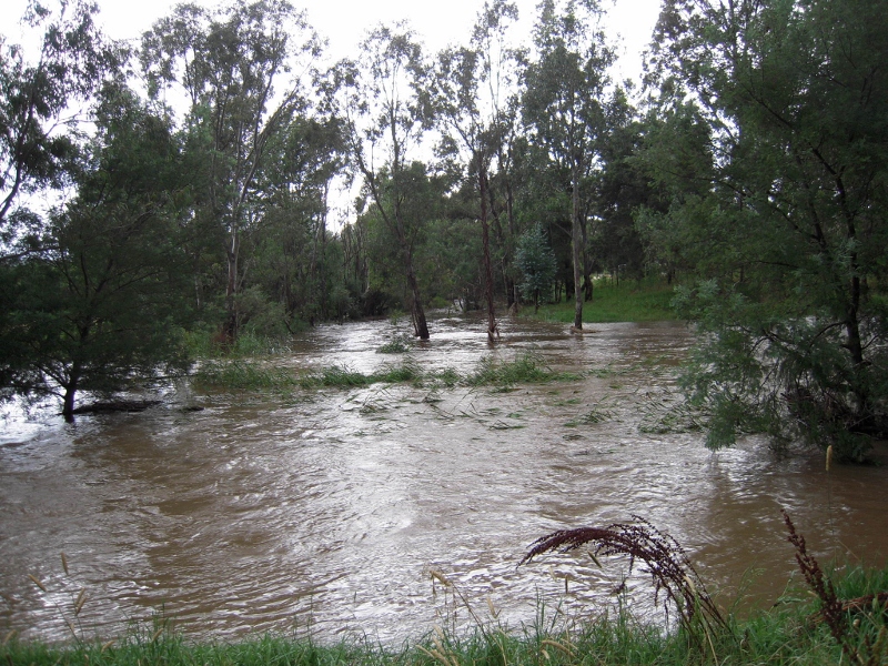
Forest Creek/Barkers Creek junction, January 2011: at the high point of the floods water coming into the streams was five times the carrying capacity of the stream beds.


There was an expectation that this would be a fiery meeting because of dissatisfaction with the way flooding has been handled: and it was clear from this meeting that there’s still plenty of anger and pain in the community about the issue, some of those affected by floodwaters  calling for extensive clearing of vegetation along Barkers and Campbells Creeks. It’s also clear that there’s a bit of confusion in the community about who exactly is responsible for our waterways, and it’s to be hoped this can be cleared up in this process.

The main thrust of the meeting, however, was to take and assess as many ideas as possible to prevent a repeat of the damage inflicted by the floods of 2011 and 2012. Among the ideas fielded were:

  • Essential services protection: the Castlemaine water treatment plant being a prime example. Flooding of this plant caused significant downstream pollution and some potentially serious health issues.
  • Vegetation along creeks: there are still calls for wholesale clearance, on the assumption that ‘the flood wouldn’t have damaged houses if all those trees hadn’t been there.’ This belief is quite false [see our posts here and here]. One group in 2011 even called for the clearing of ‘all trees growing below that which would be considered the high water mark.’ This would involve demolishing about a quarter of the Botanical gardens and turning the creek system into a gigantic ditch. Nevertheless it’s clear that some management of vegetation [particularly of willows, which raise the stream bed] is justified.
Continue reading →

Posted in News | Comments Off on Flood management plan on the way?

Where’s the heritage?

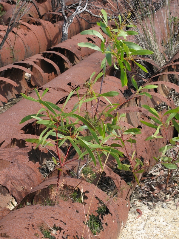
The photo below shows old sluicing pipes in the Fryers Forest. As they decay, they provide shelter for the growth of seedlings which will eventually hasten their destruction.

Is this decay the gradual fading of our heritage? Maybe–if we identify ‘heritage’ with old objects.

Nature reclaims the sluicing pipes, Fryers Forest: the regenerating bush is part of our heritage. Photo: Margaret Hogg


The Heritage Action Plan for the Castlemaine Diggings National Heritage Park says:

‘The current forest setting is…an interpretive bonus for the Park.  It highlights the transience of mining, demonstrates the severe environmental impact that can result from inadequate environmental constraint, and illustrates some of the resilience of Australia’s native vegetation.’ (page 29)

Continue reading →

Posted in Nature Observations | 2 Comments

Ant behaving strangely

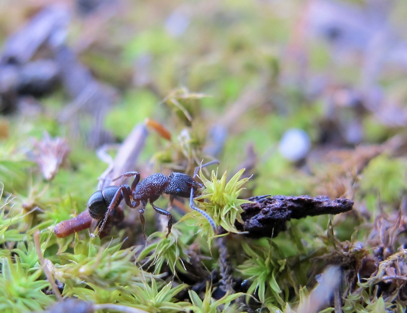
The ant pictured below is a member of the genus Rhytidoponera. The curious thing about it is that the creature is labouring to carry a shoot of moss [Pseudocrossidium crinitum].

Ant behaving strangely, Kalimna Park, February 2013


As far as we know, ants feed on other invertebrates and forage for such matter as honey. Moss somehow doesn’t fit the bill. The specimen above lugged its burden over difficult terrain for about a metre, then abandoned it. Any clues about this behaviour are welcome.

Posted in News | 1 Comment

Ever wonder where the soil went?

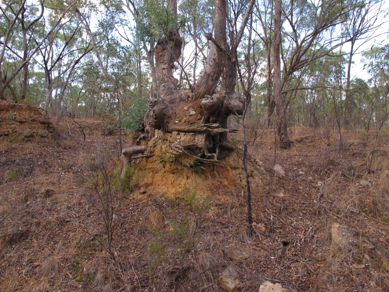
The photo below could be duplicated hundreds of times through our region: a tree sitting on a ‘pedestal’on the edge of a deeply eroded gully. When that tree was young, it was at ground level. So, where has all the soil gone?

Tree 'pedestal', German Gully: once this tree stood at ground level. Annual soil loss in most of Australia is estimated at one tonne per hectare, twice the rate at which it can be replaced by organic decomposition.


The obvious answer is, it’s been washed away downstream, eventually ending up in the Loddon, as a result first of nineteenth century mining works, and afterwards of a long process of erosion.  Here’s a report from the Mount Alexander Mail, August 27 1854:

‘The water in the Loddon was higher last week than it has been all the season. The puddling and sluicing on the banks of the stream have converted its once clear current into as muddy a state as many of its tributaries. It is said that the fish that were occasionally washed down Fryers Creek sunk to the bottom, as though suddenly deprived of motion, on reaching the earth-laden waters of the Loddon. Just now it is questionable whether any of the finny tribe can be found near the Junction.’

Almost all of our eroded gullies show a dual process: relentless erosion, and painfully slow build up of vegetation cover counteracting that erosion. In theory, land management policy encourages the second process to stop the first.

Continue reading →

Posted in News | Comments Off on Ever wonder where the soil went?

Should prospecting be extended?

The State Government has directed the Victorian Environmental Assessment Council to nominate areas in six National and State Parks where recreational prospecting will be allowed. Details of the brief are here.

FOBIF has made a submission to VEAC, which reads partly as follows:

It is hard to believe that VEAC has been given such a brief without prior authority to investigate first the question, ‘should any additional areas be made available for recreational prospecting in our National and State Parks.’

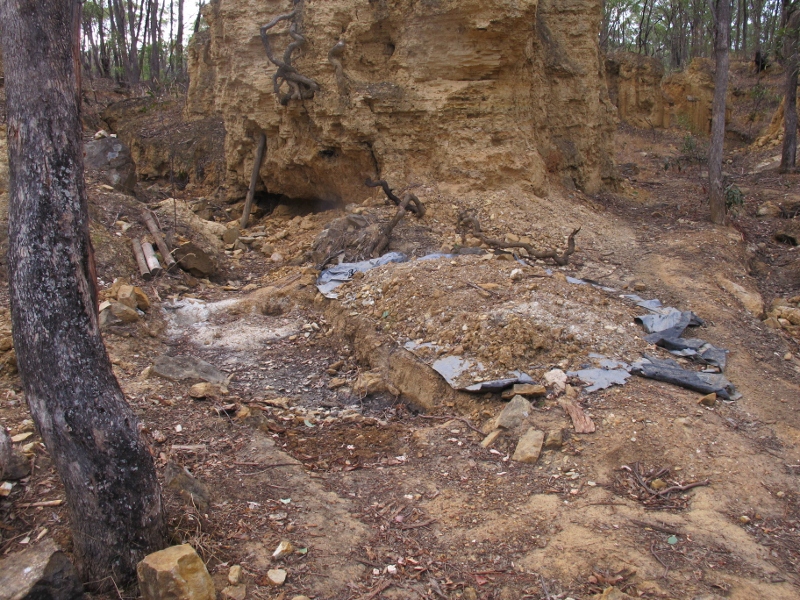
Prospecting site, Castlemaine Diggings NHP: there appears to be no monitoring of prospecting in the Park. Ranger resources are too limited for any effective supervision, and there seems no way of controlling rogue prospectors.


Prospecting has been permitted in the Castlemaine Diggings National Heritage Park for about ten years. The Park’s Management Plan [2005-7] specifies that management ‘monitor the impacts of prospecting on cultural and natural values of the park’ and work with relevant groups to address the causes.’ [page 42]

It would seem logical that no decision about additional areas for prospecting should be made without first checking on the experience with the practice in this park.

What is the status of the monitoring of prospecting in the Castlemaine Diggings NHP? What conclusions can be drawn from it about potentially damaging practices?

Continue reading →

Posted in News | Comments Off on Should prospecting be extended?