FOBIF walk in Maldon Historic Reserve

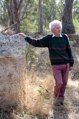
A group of 20 eager bushwalkers emerged from their summer hiatus to participate in the first walk of the 2013 FOBIF calendar.  The walk was led by Chris Johnston, who has built up a considerable body of knowledge about the Maldon Historic Reserve and the Muckleford Forest. 

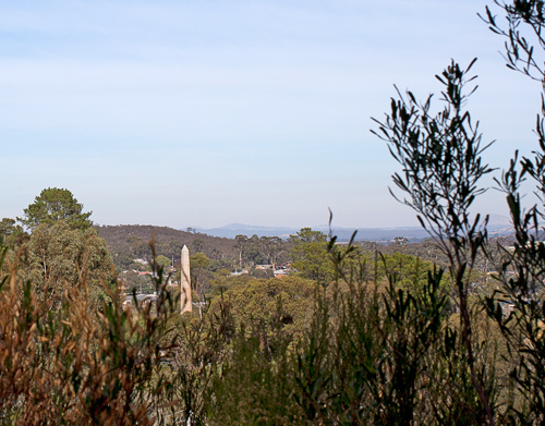
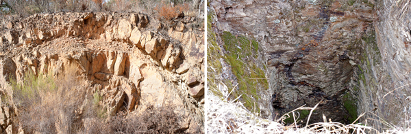
The walk commenced at the ruins of the Gowar School and wended its way through impressive box-ironbark forest up to Smiths Reef Dam, built in 1860.  A number of native under storey species were identified along the way.  Following a break for morning tea at Smiths Reef Dam, the group explored a number of the digging sites to the east of the dam.   

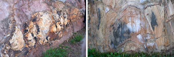
Hairy mullock heaps. Photo by Dominique Lavie


Photo by Dominique Lavie

A disturbed bottle dump was located with many fragments of old bottles still present.  The archaeological knowledge of one of the walkers (from Kyneton) was put to good use in describing the style of the bottles, the production processes and the possible uses.

The walk continued along the Spur Track with a marked contrast observable in the vegetation on either side of the track resulting from previous prescribed burns.


Photo by Frank Forster

A lunch break was taken in the lee of a large rocky outcrop providing an interesting micro-climate for small ground covers, ferns and lichen.

After lunch the group returned along Clarry’s Track and the Gowar Road, taking note of the areas designated for prescribed burns in autumn 2014.  Chris Johnston is coordinating a data collection exercise in the designated area and is seeking a few volunteers to assist in the process.  This is scheduled for Sunday 14 April;  please email mucklefordffg@bigpond.com if interested.

This walk was a great start to the 2013 program, and thanks are due to Chris Johnston for her detailed preparation and informed guidance. You can view more of Dominique Lavie’s photos by clicking on her Facebook page.

Posted in News | Comments Off on FOBIF walk in Maldon Historic Reserve

Don’t try this yourself!

Bird netting which lies loosely on the ground can be a menace to small animals like echidnas…and also to snakes, as the picture below shows.

Doug Ralph was asked by a local to help out when a brown snake about two metres long became entangled in netting dragging on the ground.

Eastern brown snake caught in bird netting, Castlemaine: nets which drag on the ground can entangle small animals, with sometimes dangerous results.Photo: Doug Ralph


This situation isn’t good for anyone–the snake, which could die from the exhaustion of trying to get away, or any person who may lack the expertise to deal with a potentially dangerous creature.

Snake rescue: definitely not recommended for non experts. Photo: Jan Hall


Doug’s method is illustrated above: lift the snake, cut the netting away, then put the creature in a bucket and take it out into the bush. We don’t advise anyone without the expertise to attempt this, however. The Eastern (or Common) Brown is extremely venomous, and becomes aggressive if threatened.

The moral is: don’t let your bird netting drag loosely on the ground.

Posted in Nature Observations, News | Comments Off on Don’t try this yourself!

‘Castlemaine’s first environmental cause’

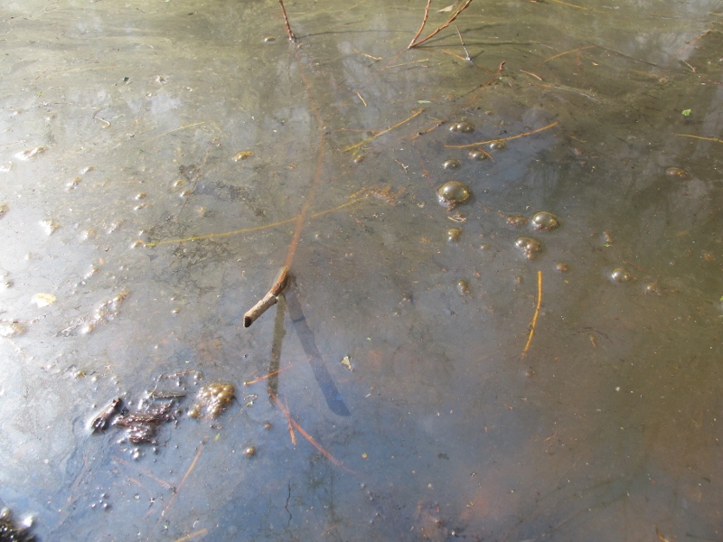
The curious circular earth formation pictured below isn’t a mysterious religious site. It’s a puddling wheel, and if you want to know how it used to work, check out historian Marjorie Theobald’s article ‘Commissioner Bull and the Puddling Machines: Castlemaine’s first Environmental Cause’:

Puddling machine, Cobblers Gully: Circular ditches like this, with islands in the middle, are fairly common in our district. The fallen trees are recent intrusions--natural heritage at work.


‘In the years 1851-1855 the area known as the Mount Alexander gold fields, about ten square miles including the towns of Castlemaine, Chewton and Fryerstown, was ransacked by the alluvial miners; no creek was left unchanged, no gully was left unscarred, no ridge was left unpierced. Concern for the environment as we understand it today did not exist. It comes as a surprise then to find that in January 1855 Resident Gold Commissioner for Castlemaine, J.E.N. Bull, took a stand on precisely these grounds: he sent to each proprietor of a puddling machine an edict that from the 31 March 1855 these machines would be banned from the main creeks in his district. This was necessary, he wrote, to safeguard the water supply of Castlemaine, the operations of the miners using cradles and Long Toms, and the health of the creeks and flats generally.’

What happened next? To find out, check Marjorie’s excellent article on the online Central Victorian Ecology blog.

Posted in News | Comments Off on ‘Castlemaine’s first environmental cause’

Flood management plan on the way?

About 100 people turned up to the first public consultation meeting on flood management on February 18 at the Castlemaine Town Hall.

The meeting consisted of three presentations on flood issues by Catchment Managers and water industry experts—unfortunately rather repetitive and sometimes barely audible in the town hall acoustic. The presentations were followed by one on one discussions between officials and residents using large maps of the area.

Forest Creek/Barkers Creek junction, January 2011: at the high point of the floods water coming into the streams was five times the carrying capacity of the stream beds.


There was an expectation that this would be a fiery meeting because of dissatisfaction with the way flooding has been handled: and it was clear from this meeting that there’s still plenty of anger and pain in the community about the issue, some of those affected by floodwaters  calling for extensive clearing of vegetation along Barkers and Campbells Creeks. It’s also clear that there’s a bit of confusion in the community about who exactly is responsible for our waterways, and it’s to be hoped this can be cleared up in this process.

The main thrust of the meeting, however, was to take and assess as many ideas as possible to prevent a repeat of the damage inflicted by the floods of 2011 and 2012. Among the ideas fielded were:

  • Essential services protection: the Castlemaine water treatment plant being a prime example. Flooding of this plant caused significant downstream pollution and some potentially serious health issues.
  • Vegetation along creeks: there are still calls for wholesale clearance, on the assumption that ‘the flood wouldn’t have damaged houses if all those trees hadn’t been there.’ This belief is quite false [see our posts here and here]. One group in 2011 even called for the clearing of ‘all trees growing below that which would be considered the high water mark.’ This would involve demolishing about a quarter of the Botanical gardens and turning the creek system into a gigantic ditch. Nevertheless it’s clear that some management of vegetation [particularly of willows, which raise the stream bed] is justified.

Continue reading

Posted in News | Comments Off on Flood management plan on the way?

Where’s the heritage?

The photo below shows old sluicing pipes in the Fryers Forest. As they decay, they provide shelter for the growth of seedlings which will eventually hasten their destruction.

Is this decay the gradual fading of our heritage? Maybe–if we identify ‘heritage’ with old objects.

Nature reclaims the sluicing pipes, Fryers Forest: the regenerating bush is part of our heritage. Photo: Margaret Hogg


The Heritage Action Plan for the Castlemaine Diggings National Heritage Park says:

‘The current forest setting is…an interpretive bonus for the Park.  It highlights the transience of mining, demonstrates the severe environmental impact that can result from inadequate environmental constraint, and illustrates some of the resilience of Australia’s native vegetation.’ (page 29)

Continue reading

Posted in Nature Observations | 2 Comments