Fire: who knows how to use it?

DSE Chief Fire Officer Ewan Waller claimed on ABC Radio on March 30 that one of the aims of his department is to create a ‘pre European’ forest structure by using fire. This seems to suggest that he is familiar with pre European fire regimes. We’re not sure what these regimes were in our area, but it’s worth brooding on one recent effort to describe them.

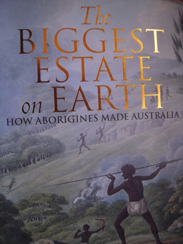
In his book The Greatest Estate on Earth [Allen and Unwin 2011] Bill Gammage argues that Aborigines used fire not as a simple survival tool, but as a sophisticated means of shaping the environment: and that they made Australia a ‘farm without fences’ with it, a place frequently referred to by early white settlers as ‘a gentleman’s park’.

Gammage argues that Aborigines used fire throughout the continent, but the picture he creates of indigenous methods of burning provides an interesting contrast with the kind of massive, blunt and destructive exercises we are seeing today. In brief:

–Aboriginal groups had territories they understood in intimate detail.

–their burns were small scale, modified for different species patterns, conducted with an expert eye on the weather, and controlled. Although he doesn’t discuss practices in our area, he mentions, for example, that in the Western Desert, most patches burnt were ‘less than five hectares.’ This contrasts dramatically with the hundreds of hectares being burned around here, and the thousands being done at a time in the Mallee.
–They managed their territories in varying degrees of intensity depending on use, spiritual significance, etc

–Management included long periods without fire for some areas [eg, no burning for ‘generations’] if that is what they perceived the country as needing.

–They were conscious of shape, topography and access, and burned diligently at, say, forest edges, clearings, access routes.

–Aborigines timed ‘most [not all] fires to go out at night: overnight fires could confess loss of control’.

–They very rarely killed mature trees with their fires.
Continue reading →

Posted in Fire Management, News | Comments Off on Fire: who knows how to use it?

DSE answers on Tarilta fire

Last week FOBIF secretary Bernard Slattery wrote to DSE Bendigo to express our concerns about Tarilta Gorge, in particular the massive soil loss resulting from the Department’s management burn [see our post].We’ve received the following answers to our questions from Paul Bates,Forest Manager, Bendigo Forest Management Area. For convenience of readers, we’ve put our questions in italics before each answer. Readers can assess whether our questions have been answered:

1.     Last year in our submission on fire zones we drew attention to the steep slopes in this area, and the need to be extra careful in any burning operation. Given that heavy rain was predicted in the week after the proposed burn, why was there evidently no effort to protect the steeper slopes? [Sludge in the creek is up to a metre deep in parts. In walking along the creek bed I went up to my waist at one point in soil and ash]

DSE: ‘DSE monitors fuel and weather conditions when completing prescribed burns. The weather records over the days when this burn was ignited show that the conditions were within the limits for burning in this type of forest. DSE also monitors weather forecasts for the days following ignition of a prescribed burn including potential rainfall. Predicting accurate rainfall amounts and intensity can be difficult, especially predictions several days ahead. All weather factors are considered and a decision was made in this particular case that ignition of the burn area would proceed.’

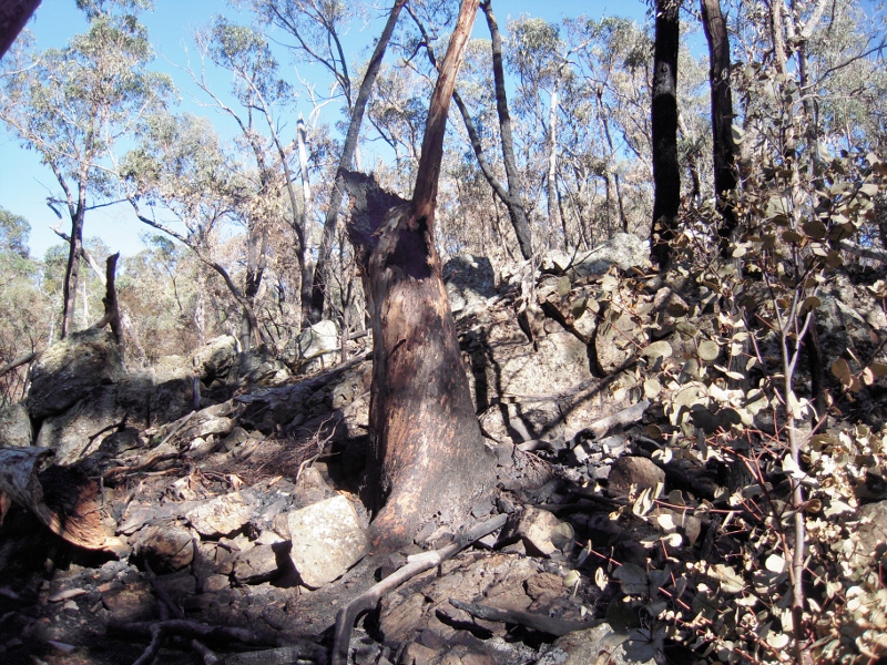
Destroyed candlebark, ten metres from Tarilta creek. We estimate that the tree was about a metre in diametre at breast height. Although it is hard to estimate its height, it may well have been the tallest tree in the valley [see additional photo below


2.     We’re still at a loss as to DSE’s inability to protect large trees from these burns. Red box on the slopes and even larger trees on the valley floor have been destroyed. We’d like to know what kind of supervision takes place in this area.

Continue reading →

Posted in Fire Management, News | 4 Comments

What happens under the tractor?

The first public evening session in Connecting Country’s 2012 Education Program was attended by 75 people at Campbell’s Creek last week.

The talk was given by Dr Denis Saunders, who posed a set of question about the long term viability of agriculture in Australia. He discussed the curious fact that we know little or nothing about the effect of agricultural practice on soil micro organisms, and argued that ignorance on such matters might lead to long term bad practice. His theme, on the interdependence of people and environment, was stated as an acknowledgement of Aboriginal land management practices in the words: ‘we are country, country is us.’ A fuller report on the evening, together with info on the remaining sessions in the program, can be found here.

Posted in News | Comments Off on What happens under the tractor?

Tarilta questions

Following our visits to the DSE burn site in the Tarilta Gorge [see our post] we have written to DSE management in Bendigo seeking a response to the following questions:

1. Last year in our submission on fire zones we drew attention to the steep slopes in this area, and the need to be extra careful in any burning operation. Given that heavy rain was predicted in the week after the proposed burn, why was there evidently no effort to protect the steeper slopes? [Sludge in the creek is up to a metre deep in parts. In walking along the creek bed you can go up to your waist at one point in soil and ash]

2. We’re still at a loss as to DSE’s inability to protect large trees from these burns. Red box on the slopes and even larger trees on the valley floor have been destroyed. We’d like to know what kind of supervision takes place in this area.

3. The Ecological Management Zone’s purpose is ‘promoting biodiversity and ecological renewal. Planned burning will be used to manage native species and ecological communities which require fire to regenerate.’ Can you tell us which species you had in mind in this operation? Is there baseline data to enable an assessment of the success of the operation?

4. We were under the impression that in this zone the intention is to do a mosaic burn covering about one third of the area. It seems to us that much more was actually burnt. Can you tell us what your estimate is of the burn coverage?

We’ll post the reply as soon as it’s available.


Posted in Fire Management, News | Comments Off on Tarilta questions

Floods: running to the past

Recent heavy rains in Victoria have brought about a return of calls to strip vegetation from waterways as a way of reducing flood levels.

The claim that vegetation along waterways raises water levels was raised last year when some locals blamed landcare plantings for flooding in Castlemaine. At the time FOBIF pointed out that creeks and streams had been stripped of vegetation for many years up to the 1990s. This practice had not solved the flood problems but had produced a few of its own, including, predictably, erosion of stream banks. It’s worth remembering that the shocking floods in the past came along streams entirely stripped of vegetation—the catastrophic 1889 event being the most infamous.

In our post we quoted Australian Land and Water research which showed that ‘Adding or removing large wood (snags) in streams has little effect on the height and duration of large floods.’ This is the consensus opinion of those who have looked seriously at the flood problem, but it has not stopped the State government from announcing that it would consider going back to the practice of ‘desnagging’ streams. It’s hard to believe that the government will proceed with a practice which so obviously failed, but we’ll have to wait and see.

In the meantime the Midland Express carried a front page article with photo on March 6 showing Nationals MP Damien Drum with a local businessman examining vegetation which allegedly raised flood levels in the previous week. FOBIF members have been down to look at the site in question. There is debris in the creek at the point in question, but in our opinion there is no case for wholesale vegetation removal [see picture]. At that point Campbells Creek does a sharpish left turn which would cause some banking of water, but the creek itself was not seriously blocked.

Campbell's Creek near Gaulton St, March 14 2012. FOBIF believes that there is a case for vegetation management in town creeks, but that wholesale removal of native vegetation is a policy proven to have failed in the past.


There is a case for removing vegetation which clearly chokes streams—willows being a prime villain in this respect, and the CMA has been busy in Campbell’s Creek doing just that. It is also obvious that some measures should be taken to protect buildings which past planning mistakes have allowed to be built under flood levels—and that Council should vigorously resist future attempts to build on flood  prone land. For this to happen we would need precise flood mapping–and, amazingly given the number of floods we’ve had over the last hundred and twenty years, that doesn’t seem to be available.

Posted in News | Comments Off on Floods: running to the past