FOBIF Moss book launch

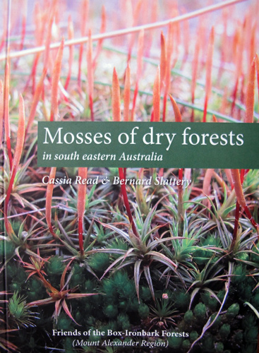
castlmaine-etc-13-5-14-013-(752x1024)The FOBIF publication, Mosses of Dry Forests in South Eastern Australia, will be launched by Frances Cincotta on 31 May. The launch invitation can be downloaded here. Everyone is welcome to attend.

An order form which includes a sample page from the book can be downloaded here.

Posted in News | Comments Off on FOBIF Moss book launch

New fungi poster from FOBIF

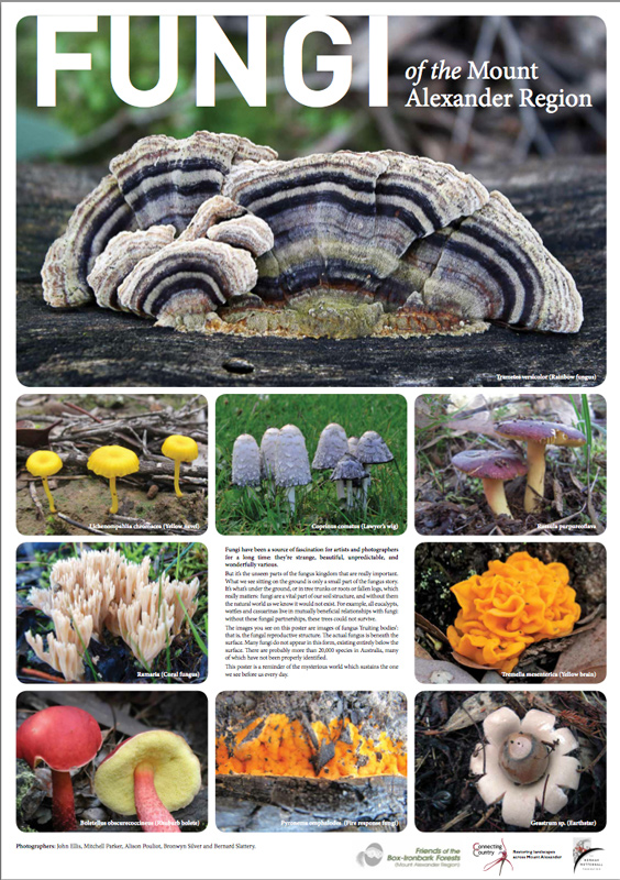
web-fungi-posterFOBIF has produced an attractive and informative poster about Fungi of the Mount Alexander Region. The A2 poster will be available for sale ($5) at the launch of the FOBIF moss guide on 31 May.

You can also purchase it from

Beth Mellick (Norman Wettenhall Foundation), The Hub, Office 5,
233b Barker St, Castlemaine (Enter glass door on Templeton St)

or the

web.frank's-logo

325 Barker St, Castlemaine

The FOBIF publication, Mosses of Dry Forests in South Eastern Australia, will also be available at these two locations.

Posted in News | Comments Off on New fungi poster from FOBIF

FOBIF walk to Poverty Gully and Eureka Reef

Fifteen people came on the 12 km April walk to Poverty Gully and Eureka Reef. The weather was perfect for walking with the sun shining and a light breeze. We followed the water races for most of the time weaving through the forest.

Marion Letcher was our leader. She has a keen interest in the local history and geography of the Castlemaine Diggings which she shared with the group as we came across many sites of interest.

The group heard about Joseph Brady who in 1865 was the architect of the Coliban Water Supply Scheme to bring water to Castlemaine and Bendigo via a series of channels and aqueducts, some of which we saw along the way.

We stopped for lunch near the Eureka Reef where we took time to take in the amount of excavation and hard work the miners must have done here.

web.-(2)-Cornish-Chimney

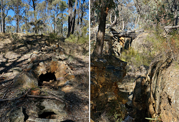
Cornish Chimney (left) and Eureka Reef. Photos by Harley Parker

Continue reading →

Posted in News | Comments Off on FOBIF walk to Poverty Gully and Eureka Reef

Tarran Valley 1: development proposal comes up for air

Members will have seen local press reports on a proposal to develop land at Tarran Valley in the Sandy Creek area, 2 kilometres from Maldon, on the north side of the Maldon-Castlemaine road.

The development proposal, first put up in 2006, involves rezoning the 125 hectare lot from Farming to Rural Living zone and the building of 42 houses.

FOBIF objected to the original proposal before a planning panel on the grounds that the area is fire prone: radical fuel reduction measures in the adjacent Maldon Historic Reserve would be required to ensure safety of the new residents–and these would have damaging ecological effects.

The panel report, completed just before the catastrophe of Black Saturday 2009, did not list bushfire safety as an issue, and approved the rezoning. The Mount Alexander Shire adopted the rezoning in March 2009, but—newly conscious of the bushfire threat— added the important proviso that ‘Council expects the Minister may modify the Amendment [to the planning scheme] in light of recommendations of the Royal Commission into the recent bushfires.’ The proposal has been in limbo since then.

In July last year the Planning Minister, Matthew Guy, referred the matter to the state’s Bushfire Management Overlay Standing Committee. The committee will hold a hearing on May 7 on the matter, and will hear from Council, the proponent, the CFA, the Department of Environment and Primary Industries and Parks Victoria. FOBIF will attend the hearing, and submit a statement, but cannot speak. The focus of the panel is the fire risk: other matters [like whether the development is a good idea generally] are not under discussion.

Details of the panel and submissions to it can be found here.


Posted in Fire Management, News | Comments Off on Tarran Valley 1: development proposal comes up for air

Tarran Valley 2: the cost of development to nearby bushland

Would the development require that woodland in the reserve be severely altered in order to protect residents from fire?

The CFA submission to the panel states that ‘the broader surrounding bushland having interface with the subject land has the potential to generate severe bushfire behaviour, including crown fires, extreme ember attack and significant radiant heat.’ The CFA handpasses the management of this problem to the land manager, the Department of the Environment.

Mount Alexander Shire planners, who support the proposal, do likewise, saying blandly that ‘determining whether the proposal will change the way surrounding bushland needs to be managed in the long term is the responsibility of other authorities.’

The submission by the ‘other authority’, the Department of Environment, is quite clear on the matter: the location of houses close to the Reserve would immediately create pressure for it to be rezoned to Zone 1 [Asset Protection] for the purposes of fire protection.  Here’s the DEPI submission:

‘A change in adjacent use is likely to cause a change of the surrounding fire management zone to FMZ1 Asset Protection Zone. In order to provide additional protection for the subdivision fuel reduction of an area of approximately 270 hectares would need to occur … To achieve the fuel hazard requirements of an APZ, the fuels in the area would be maintained at a ‘moderate’ level over approximately 90% of the 270 ha. This will result in a burning regime of fuel reduction burns being conducted on a five-year rotation.

‘An increased rate of burning will result in a significantly changed landscape. Regular burning to meet FMZ1 objectives results in the eventual loss of coarse woody debris on the ground, which removes key habitat for invertebrates and small mammal and reptile species. Over time, this will diminish the abundance and complexity of faunal species within the historic area.

‘An increased burning regime is expected to result in the loss of trees containing hollows used by native fauna. This loss of habitat is likely to impact on the abundance of fauna over time. More regular burning will also alter flora species composition, as a five-year rotation is below the average tolerable fire interval for many box-ironbark species and so we could expect to see a move to a simpler structure in the forest most likely containing larger grassland areas and fewer mid-storey species.’
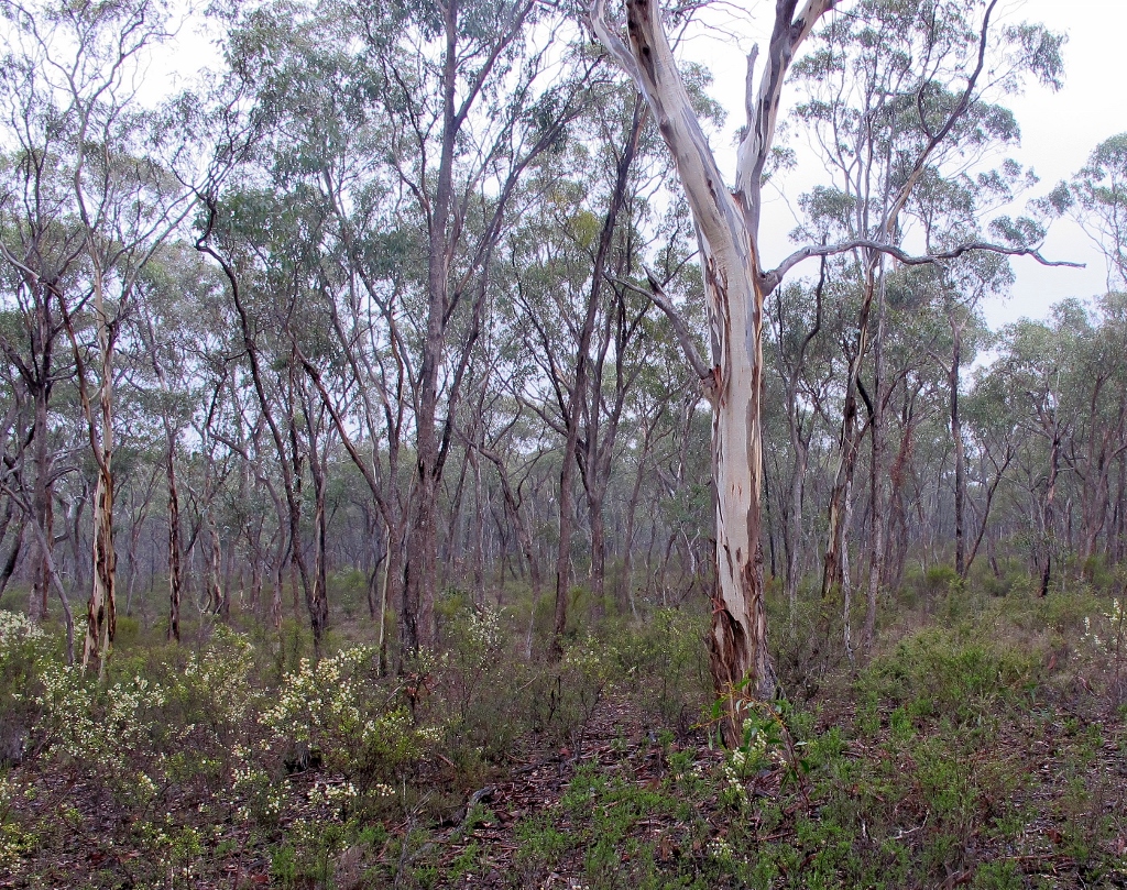
In the Maldon Historic Reserve: DEPI says that proposed development nearby would inevitably require severe fuel reduction in the reserve, with inevitable damage to forest structure. The Department adds that 'it is not appropriate to manage risk created on private land using Crown land for defendable space.'

In the Maldon Historic Reserve: DEPI says that proposed development nearby would require severe fuel reduction in the reserve, with inevitable damage to forest structure. The Department adds that ‘it is not appropriate to manage risk created on private land using Crown land for defendable space.’

 

Posted in Fire Management, News | Comments Off on Tarran Valley 2: the cost of development to nearby bushland