
The gouged and eroded gullies of our region are a heritage of the gold rushes, a time when an unknown quantity of topsoil was lost through deforestation and creeks were scoured for gold. There are a few reminders, however, of how creeks might have looked in former times: rock walls and formations suggestive of flowing creeks and permanent pools. One such is pictured below, after last week’s rain: chain of ponds in the Railway Dam catchment. It’s not Niagara, but for the moment it’s the best we can do–and right now it’s rich in mosses, lichens and fungi.
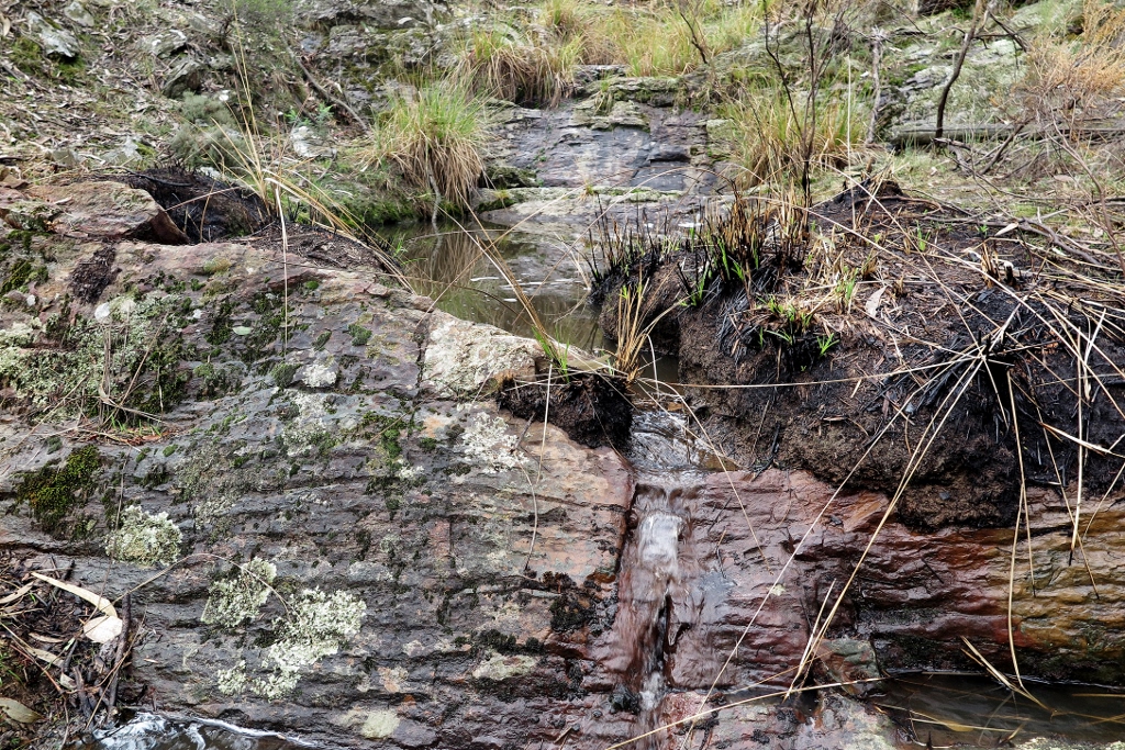
Rock wall with water, Tunnel Hill, April 26: ‘waterfalls’ like this rarely flow, but they are reminders of a time when our waterways were more reliable and abundant.


 Click on image for info/order page
 Click on image for info/order page
 Click on image for info/order page

")


")


Very pretty, ta.
The ‘creek’ running beside Cruits Lane Muckleford (off Rilens Rd) is 20 feet deep & wide for much of the way, & dead straight – an ecological disaster. But where Cruits Lane becomes Tear Rd the creek seems to have been left alone. It becomes a foot or so deep, and meanders wildly through verdant undergrowth.