Photos coming in for our FOBIF show

Several photos for our 2017 exhibition, Mountains and Waterways, have been added to our new Flickr album during the last week. Noel Muller, Ranger Team Leader Goldfields, Parks Victoria, has sent a quirky tree photo from Mount Tarrengower and several FOBIF members have been visiting our flooded swamps. It’s a good time to get out and take water related photos after our recent rains. If you would like directions on how to get to swamps and other sites let us know at info@fobif.org.au

web-mountains-revised-noel-img_1629-medium

Mount Tarrengower, 15 October 2016

web-walkers_mg_4524

Walkers Swamp, 14 November 2016

web-bells-swamp-9-11-16-2-800x600

Bells Swamp, 9 November 2016

Posted in News | Comments Off on Photos coming in for our FOBIF show

Not news on the highway

Snakes are out and about, though they’ve become active a little later this year because of cooler conditions.

Obviously people should be careful in areas where snakes are likely to be present–and not only for their own safety.

The picture below is a dismal reminder of the annual massacre on our highways. As we’ve reported before, the kill rate on the roads is both frightful, and very often avoidable: and reptiles are special victims.

Another reason for slowing down…

Pyrenees Highway, McKenzie Hill, November 9:

Pyrenees Highway, McKenzie Hill, November 9:  a sight so common as to be almost unnoticeable.

And on a more positive note: below is a photo of a turtle [any suggestions on the species? We think it might be a Common Long Neck–Chelodina longicollis] found by a driver in the middle of a dirt road in Walmer, and safely removed to the side of the road:

web-_mg_4514

Posted in News | Comments Off on Not news on the highway

Call for photos!

The theme of the next FOBIF photo exhibition is Mountains and Waterways.

TOGS Cafe in Castlemaine will host the exhibition in November 2017.

So if you have a favourite photo/s of

  • Mount Alexander, Mount Tarrengower or other mountain in Mount Alexander region (you can include photos of the mountains and flora and fauna on the mountains) and/or
  • Waterways such as creeks, rivers, dams, Expedition Pass, Bells Swamp, Cairn Curran (photos of the Moolort Swamps can also be included)

send them along to FOBIF (info@fobif.org.au). There is also plenty of time to take new photos: the closing date for the submission of photos is not till 1 October 2017. We are telling people well in advance of the exhibition as this years heavy winter and spring rains means now is a perfect time now to take waterways photos.

We will place all photos we receive in a designated album on the FOBIF Flickr site as long as they fall within the guidelines. A FOBIF sub-committee will then select approximately 18 photos to be printed and framed for the exhibition.

If your photo is selected, as well as being included in the exhibition, you will receive a free framed copy of your photo.

Guidelines

  1. Photo to include Mountains or Waterways within the Mount Alexander region and including Moolort Plains.
  2. A small file size is fine for Flickr but the photo will need to be at least 3 mg to be printed and included in the exhibitions. (At this stage only send files under 1mg).
  3. Include the photo’s location, date, plus identification of flora and fauna.
  4. Photos can be closeups, landscapes as well as photos where flora and fauna associated with mountains and waterways are the main feature.

We have already set up the Mountains and Waterways album so you can get an idea of the range of photos that fall within the guidelines. See also photos on this post

Contact Bronwyn Silver at info@fobif.org.au or 54751089 for further information.

Posted in Nature Observations, News | Comments Off on Call for photos!

Let’s burn the Res! And while we’re about it, let’s burn the Loddon!

Fire management zones in our area have been revised to accommodate the new ‘risk’ system which has replaced the unlamented five per cent target.

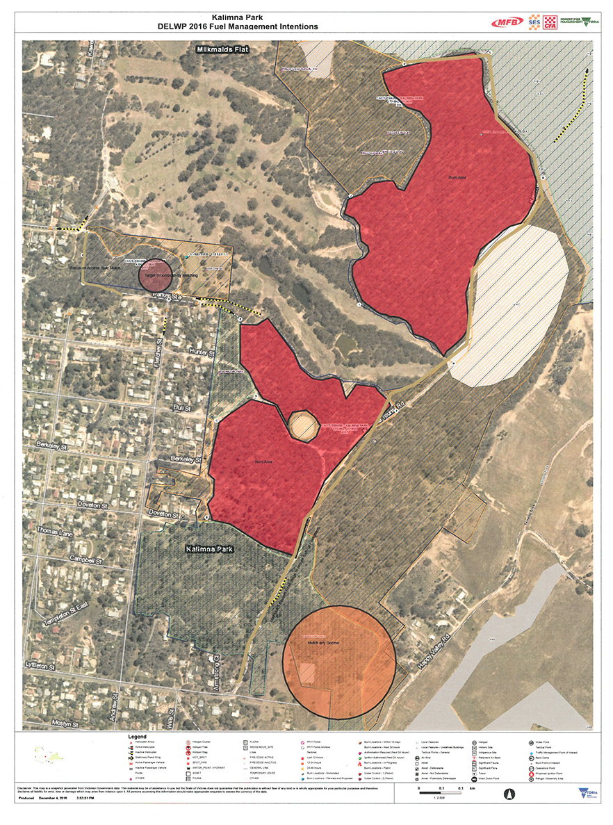
The  new zones–which are up for public comment– can be seen the map at the end of this post. For a map which can be expanded, go to this link . Click on the zoom to get detail.

Fancy a swim in the ash? It's proposed to burn this bush severely at regular intervals.

Fancy a swim in the ash? It’s proposed to burn this bush–and all around the Expedition Pass reservoir–severely, and at regular intervals.

Matters of serious concern to FOBIF are

–a Zone 1 area now completely surrounds Expedition Pass reservoir and Dunstans Flat:  this means the area around the Res will be severely burned as often as every five  years.

–The Loddon River Valley around Vaughan is Zoned 2, with a narrow Zone 1 strip.

The Expedition Pass reservoir and surrounds, apart from being an important amenity for locals, contains some of the oldest Stringybarks in the region, the best collection of White Box in the region, and some very old Grey and Red Box trees.

Remnant Red Stringybark towers above surrounding regrowth bush north of Expedition Pass reservoir. The upper slopes of this hill are rich in older trees.

Remnant Red Stringybark towers above surrounding regrowth bush north of Expedition Pass reservoir. The upper slopes of this hill are rich in older trees.

Justification for the proposal [coded CAS 02] is given as ‘for the protection of Faraday from fires spreading from south west of the community’. At this stage, we’re completely unable to see the logic in this: it looks to us as if someone in an office has done a desk top modelling exercise without any knowledge of the area and its value. We’ll quiz fire officers about the detail of this proposal. We’ll also be asking what fuel reduction, if any, is proposed for private land in the area: according to the original West Central documents, private land throughout Faraday and Sutton Grange is a ‘priority fuel management area’…but not enough of a priority to actually do anything, it seems.

And what about the Loddon?

For some months West Central maps have shown an extensive area along the Loddon near Vaughan as zoned 2 ‘bushfire moderation’, that is, up for regular burning.  We were assured by fire officers a few months ago that this ‘would not happen’, because DELWP policy was not to burn areas of River Red Gum, the dominant tree in this valley. We’re now wondering what such assurances are worth.

Of course, the zoning system applies only to public land. As we’ve noted above, the much proclaimed ‘tenure blind’ system of looking at landscapes for fire protection purposes seems to be as dormant as ever: so public land cops the brunt of fuel reduction exercises, and private land—at least as dangerous—is left alone, as too hard to handle, or left to erratic or inconsistent local rules.

More details on the risk landscape approach can be found here, together with info on how to put in a submission.

FOBIF will be making a submission to this consultation before the closing date of November 25. We urge others to do the same: even asking a question has a use. Send comments or questions to west.central@delwp.vic.gov.au

west-central-fire-management-zone-review-2016

This link is DELWP’s feedback form: pdf 2.

This link offers a brief justification of the Phoenix Rapidfire modelling system: pdf 1

Posted in Fire Management, News | 1 Comment

Talking Fire weekend is coming up

Maldon area; fire, ecology, people - can they all co-exist? Photo by Janet Barker

Maldon area; fire, ecology, people – can they all co-exist? Photo by Janet Barker

The Muckleford Forests Friends Group has provided us with an updated program for the Talking Fire weekend:

Come along to Talking Fire, 12-13 November. It’s free and you can come for the whole weekend, or drop in for a day or a session.

Talking Fire is about our local community, and fire in our local landscape. How can we work better as a community to reduce the risk to us – to our homes, families and friends – as well as protect our forests, wildlife and cultural sites? Talking Fire won’t be anything like the standard annual fire briefing!

Saturday will start at 10am with a welcome to Country, short talks on cultural burning, ecology, local fire experiences and fire myths with speakers Trent Nelson, Professor Andrew Bennett, Joan Sartori and Sam Strong. Then we’ll head out to Mt Tarrengower to hear from long-term fire spotter Peter Skilbeck. Then we will visit the Muckleford Forest to look at how the forest has recovered after the 1981 fire and the more recent planned burns, with guides Paul Bates (DELWP), Tanya Loos, David Cheal and others. Instead you can drop into the Newstead Community Centre and record your fire stories with Gordon Dowell, or map favourite places that you’d like to see protected from fire. Everyone will come together at 3.30 to share what we have learnt, and set the scene for Sunday.

Sunday morning starts at 10.30, and our focus will be on risk. We’ll hear about landscape-scale fire planning from Alison Boak (DELWP), community planning around risk from Steve Pascoe, and vegetation and fire from David Cheal, fire ecologist. Turning to the local scene, representatives from our local brigades and the Shire will look at how local planning could reduce risk.

After lunch, provided by Newstead Men’s Shed and Community Garden, Jinette de Gooijer will facilitate an exploration of ideas and options on how we might respond – as a community – to what we have learnt over the weekend.

What will come out of Talking Fire? That is in the hands of everyone who comes and contributes! So come along. Register via our website – talkingfire.org – it only takes a minute and it’s free.

Thanks to Mount Alexander Shire Community Grants, Maldon & District Community Bank (Bendigo Bank), and the Norman Wettenhall Foundation for funding support, and to all the local organisations and individuals who are helping make Talking Fire a reality.

Posted in Fire Management | Comments Off on Talking Fire weekend is coming up