Sutton Grange Organic Farm

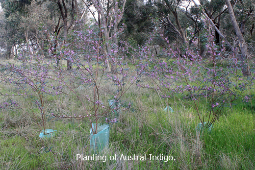
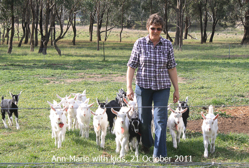
Can you farm in a different way? Is farmland degraded land? These are two of the questions Ann-Marie Monda and Carla Meurs from Sutton Grange Organic Farm addressed in their inspiring and informative presentation to Connecting Country’s AGM on 26 September 2011.

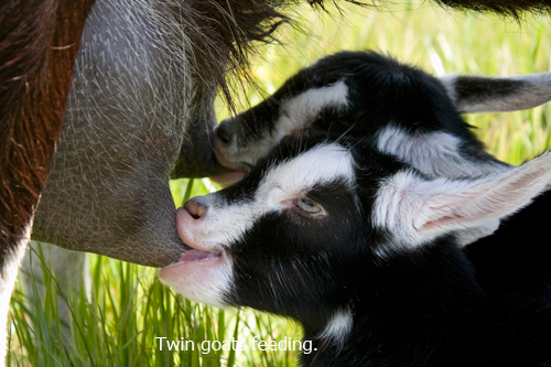
Their farm is organically certified and consists of 205 acres of granitic sandy loam. Rainfall is between 400 ml and 1000 ml rainfall a year. They run 75 goats and produce the award winning Holy Goat organic cheese which they sell at Farmers’ Markets and through a distributor who supplies outlets in regional Victoria, Melbourne and  Sydney.

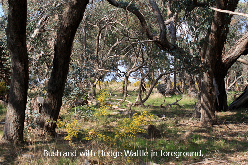
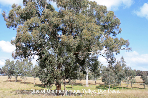
Twenty-nine percent of the farm is bushland and two percent is infrastructure. The benefits of protecting this extensive bushland include the maintenance of seed banks, the protection of pasture provided by birds, insects and windbreaks and the beauty of this land which they believe benefits the goats and people.

The farmland zone is sixty-nine percent of the total land and supports substantial stands of native grasses which are deep-rooted, perennial and drought tolerant. Kangaroo and Wallaby grass are particularly beneficial in providing vital minerals and fibre. They described their successful efforts in increasing levels of phosphorous, calcium, magnesium, iron and PH levels in the soil. They have also recently trialled an innovative method for controlling Cape weed.

Anne-Marie and Carla concluded their talk by explaining their vision for the farm. They distance themselves from the conventional idea that growth means more goats and producing more cheese which could eventually be exported. Instead they view the growth of their farm in terms of sustainability, quality and generosity for their goats, the land, people and the soil.

The slide show below is made up of recent photos from the the Sutton Grange Organic Farm.

More information about Connecting Country’s AGM can be found here.

Posted in News | Comments Off on Sutton Grange Organic Farm

Illegal dumping of green waste

In August FOBIF wrote to Mount Alexander Shire suggesting that the issuing of free garden rubbish vouchers to residents might lead to a reduction in the amount of illegal dumping of green waste in our forests.

We have received the following reply from the Council:

“Mulching green waste taken to the Castlemaine landfill and then reused costs Council in excess of $100,000 per year. This processing cost is offset by the gate charge to the community when they bring green waste to the site. Hence, Council does not intend to discount or waive the fees to dispose of garden and other green waste at the Castlemaine landfill.”

In the meantime we have noted that Macedon Ranges Shire Council has introduced a new green garden recycling service whereby residents are supplied with a green garden bin. They have also introduced a free ‘Green Drop’ service at the Council Transfer Stations for larger, woody garden prunings. These initiatives would involve a high startup financial outlay but in the long term would be a great way to reduce illegal dumping and waste generation as well as increasing recycling.

Unfortunately given the constraints on the MAS budget, cost would make the adoption of the Macedon Ranges scheme unlikely in the short term. However FOBIF intends to keep raising this green waste issue with Council and looking at alternatives to the current unsatisfactory situation. Click here to view our earlier post on this subject.

Posted in News | Comments Off on Illegal dumping of green waste

Looking more closely at the Selwyn map

Recently we posted an piece on the 1853 Selwyn map. We have found out that quarter sheets of this map are available on this site enabling more detail to be viewed.  Most if not all maps can be downloaded for free at 75 dpi resolution. Or else you can buy the whole lot for $10.

Posted in News | Comments Off on Looking more closely at the Selwyn map

Reporting sick, dead or dying wildlife

Wildlife Health Surveillance Victoria investigates reports of sick and dead wildlife from free ranging populations in Victoria to understand baseline health, detect changes and identify risk factors. The organisation is based at the Faculty of Veterinary Science, University of Melbourne, Werribee. For more information, including contact details if you see sick, dead or dying wildlife, click here.


Posted in News | Comments Off on Reporting sick, dead or dying wildlife

The sounds of spring, part 2

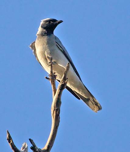
Black-faced Cuckoo Shrikes Coracina novaehollandiae are another arrival that have a loud and distinctive call. These birds can often be seen flying about or calling from high points, often on dead branches.

Black-faced Cuckoo Shrike. Newstead. Photo by Damian Kelly, 4 September 2011

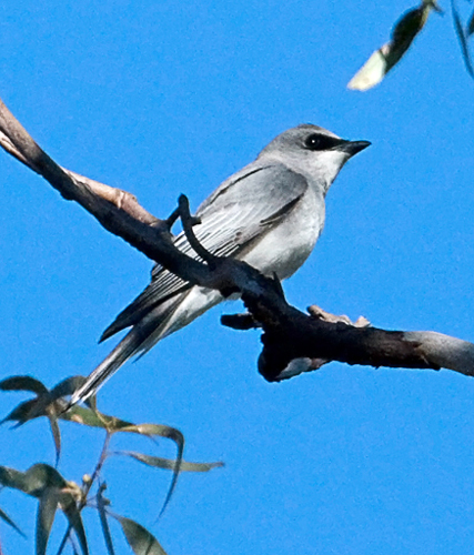
A less common migrant, but one seen recently at Bells Swamp is the White-bellied Cuckoo ShrikeCoracina papuensis. Not common in the area, but around nevertheless. At first glance it looks a little like its relative, the Black-faced Cuckoo Shrike, but colouration and call are quite different.

White-bellied Cuckoo Shrike. Bells Swamp. Photo by Damian Kelly, 28 July 2011

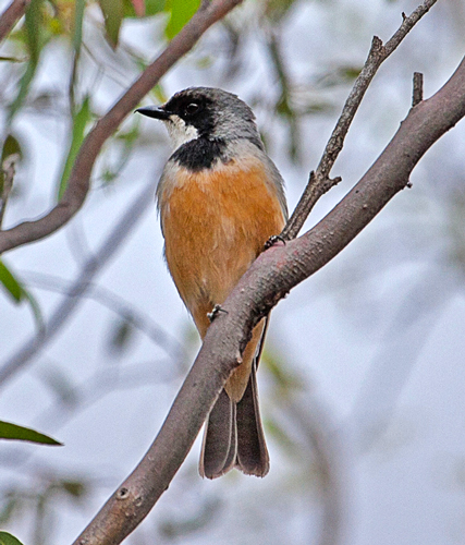
In spring the call of the Rufous Whistler Pachycephala rufiventris can be heard throughout the forests. Quite a musical tone that is repeated regularly. The male has the distinctive colouration, whilst the female is more cryptically coloured.

Rufous Whistler. Kalimna Park. Photo by Damian Kelly 14 September 2011

Posted in News | Comments Off on The sounds of spring, part 2

Researching Forest Creek

Historian, Robin Ballinger, at Campbells Creek Community Hall

Sixty-five people turned out at Robin Ballinger’s talk on the environmental history of Forest Creek on 8 September. Robin used many early documents and maps to demonstrate the interaction between the indigenous people, squatters, goldminers and the local environment.

She outlined the early geological history of the Forest Creek and the relationship between the Aboriginal people, the Dja Dja Wrung, and the land prior to white settlement. Robin then described the impact on the landscape and the Jarra people of the mass influx of squatters which followed the 1838 publication of Major Mitchell’s diaries.


This pastoral development was followed by the gold rushes and the devastation of Aboriginal life continued. Gold mining had an enormous impact on the landscape in a very short time. However, while in 1852 there were 25,000 people, by 1854 Forest Creek was virtually deserted. The easily-obtained gold had all but gone. Continue reading

Posted in News | Comments Off on Researching Forest Creek

It’s all happening at Bells Swamp

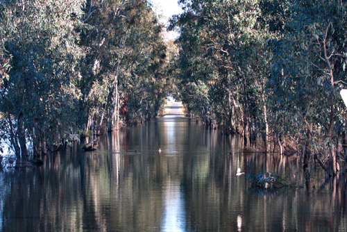
After an extended dry period, Bells Swamp has now flooded so extensivley that it has swallowed up the main road as well. The large extent of water has encouraged a wide range of birds and the former main road provides an easy, dry walk right through the centre of the swamp allowing visitors to enjoy the watery environment without getting wet feet.

Side roads, however, have disappeared under the flooding waters.

A wide range of birds abound and the air is alive with calls and activity. A sample of common birds follows.

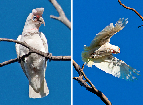
Long-billed Corella. Photos by Damian Kelly

Long-billed Corella Cacatua tenuirostris is typical bird of the open country and edges of the forests and swamps. Generally moves around in flocks, calling loudly. With large groups the noise can be deafening! These birds roost in the big gums around the swamp.


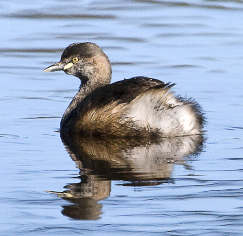
Australasian Grebe. Photo by Damian Kelly

Australasian Grebe Tachybaptus novaehollandiae is a small, but very cute diving bird. Often dives and appears a long way off after 30 seconds or more underwater.


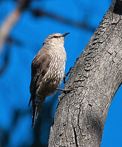
Brown Treecreeper. Photo by Damian Kelly

At Bells Swamp the Brown Treecreeper Climacteris picumnu can be seen as often on the ground foraging as it is in the trees creeping up trunks in search of food.

Posted in News | Comments Off on It’s all happening at Bells Swamp

Muckleford Forest: proposed DSE Fire Operations Plan fuel reduction burn

DSE held a meeting at the SEC Dam, Muckleford Forest, on Thursday 21st September at 10 a.m. as part of its community consultation process. Chris Johnson wrote the following report on the meeting.

Who was there from DSE: Steve Nicholson (Bendigo); John Hosking (Castlemaine); Jamie Roberts (Castlemaine); Petina Blackwell (Biodiversity).

Who was there from community: members/reps from Newstead Landcare, Friends of Box Ironbark Forests; Castlemaine Field Naturalists;  people from Green Gully (including those who are part of Green Gully Community Fireguard); interested locals and apologies were given for a number of others who couldn’t make it.

What is the purpose of the proposed burn? Answer was to protect Castlemaine from fire from the west on a wind change. This was a surprising answer as the FOP (Fire Operations Plan) says it is to protect Green Gully and Newstead.  It was also mentioned that access between Newstead and Castlemaine via the Pyrenees Highway was important.

What is driving this and so many burns? The Royal Commission’s recommendation that 5% of Victoria’s public land be ‘burnt’ each year and DSE is required to implement government policy.

What determines the area and amount of burning proposed? The fire management zones. These are set by another part of DSE in consultation with other government agencies. The DSE people said they were just responding to the burn requirements of the zones. There are 4 zones – zones 1 and 2 affect the Muckleford area. In Zone 1 (red on map) the goal is to reduce fuel load to moderate across 90% of area – and its 80% of Zone 2 to moderate. (Zone 3 is 30-50%, and Zone 4 is no burning). The frequency of burning – possibly every 10-12 years in these zones depending on conditions. Continue reading

Posted in Fire Management, News | Comments Off on Muckleford Forest: proposed DSE Fire Operations Plan fuel reduction burn

FOBIF September walk


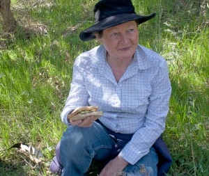
Marie relaxing during the lunch break

Twenty-six people enjoyed sunny spring weather on the September FOBIF walk. The walk followed bush tracks to the north and east of Expedition Pass Reservoir.

Marie Jones provided a fascinating commentary on the changing landscape based on her intimate knowledge of this area where she walks every morning.


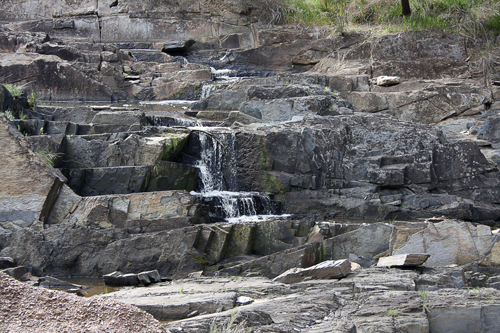
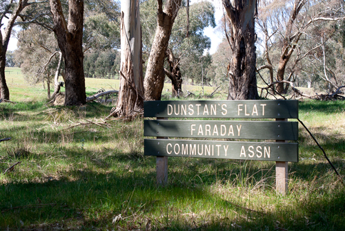
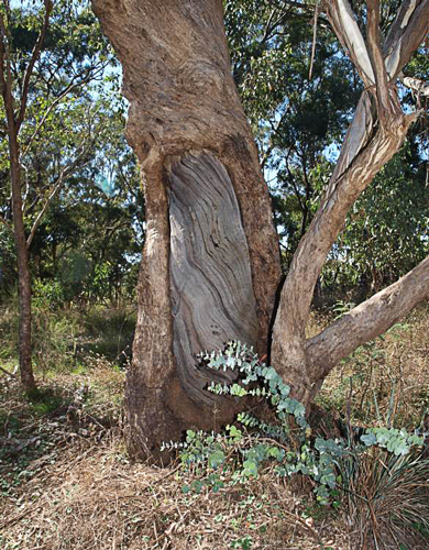
Some of the highlights were seeing water flowing over the Cascades near the start of the walk, finding out about the history of Dunstan’s Flat and viewing two scar trees near Golden Point Road.

Photo by Dominique Lavie

Photo by Bronwyn Silver

Photo by John Ellis

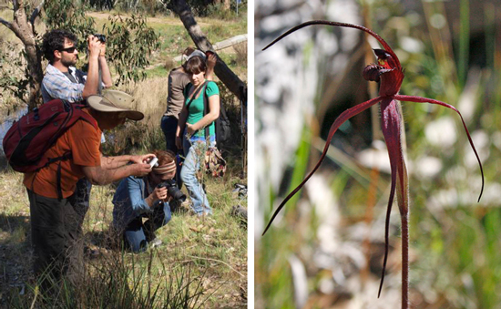
There were plenty of wildflowers and towards the end of the walk we found a Crimson Spider Orchid. Photographers were busy.

Photos by John Ellis (left) and Dominique Lavie (right)

Posted in News | Comments Off on FOBIF September walk

The sounds of spring, part 1

Each spring a variety of birds migrate back into the area for breeding. Hence the forests become alive with the calls of these species that haven’t been heard in the area for quite a while. This post introduces you to two of these spring migrants and their calls.

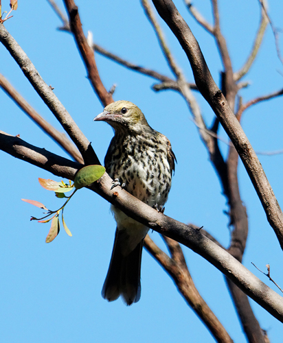
The Olive-backed Oriole Oriolus sagittatus is an early spring arrival. Rather cryptic in colouring, it moves about in foliage making it somewhat hard to spot at time. But it has a quite distinctive call that carries a long way in the forest.

Olive-backed Oriole. Newstead. Photo by Damian Kelly, 2 September, 2011

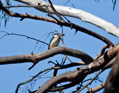
Sacred Kingfishers Todiramphus sanctus are another spring migrant. Generally found near water, it nests in hollows in the forest. With a rapid, high-pitched call this bird is another early spring migrant that can be heard calling long before your actually see it sometimes.

Sacred Kingfisher. Bells' Swamp. Photo by Damian Kelly, 24 August 2011

Posted in Nature Observations, News | Comments Off on The sounds of spring, part 1