About 100 people turned up to the first public consultation meeting on flood management on February 18 at the Castlemaine Town Hall.
The meeting consisted of three presentations on flood issues by Catchment Managers and water industry experts—unfortunately rather repetitive and sometimes barely audible in the town hall acoustic. The presentations were followed by one on one discussions between officials and residents using large maps of the area.

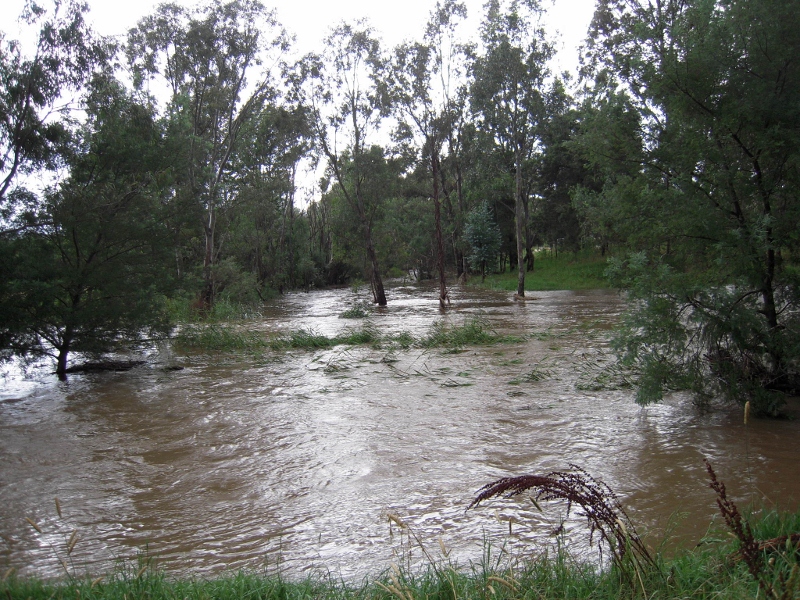
Forest Creek/Barkers Creek junction, January 2011: at the high point of the floods water coming into the streams was five times the carrying capacity of the stream beds.
There was an expectation that this would be a fiery meeting because of dissatisfaction with the way flooding has been handled: and it was clear from this meeting that there’s still plenty of anger and pain in the community about the issue, some of those affected by floodwaters calling for extensive clearing of vegetation along Barkers and Campbells Creeks. It’s also clear that there’s a bit of confusion in the community about who exactly is responsible for our waterways, and it’s to be hoped this can be cleared up in this process.
The main thrust of the meeting, however, was to take and assess as many ideas as possible to prevent a repeat of the damage inflicted by the floods of 2011 and 2012. Among the ideas fielded were:
- Essential services protection: the Castlemaine water treatment plant being a prime example. Flooding of this plant caused significant downstream pollution and some potentially serious health issues.
- Vegetation along creeks: there are still calls for wholesale clearance, on the assumption that ‘the flood wouldn’t have damaged houses if all those trees hadn’t been there.’ This belief is quite false [see our posts here and here]. One group in 2011 even called for the clearing of ‘all trees growing below that which would be considered the high water mark.’ This would involve demolishing about a quarter of the Botanical gardens and turning the creek system into a gigantic ditch. Nevertheless it’s clear that some management of vegetation [particularly of willows, which raise the stream bed] is justified.
- ‘Holding dams’: there have been suggestions that Expedition Pass reservoir could be raised to control the huge volume of water coming down Forest Creek. It seems this idea would be prohibitively expensive and possibly impractical. Some have also suggested the building of smaller retaining basins in the Poverty Gully area to reduce the rush of water into Campbells Creek.
- Vegetation in Catchments: some key catchments [like Poverty Gully] have thin soil and little vegetation cover. Heavy rain therefore runs off very quickly. Some revegetation could slow the flow significantly…but this area is regularly burned for fuel reduction.
- Planning issues: permits should not be issued for building on flood plains—a recipe for future disaster. Buildings already exposed to floods should be protected.
The bottom line in all these discussions seems to be that when we get large dumps of rain, floods are inevitable because there’s too much water for the streams to hold. One estimate is that at the height of the flood the amount of water in Barkers Creek was five times the capacity of the stream bed. At times like this, water naturally overflows into flood plains, and the moral is: avoid these areas.
The material collected at the meeting and from community questionnaires is being considered by a community based steering committee on flood issues. Further community updates will be provided allowing more opportunities for the community to make additional calls for mitigation ideas.
There’s a Community Questionnaire on these issues in circulation. It’s supposed to be on the Catchment Management Authority’s website, but if you can’t find it there, look in the Documents section of this site.


 Click on image for info/order page
 Click on image for info/order page
 Click on image for info/order page


