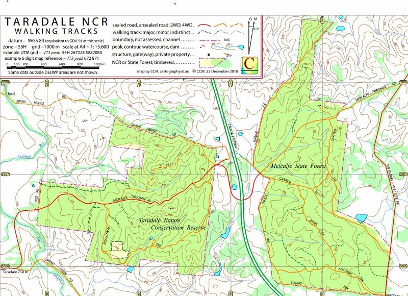
Mal ‘Jase’ Haysom has produced yet another useful map of our area: this time, roads and tracks in the Taradale Nature Conservation Reserve and [almost] adjacent State Forest. The map can be found online here, or a paper version can be picked up from the Castlemaine Market Building. It’s free.

These small but intriguing forest patches were threatened with serious damage in the planning stages of the Calder Freeway Malmsbury and Taradale bypass ten years ago: early proposals would have had the road slice into the Nature Conservation Reserve. Intervention by FOBIF activists persuaded engineers to route the freeway between the two forest patches. The freeway also has a wildlife underpass, allowing animal traffic between the two forest reserves. Judging from the look of the underpass, it’s very heavily used.


 Click on image for info/order page
 Click on image for info/order page
 Click on image for info/order page


It has been suggested that the curve in the freeway to avoid the reserve should be named ‘Doug’s Bend’ after Doug Ralph. Maybe we could put up a sign on the corner of the reserve visible from the freeway so that every time we go past we are reminded of Doug’s work.