
So it’s been the driest June on record around much of Victoria. Castlemaine weather station recorded 7 mls of rain for the month, compared to long term average of 56 mls. The previous lowest June rainfall was 13 mls in 1969. And it’s been pretty bleak into the bargain—rather too many grey but unproductive days.
There are interesting bright spots, however. For a few weeks now, large areas along Porcupine Ridge have been blooming with extensive stands of Woolly Wattle [Acacia lanigera]: quite a spectacular sight from the Ridge road:
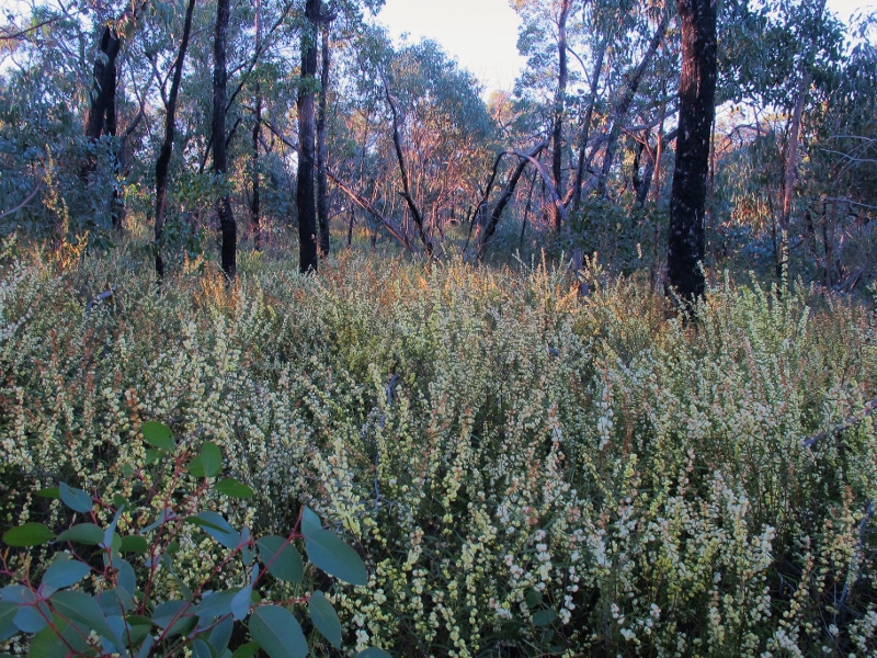
The wattle season is on: dense Acacia lanigera regrowth along the Loop Track, July 3. It’s very beautiful, but casts doubt over the effectiveness of severe ‘fuel reduction’ burns.
Wattle stands in this area are dense and up to nearly two metres high—impossible to negotiate with any ease. Interestingly, this area was the recipient of a very severe DSE fuel reduction exercise in 2011–supposedly a ‘mosaic burn’– in which large areas of the fire zone were reduced to ash, and numerous big trees killed. Recovery has been patchy, with some areas showing good species regeneration. On the whole, however, it’s hard to escape the conclusion that this ‘reduction’ exercise has actually increased the fuel load. Dense shrub and tree regrowth has replaced tussock woodland, and the area is definitely harder to negotiate on foot than the adjacent unburnt areas.
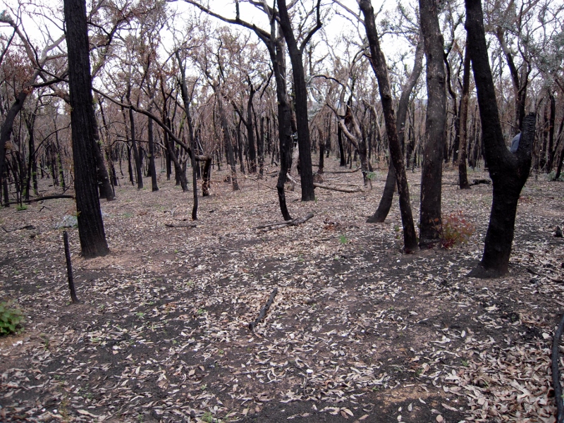
Loop Track, November 2010: DSE’s fuel reduction exercise looked like a bushfire, and its long term effectiveness is doubtful.


 Click on image for info/order page
 Click on image for info/order page
 Click on image for info/order page

")


")


