
Report written by Cassia Read.
Clive Willman led members of FOBIF on a fascinating geological tour, exploring the dynamic history of volcanoes and rivers that shaped landscapes in the Mount Alexander region. Evidence of this history was visible in rock profiles and landform features at five different stops visited around Castlemaine and Guildford. The ancient story told by Clive at each of these stops is described below.
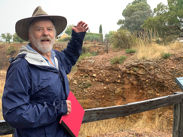
Figure 1 Clive Willman “waxing lyrical” about the mighty, ancient Forest Creek (Photo Bronwyn Silver)
Stop 1: Forest Creek Historic Gold Diggings Reserve
A short walk north of the Diggings Reserve carpark brought us to a 10m deep cutting, down through ancient alluvial sediments. The cutting was formed by miners digging and sluicing in their search for alluvial gold amongst gravels deposited by ancient rivers. This cutting reveals a profile through sedimentary layers that tell a story of high energy rivers that flowed across the Mount Alexander region around 60 million years ago (mya). At this time Gondwana was breaking up and Australia split from Antarctica to begin its slow migration north. These tectonic movements caused major deformation of Eastern Australia and the uplift of the eastern highlands. The elevated gradient of these uplifted mountains, combined with the cool, wet climate of the time, created high energy rivers that flowed north from the divide. Evidence of the energy in the ancestral Forest Creek can be observed in the poorly sorted boulders, cobbles and gravels that make up the lower layer of the profile. Much higher flow rates and water volumes than we see today were necessary to transport these large materials through the river’s course. Over time the energy in the rivers declined, perhaps as the climate dried or the slopes of mountains eroded to be less steep, until they transported and deposited only smaller cobbles and sand with pebbles and clay – now visible in the middle layer of the profile. Another episode of high energy flow followed which again bought coarser material down the river to be deposited in the upper layer of the profile.
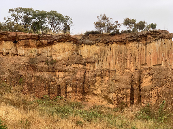
Figure 2 This profile at the Diggings Reserve indicates wide variation in the flow of Forest Creek over geologic timescales, with boulders and cobbles at the bottom and top of the profile deposited during periods of high flow rates and finer sediments in the middle of the profile deposited during periods of low energy flow (Photo: Bronwyn Silver)
Layers of coarse material in the profile became very hard conglomerate rock. Cementation occurred as iron oxides leached out of water moving through the gravel layers and then strongly bound sediments together as the ground dried out. These almost impenetrable cemented layers greatly frustrated the miner’s efforts to reach gold in the lower layers of the profile.
Stop 2: Old Guildford Railway Station
The railway cutting near Guildford revealed three distinct rock types within a few hundred meters distance and provides a window into key events in the geological history of our region. At one end of the cutting, an ancient bedrock of deep marine sandstones and mudstones can be seen. These were formed when sediments were laid down under the sea around 468 mya. These sediments washed off a mountain range to the west and settled in an ocean basin in layers. A phase of mountain building in eastern Australia around 440 mya compressed these sedimentary layers so they folded, much like a cloth on a Laminex table that is compressed from two sides to create a series of sharp folds. Evidence of the forces operating on these sedimentary rocks is seen in the almost vertical angles of these sedimentary layers (strata) on the face of the railway cutting.
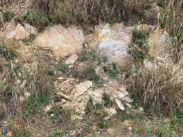
Figure 3 Sedimentary strata are oriented at near vertical angles due to folding and uplift of South Eastern Australia around 440 mya (Photo: Bronwyn Silver)
A short walk northwards along the railway line (away from Guildford) brought us to a dramatic change in rock type, with cemented conglomerate rock overlaying the sedimentary bedrock. The pebbles and cobbles that make up the conglomerate were laid down by the ancient Loddon River, during the same period as the conglomerate from the ancient Forest Creek. In this area the layers of pebbles and gravels are cross bedded, indicating sections of the ancient river that were at an angle to the riverbed, such as longitudinal bar deposits. The interface between these ancient gravels and the bedrock is where miners found gold as alluvial gold settled at the bottom of the ancient rivers.
Trekking back towards Guildford brought us to a mining tunnel, or adit, dug into the sedimentary rock, where miners cut under the conglomerate to extract the gold bearing gravels above.
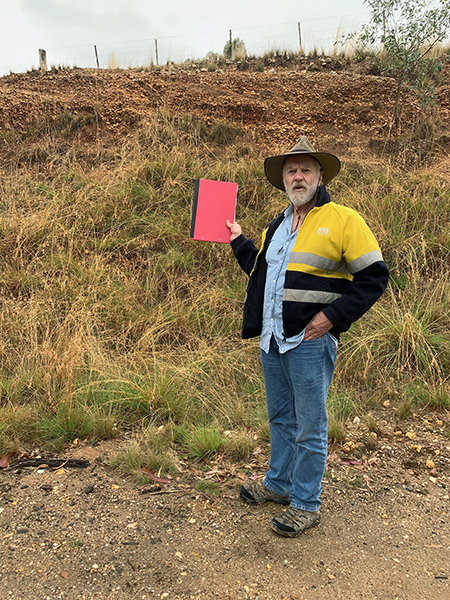
Figure 4 A profile at the Railway cutting near Guildford reveals cemented, conglomerate rock (Photo by Bronwyn Silver)
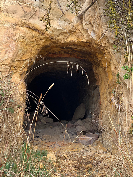
Figure 4 A profile at the Railway cutting near Guildford reveals cemented, conglomerate rock (Photo Bronwyn Silver)
The age of these ancient river sediments is uncertain, but some evidence of their age comes from the discovery in the region of a fossil bearing clay layer (called lignite) that was found near the base of the river sediments. The fossils were discovered when a rock core was taken for mining exploration. Because fossils can be used to accurately date sediments, they provide a means for gauging the age of the river sediments. The lignite was full of fossilised plant matter. Pollen grains from this material revealed that forests of Nothofagus and Podocarpus grew here and enable dating of the lignite layer at about 25 mya. Elsewhere in the Loddon system, the river sediments are older than this and are probably 40 mya or more. It’s fascinating to imagine the primeval Beech and Conifer forests that carpeted the landscape and were able to exist because of a much wetter and cooler climate.
Walking a little further along the cutting towards Guildford brought the group to a third distinct rock type overlaying the conglomerate rock: basalt rock. This basalt has its origins in two ancient lava flows from Gooches Hill near Glenlyon, perhaps around 2-3 mya. When Gooches Hill erupted, the lava travelled along the course of the ancient Loddon River in two continuous flows. The lava flows poured on top of the river sediments and filled the river valley and floodplain, contained by the surrounding sedimentary hills. The mass of lava cut off the course of both the ancient Loddon and Campbells Creek, forcing these rivers to migrate southwards and to the west to find another course.
Stop 3: Guildford Lookout
Adventuring up the steep hill to Guildford Lookout afforded us with striking views of the basalt plateau to the north of Guildford township. From this vantage point, Lalgambook (Mt Franklin) could also be seen; the site of an early volcanic cone that erupted around 47,000 years ago.
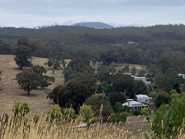
Figure 6 View of Lalgambook (Mount Franklin) from the Guildford Lookout (Photo: Bronwyn Silver)
The flat-topped hills that make-up the Guildford Plateau were once the bottom of the river valleys and represent an inverted landscape. The plateau formed because the basalt created a harder, more durable capping to the softer sedimentary rock. Over many thousands of years, the basalt was exposed and eventually elevated relative to the sedimentary hills that had surrounded the basalt flow, because the sedimentary hills eroded at a faster rate than the basalt capping. The hills in this area were also cut through by the Loddon River and Campbells Creek, after they were blocked by the ancient lava flows.
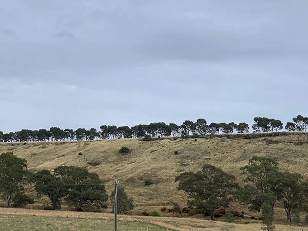
Figure 7 Guildford Plateau, formed because the surrounding sedimentary hills eroded at a faster rate than the basalt capping (Photo: Bronwyn Silver)
From our high vantage point at the lookout, we learned about another significant geological feature in the landscape that was just out of view. This was the Muckleford Fault, a major fault line, oriented on a north-south axis, a little to the west of Guildford. This is a reverse fault and has a depth of 30km and stretches from the Harcourt granodiorite in the north to Daylesford in the south. Monitoring of the fault by local seismologist Gary Gibson reveals the fault is still active and moves monthly. This reverse fault causes uplift to the west and displaces the basaltic and gravel layers that lie across the fault.
Stop 4: Shicer Gully Road
A short drive along this road afforded a view of an erosion face on some steep hills on agricultural land. This erosion face exposed a disconformity within the geological profile, where gravels from the ancient Loddon River were overlain by basalt from the lava flow from Gooches Hill. Essentially this disconformity represents a break in geologic time, where intervening events in the geologic history of the region cannot be determined from the profile.
Stop 5: Galaxia Road
Just off Galaxia Road, we visited a small adit that was driven through the sedimentary bedrock to undermine the conglomerate of river gravels. The boundary here between river gravels and the bedrock is called an angular unconformity because the gravels overlie folded bedrock. This unconformity represents a missing piece of 400 my of history as the the sedimentary rock was folded, and the beds became upright, about 440 mya, while the gravel bed is a mere 40 my old. Geology enthusiasts in the group put their finger at the point where these two pieces of geologic history meet and wondered at the mystery of the intervening time.
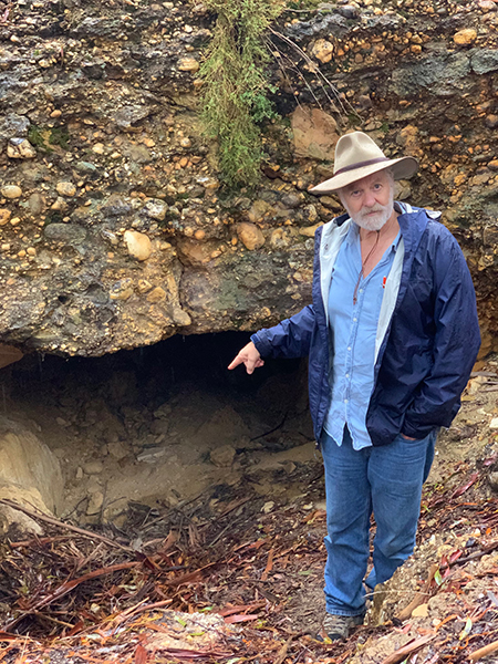
Figure 8 Clive readying himself to place his finger on the unconformity at the adit on Galaxia Road. (Photo Bronwyn Silver)


 Click on image for info/order page
 Click on image for info/order page
 Click on image for info/order page

")


")


Thank you Cassia for this informative record of the first Fobif excursion which we unfortunately missed out on.
We were sorry to miss the on site history lesson so well researched by Clive.
Jules and Rex.