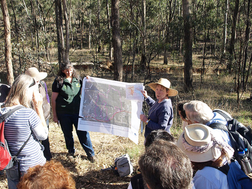
Forty-five walkers set out from the SEC Dam Track in Green Gully on 21 March for the first FOBIF walk of the year. It was not the normal scenic bushwalk as the route was mainly through areas of the Muckleford Forest which had been burnt in the fuel reduction burns in the Spring of 2011.
Frances Cincotta from Newstead Natives Nursery and Chris Johnston, author of the Muckleford Forest blog led the group.
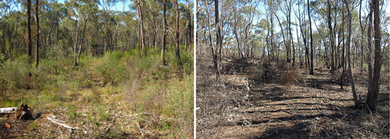
The areas burnt in spring were mainly in Zone 2 and 3 – Zone 2 is Strategic Wildfire Management Zone and Zone 3 is Ecological Management Zone. One of the aims of the walk was to see if we could identify the differences in the % of landscape burnt based on the zoning. Zone 2 can be up to 80% burnt, and Zone 3 is 30-50% burnt. (Zone 4 Prescribed Burning Exclusion). The group walked along Demo Track, a renowned wildflower area, so people could see the stark difference between the burnt and unburnt sides of the track.
Apart from Gold Dust Wattle, Dianella and epicormic growth on eucalypts there was little evidence of regrowth and the number of trees, including at least one Native Cherry Exocarpos cupressiformis, that had been destroyed was disturbing. This post is based partly on a Muckleford Forest blog article. Click here to see more.


 Click on image for info/order page
 Click on image for info/order page
 Click on image for info/order page


